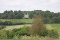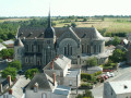
The Chanzeaux bocage

Take a stroll around the small village of Chanzeaux and discover its heritage as you pass the mills you’ll encounter along the way!

Details

n°3485734
Creation:
Last update:
Last review:
  • Walking
    Activity: Walking
  • ↔
    Distance: 5.36 mi
  • ◔
    Average duration: 2h 35 
  • ▲
    Difficulty: Easy

  • ⚐
    Back to start: Yes
  • ↗
    Ascent: + 121 ft
  • ↘
    Descent: - 144 ft

  • ▲
    Highest point: 302 ft
  • ▼
    Lowest point: 135 ft
  • ⚐ Country: France
  • ⚐ City: Chanzeaux (49750)
  • ⚑
    Start/End: N 47.264204° / W 0.644451°
  • ❏
    IGN map(s): Ref. 1523SB
  • Hour-by-hour weather

Photos

Description of the walk

Follow the red markings.

(S/E) After setting off from the church square, head down Rue du Val d’Hyrôme, then turn left onto Route du Moulin du Chapitre, which runs alongside the castle grounds.

(1) Just before you reach the mill (private), take the path leading uphill to the left. At the crossroads, carry on straight ahead

(2) Walk past the Peltier mill and, 300 metres further on, turn onto thefirst path on the right. Cross the Ruisseau de la Planchette and continue due south. Carry on along the road (cross) then turn towards Saint-Amroise.

(3) Carry on along the track heading east, cross a road and continue to Le Délin and its pond.

(4) Carry on along the road, cross the D121 carefully by making a first turn right then left, and continue, veering slightly to the left towards the Pâtis de la Lande.

(5) Go round the farm, pass under a power line and past an aerial. Cross a road and, shortly afterwards, turn left onto the path leading to La Beltière.

(6) As you leave the hamlet, follow the road that passes under a power line. At the next junction, head towards Villeblanche but carry straight on along the track for 1 km, passing to the left of a lake, then turn left towards the Chapelle du Plessis.

(7) Turn right onto the D199, then, at La Brouarderie, take the D204 towards Beaulieu. At the bend (Croix de la Percerie), turn left towards Les Croix de la Camarde.

(8) Continue along the path towards the village and you’ll reach Rue des Fontaines.

(9) Follow this street, then turn into Rue Saint-Pierre to reach the church at Chanzeaux (S/E)

Waypoints

  1. S/E : mi 0 - alt. 184 ft - Église Saint-Pierre (Chanzeaux)
  2. 1 : mi 0.53 - alt. 138 ft - Moulin du Chapitre - Hydrôme (rivière)
  3. 2 : mi 0.76 - alt. 253 ft - Peltier Mill
  4. 3 : mi 1.65 - alt. 279 ft - The village of Saint-Ambroise
  5. 4 : mi 2.15 - alt. 295 ft - A place known as Le Délin
  6. 5 : mi 2.55 - alt. 302 ft - Pâtis de la Lande
  7. 6 : mi 3.19 - alt. 276 ft - La Beltière
  8. 7 : mi 4.13 - alt. 282 ft - Plessis Chapel
  9. 8 : mi 4.67 - alt. 253 ft - Croix de la Camarde
  10. 9 : mi 5.15 - alt. 157 ft - Rue des Fontaines
  11. S/E : mi 5.36 - alt. 184 ft - Église Saint-Pierre (Chanzeaux)

Worth a visit

The Church of Saint-Pierre in Chanzeaux.
The square bell tower is all that remains of the old church, which was largely burnt down during the Revolution and rebuilt in 1898–1899 in the Neo-Romanesque style. It was deliberately preserved at that time in memory of the ‘martyrdom’ of its 28 defenders who faced 2,000 ‘blue’ soldiers on 9 April 1795. Don’t miss the stained-glass window depicting the Communion at La Coulée de Fruchaud – the largest of the 75 stained-glass windows in the rebuilt church – as well as the remarkable murals that bring colour to this bright and airy church and illustrate the events that took place in Chanzeaux during the Wars of the Vendée.

The mills and bridges.
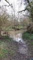
The Hyrôme rises at Saint-Georges-des-Gardes and flows into the Layon 28 km further on. It once powered 29 mills, the remains of which you’ll come across along the route: La Roche-Jeannette, Girôme, Sénéchaux, Argogne, Drapras…
You’ll also have the chance to cross some very old bridges, including the one at Couton – a very photogenic structure with its three arches – which marks the furthest point of the walk.

Reviews and comments

5 / 5
Based on 1 review

Reliability of the description
5 / 5
Ease of following the route
5 / 5
Route interest
5 / 5
User 26412641

Hello,
We tried to follow the red markings without following the directions on the map.
However, we very quickly lost our way and followed the yellow and red markings by mistake.
So we turned back at some point.
We’ll have to do this hike again.
Tip: make sure you follow the directions carefully; the markings are often hidden by vegetation in spring.

Machine-translated

Jean-Miche49
Jean-Miche49

Overall rating : 5 / 5

Date of your route : Nov 10, 2022
Reliability of the description : ★★★★★ Very good
Ease of following the route : ★★★★★ Very good
Route interest : ★★★★★ Very good
Very busy route : Yes

The description does not specify the colour of the markings; please add that they are red.

Machine-translated

Other walks in the area

For more walks, use our search engine .

The GPS track and description are the property of this route's author. Please do not copy them without permission.