Country:
 City:
City:


(S) Leave the section shared with the GR® de Pays Coteaux du Layon et de la Loire by crossing the Pont Barré, which spans the confluence of the Layon and Hyrôme rivers. Continue along the path leading to a small road; follow this for about twenty metres before crossing the busy road from Angers to Cholet (take care when crossing).
(1) Follow the small road opposite, then the winding path to Saint-Lambert-du-Lattay through the vineyards and the Coteaux du Layon. At the junction, carry on straight ahead, then turn left. At the end of the path, keep to the left.
(2) In Saint-Lambert-du-Lattay, cross the Angers–Cholet road again (at a safe crossing) and turn right towards Place de l’Europe, heading towards the far left-hand side of the square. Then follow the signposts through the vineyards. Turn left, then follow the road to the right until you reach the entrance to Parc Ludovic Piard. Enter the park through a small gate on your left, then head down the narrow path immediately on your right to the campsite and take the road on the left.
(3) When you reach the banks of the Hyrôme, follow the path on the right alongside the river until you cross it via a bridge. After a climb, you’ll reach La Jutière.
(4) Turn right. Go round the vineyards and follow the series of paths. At the end of the path, make a quick first turn right then left before keeping to the left until you’re walking alongside a motorway for 2 kilometres, then past farmland, before finally coming out onto a small country road.
(5) Take the road on the right before heading straight on until you reach a crossroads with a wayside cross.
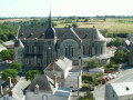
(6) Reach Chanzeaux via the road on the left, which continues as a path. Carry on straight ahead all the way to the village. The church, the vicarage and the castle are a few hundred metres away.
(7) On the main street, follow the signposts, first turning right then left to take Rue du Chapitre at the entrance to the village. Head towards the Moulin du Chapitre (lodges and guest rooms perfect for relaxing on the banks of the Hyrôme).
(8) Take the path leading uphill to the left and turn right towards the Moulin de Point to rejoin the River Hyrôme. Follow the river to the left as far as the Couton bridge. Cross the River Hyrôme.
(9) Once you’ve crossed, turn left; shortly afterwards you’ll pass the guest rooms and open-air café at the Moulin de Drapras, then go under the motorway viaduct and arrive at the ruins of the Moulin d’Argogne.
(10) Shortly afterwards, at the bend, take a path leading uphill to the left, then head back down to the left before reaching the road via a new footbridge. Head down to the left, continuing to follow the River Hyrôme along the opposite bank. The path climbs steeply, with a tricky section involving steps fitted with a rope to aid the ascent. After passing through the zigzags, turn right at the end of the path to rejoin the road.
(11) Turn left. After a short stretch along the road, head back towards the Hyrôme on the right, where you’ll cross the stream several times in succession before reaching the hamlet of the same name.
(12) Keep to the left until you reach the hamlet of La Roche Jeannette.
(13) At La Roche Jeannette, take the road on the left which passes through the hamlet and, as you emerge from a bend, on your right, go through a metal gate onto a path that climbs, secured by a rope. A few hundred metres further on, the Château de l’Écho is visible on the right. You’ll come out onto a main road at the entrance to Chemillé.
(14) At this point, take the pavement on your left to cross the bridge and immediately head up Rue de Val Bourg as you enter the town. Go round the Church of Saint-Pierre on the right, then take Rue du Mail on the left, which runs alongside the Château and the Parc des Cloîtres.
(15) At the end of the car park, cross the main road opposite the cemetery entrance and head left along Rue Nationale for about 1 kilometre until you reach the Jardin Camifolia (tourist information point from May to October).
(16) Cross the road and a small garden beside it, then the neighbouring car park, before heading towards the Église Notre-Dame l’Ancienne on the right. Walk round the building on the right and enter the park after crossing the Hyrôme. Follow the Hyrôme, turning left until you reach Rue du Pont Greneau, then turn left and right at the next two junctions.
(17) At the bottom of the street, take the steps leading down into a grassy area and walk a few metres alongside the River Hyrôme before taking the street on the right. At the bend, turn right onto the small path, cross the river via the footbridge and head towards the Camping de la Coulvée. Back on the road, head towards the campsite entrance and continue straight ahead (E).
 Visorando Member
 Easy
Easy 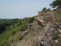

 Moderate
 Tourist office