Saint-Ambroise around Chanzeaux

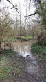
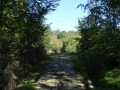
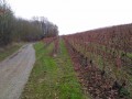
Discover the area around Chanzeaux through its mills and enjoy the tranquillity of the Hyrôme during part of your walk! Park at the Poizeaux car park and make use of the picnic tables before or after your walk. A small path winds through the hedgerows towards the hamlet of Saint-Ambroise and its little chapel.

Details

3486221
Creation:
Last update:
Last review:
  • Walking
    Activity: Walking
  • ↔
    Distance: 3.89 mi
  • ◔
    Average duration: 1h 55 
  • ▲
    Difficulty: Easy

  • ⚐
    Back to start: Yes
  • ↗
    Ascent: + 148 ft
  • ↘
    Descent: - 154 ft

  • ▲
    Highest point: 308 ft
  • ▼
    Lowest point: 131 ft
  • ⚐ Country: France
  • ⚐ City: Chanzeaux (49750)
  • ⚑
    Start/End: N 47.255921° / W 0.63906°
  • ❏
    IGN map(s): Ref. 1523SB
  • Hour-by-hour weather

Photos

Description of the walk

Park at the Poizeaux car park. Follow the yellow markings.

(S/E) Exit via the grassy path at the bottom of the grounds on the opposite side to the entrance, and follow the Ruisseau de la Planchette. A few hundred metres further on, you will reach a T-junction.

(1) Take thefirst path on the left, which leads to Saint-Ambroise. At the road, turn right, cross the hamlet and continue to the Piron well.

(2) Turn right, then left, then right again until you reach the chapel. At the chapel, continue straight on to join the road.

(3) Follow it to the left, then turn right onto thefirst path, which leads to Couton. Continue to the bridge and return to the shed.

(4) Take the path that runs alongside the Hyrôme. Pass the Moulin de Point and continue for a few metres to reach a bridge.

(5) Continue straight on without crossing the Hyrôme. Follow the path alongside the Ruisseau de la Planchette to a four-way junction. Turn right towards the Peltier mill.

(6) Take the road; at the next crossroads, turn right to return to the original crossroads.

(1) Turn left and follow the route you took on the way out to return to the car park at the Poizeaux area (S/E).


Waypoints

  1. S/E : mi 0 - alt. 253 ft - Aire de Poizeaux
  2. 1 : mi 0.24 - alt. 230 ft - Crossroads of the circular loop
  3. 2 : mi 0.75 - alt. 285 ft - The hamlet of Saint-Ambroise
  4. 3 : mi 1.05 - alt. 305 ft - Chapel of Saint Ambrose
  5. 4 : mi 2.21 - alt. 154 ft - Couton
  6. 5 : mi 2.66 - alt. 135 ft - Pont de Point
  7. 6 : mi 3.32 - alt. 253 ft - Peltier Mill
  8. S/E : mi 3.89 - alt. 253 ft - Aire de Poizeaux

Worth a visit

Chanzeaux Castle
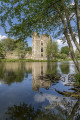
In the heart of the Hyrôme Valley, this beautiful building boasts a neo-Gothic façade designed by the architect Hodé and extensive outbuildings. It was built by the Count of Quatre Barbe and is now a private property that can be visited during the European Heritage Days.

Saint-Ambroise Chapel
This small Chapel of Saint-Ambroise was acquired by the inhabitants, mostly weavers, from the Lord of Chanzeaux. The parish suffered numerous disasters and was partly destroyed.
Like the houses, in the late 15th century, the chapel was built of earth. After it was devastated, Mlle Jaugeray had it rebuilt, placing it under the protection of Saint Ambrose and Saint Barbara.
Before the arrival of the new parish priest, Father Bonsergent, restoration work was undertaken during the winter of 1960–1961. All the inhabitants of Saint-Ambroise and the neighbouring villages came to lend a hand with the work.

Reviews and comments

4.5 / 5
Based on 5 reviews

Reliability of the description
4.4 / 5
Ease of following the route
4.6 / 5
Route interest
4.6 / 5
DPMM
DPMM

Overall rating : 4.7 / 5

Date of your route : Apr 20, 2023
Reliability of the description : ★★★★☆ Good
Ease of following the route : ★★★★★ Very good
Route interest : ★★★★★ Very good
Very busy route : No

A lovely walk through varied scenery. However, it’s best to avoid doing it during periods of heavy rain. At kilometre 5, follow the map: don’t take the narrow path that runs directly alongside the Planchette stream, but the more visible one that climbs up and then runs roughly parallel to the stream, higher up.

Machine-translated

Dame8096
Dame8096
• Edited:

Overall rating : 5 / 5

Date of your route : Nov 11, 2022
Reliability of the description : ★★★★★ Very good
Ease of following the route : ★★★★★ Very good
Route interest : ★★★★★ Very good
Very busy route : No

A really lovely route. We went on it as a family with my two daughters, aged 4 and 6. Everyone loved it – the scenery was stunning, and there were some truly wonderful places to see.

Machine-translated

Filou58
Filou58

Overall rating : 3.7 / 5

Date of your route : Mar 06, 2022
Reliability of the description : ★★★☆☆ Average
Ease of following the route : ★★★☆☆ Average
Route interest : ★★★★★ Very good
Very busy route : No

A lovely route, though the markings have faded in several places, particularly at the start... and in other spots.
Luckily we had our GPS!!!

Machine-translated

jclaudem49
jclaudem49

Overall rating : 4.7 / 5

Date of your route : Dec 20, 2021
Reliability of the description : ★★★★★ Very good
Ease of following the route : ★★★★★ Very good
Route interest : ★★★★☆ Good
Very busy route : No

Well done

Machine-translated

Ôsez Mauges
Ôsez Mauges

Thank you for your review. We look forward to seeing you again in our region, exploring the trails of the Mauges.
Marie on behalf of the ôsezMauges team

Machine-translated

Chantal & Lewis
Chantal & Lewis

Overall rating : 4.7 / 5

Date of your route : Jan 22, 2021
Reliability of the description : ★★★★★ Very good
Ease of following the route : ★★★★★ Very good
Route interest : ★★★★☆ Good
Very busy route : Yes

We had a lovely walk today. Be careful, the streams are swollen... We had to wade through a ford with about 40 cm of water; otherwise, we would have had to turn back and add 5 km to the walk!

Machine-translated

Other walks in the area

For more walks, use our search engine .

The GPS track and description are the property of this route's author. Please do not copy them without permission.