Country:

 City:
City:


After leaving the D1006, park by the cross at the entrance to the hamlet of Côte Barrier.
(S/E) With your back to the car park, head towards the campsite.
(1) At the bend in the road, take the path opposite. At first, it’s a pleasant path surrounded by pine forests. It then veers slightly to the left and enters the woodland. After passing between rocky outcrops, it descends to join the GR®9.
(2) Follow it to the right until you reach a good forest track. Leave the GR®9. First turn left then right, and head up the forest track. At the end of the track, take the path on the right.
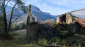
(3) Walk past a pond and arrive at a gate which you must go through. You’ll reach the ruins of Gerbaix above.
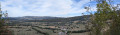
(4) Pass the ruins and, from here, follow the GPX track closely as there isn’t really a proper path. After crossing a woodland, head down to the right through mountain pastures and join a small road (there’s a caravan just before the road).
(5) Turn left onto the road until you reach the left-hand bend, where a small path descends to the right, heading due west.
(6) Take care as the path is initially obscured by ferns and brambles. It alternates between ascents and descents, sometimes through brambles and sometimes with a few rocks to cross. There are regular white markings either on the rocks or on the trees. You’ll reach the junction with the GR®9 path coming from the Saint-Blaise car park.
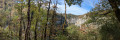
(7) Head straight on along the GR®9, which follows the cliff face of the Gorges de l’Échaillon.
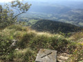
(8) Here, a panoramic view offers a glimpse of the heights of the gorges. Continue with caution along the cliff face.
(9) Leave the GR®9, which descends to the left towards Pont Saint-Martin. Turn right. Further on, at the fork, stay on the path that heads left to reach the Gerbaix viewpoint.
(10) Leave the viewpoint and follow the path to the left. At a sharp bend to the left, carry on straight ahead until you reach the junction at the 565-metre mark. Ignore the paths to the left and right and carry on straight ahead. The path will bend to the left and join the Route de Saint-Blaise.
(11) Turn right, heading due south along the small road, pass a house and arrive at the pond on your right.
(12) After visiting the spring and returning, head to the crossroads and go up to the right along the forest track for 100 m.
(13) Head far to the left onto the barely visible path through the tall grass. Keep following it straight ahead. It widens, becomes easier to walk on and joins the Route de Côte Barrier at the D1006.
(14) Do not turn onto it. Turn right, heading due east, onto the Route de Côte Barrier for 200 metres, to return to the car park (S/E).

 Visorando Member

 Easy
Easy 
 Difficult
 Tourist office