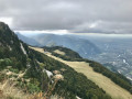
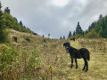
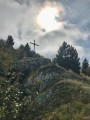
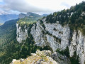
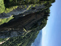
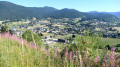
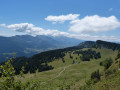
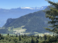
The Bec de l’Orient and the Grotte de la Ture as seen from the Banc de l’Ours

A lovely walk with no technical difficulties, on generally easy paths.
Most of the route is through woodland, interspersed in places with interesting karst landscapes. The northern section offers extraordinary panoramic views over the Isère valley and beyond.
The fascinating Grotte de la Ture offers a brief caving experience, provided you have a minimum of equipment.

Details

n°39586881
Creation:
Last update:
Last review:
  • Walking
    Activity: Walking
  • ↔
    Distance: 8.77 mi
  • ◔
    Average duration: 5h 55 
  • ▲
    Difficulty: Moderate

  • ⚐
    Back to start: Yes
  • ↗
    Ascent: + 2,175 ft
  • ↘
    Descent: - 2,175 ft

  • ▲
    Highest point: 5,266 ft
  • ▼
    Lowest point: 3,661 ft

Photos

Description of the walk

Park in one of the two dirt car parks at the crossroads 100 m before the Auberge du Banc de l’Ours.

(S/E) Leave the road to the left immediately after the right-hand bend, heading north-west. You will soon come to theGR® 9. Take this to the right, following a forest track in fairly good condition, with a generally stony or gravelly surface. Take a wide left-hand bend (the Fontaine Renard is on the right), then turn right and you will reach a lovely forest track.

(1) Cross the track and continue along theGR®-marked forest path. You’ll reach the “Sous Pierre Taillée” junction with a forest path leading uphill to the left.

(2) Take this to the left up a fairly steep climb. At the first fork, take the path on the right that climbs (yellow-green markings), then, at a high point on the path, leave it to the right via a well-marked track that climbs up to the Pas de Pierre Taillée (view over the Isère valley).

(3) Head back down to the fork you passed earlier.

(2) Continue climbing northwards along a section of refurbished forest track until you reach the crossroads known as “Les Fayards”.

(4) Ignore the right-hand branch leading to the Cabane de Nave, and continue climbing until you soon reach the ridge and the edge of the cliff. Follow it to the Signal de Nave.

(5) Continue along the path which more or less follows the ridge until you reach a junction at Pré de Nave.

(6) Ignore the path leading down to the Cabane de Nave and continue straight on until you reach a fork at La Cheminée. Approach the edge of the cliff carefully to admire, on your left, the slender vertical rock faces several hundred metres high, and a further panoramic view of the Isère valley.

(7) Continue along the path northwards to the Bec de l’Orient.

(8) Walk a short way down from the cross to enjoy one of the most impressive views.
Return to the previous junction.

(7) Turn left towards L’Avion and Gève, then, 100 metres on, visit the shelter built in memory of a Resistance camp.

(9) Retrace your steps for 50 m and take a little-used forest track, which heads due south across a karst area and winds its way in numerous zigzags, with many short ascents and descents. You’ll reach a fork in the path (alt. 1,475 m).

(10) Take care at this point: the track appears to go straight on, but you must turn sharply right to stay on the path, which continues to zigzag, generally running close to the rocks of La Ture.
After about 1,500 m of this rollercoaster ride, you’ll reach a sort of plateau.

(11) From there, take the gravel forest track, which is in very good condition and undulates gently towards the south, generally on a downward slope. Follow it for about 2 km until you reach a sharp right-hand bend, followed by a left-hand bend.

(12) Take care on this bend: the start of the path branching off to the right is not very visible. However, the path is well marked and leads to the Grotte de la Ture.

(13) You can visit the cave, or part of it, provided you have a torch and suitable equipment.
Please note: respect the peace and quiet of the bats, who are the cave’s primary inhabitants!
On leaving the cave, cross the forest track and take the path leading southwards.
After a few hundred metres, cross another forest track and continue for 300 m until you reach some pastures at the edge of the forest, where there is a sort of crossroads of paths.

(14) Take the right-hand branch, heading south-west, which descends into the meadow and then enters the forest again.
You’ll come to a junction with a main track.

(15) Take the path opposite, which leads uphill. Walk past the Auberge du Banc de l’Ours, and you’ll reach the car park (S/E).


Waypoints

  1. S/E : mi 0 - alt. 3,688 ft - Car park
  2. 1 : mi 0.84 - alt. 4,396 ft - Crossing a forest track
  3. 2 : mi 2.18 - alt. 5,036 ft - Junction A/R
  4. 3 : mi 2.49 - alt. 5,266 ft - Pas de Pierre Taillée
  5. 4 : mi 3.13 - alt. 5,115 ft - Les Fayards – crossroads
  6. 5 : mi 3.39 - alt. 5,217 ft - Signal de Nave
  7. 6 : mi 3.83 - alt. 5,000 ft - Pré de Nave
  8. 7 : mi 4.2 - alt. 4,931 ft - La Cheminée
  9. 8 : mi 4.43 - alt. 5,016 ft - Bec de l'Orient (1554 m)
  10. 9 : mi 4.7 - alt. 4,970 ft - Le Camp des Carteaux
  11. 10 : mi 5.12 - alt. 4,974 ft - Turn right
  12. 11 : mi 6.11 - alt. 4,990 ft - Viewing platform and start of the forest track
  13. 12 : mi 7.56 - alt. 4,462 ft - Grotte Trail
  14. 13 : mi 7.69 - alt. 4,350 ft - Grotte de la Ture
  15. 14 : mi 8.27 - alt. 3,819 ft - Crossroads
  16. 15 : mi 8.55 - alt. 3,661 ft - Crossroads
  17. S/E : mi 8.77 - alt. 3,684 ft - Car park

Notes

There is a fountain between (1) and (2), but the water is not declared safe to drink.
Shelter is available at (9) Le Camp des Corbeaux.
The paths and tracks present no difficulty, but mid-cut trainers are recommended for a few short stony sections.

Always be cautious and plan ahead when you're outdoors. Visorando and the author of this route cannot be held responsible for any accidents occurring on this route.

The GR® and PR® markings are the intellectual property of the Fédération Française de Randonnée Pédestre.

Reviews and comments

4 / 5
Based on 2 reviews

Reliability of the description
4.5 / 5
Ease of following the route
4 / 5
Route interest
3.5 / 5
swat
swat

Overall rating : 3.3 / 5

Date of your route : May 11, 2024
Reliability of the description : ★★★★☆ Good
Ease of following the route : ★★★★☆ Good
Route interest : ★★☆☆☆ Disappointing
Very busy route : Yes

The first section was along a path damaged by forestry work. We were lucky to do it on a Saturday; otherwise, the machinery would have been there. A few scattered views of the northern Vercors as far as the Bec de l’Orient. The return journey is uninteresting. Difficult to follow, given that there is a discrepancy between the markings on the map and the actual terrain. The path is monotonous. We should surely have taken the route via La Nave, which would have added some of the Vercors’ charm to this walk.

Machine-translated

JCParavy
JCParavy

Overall rating : 4.7 / 5

Date of your route : Oct 15, 2023
Reliability of the description : ★★★★★ Very good
Ease of following the route : ★★★★☆ Good
Route interest : ★★★★★ Very good
Very busy route : No

A circular walk undertaken on an autumn Sunday, following the route in the opposite direction to that shown on the map, so as to visit the Grotte de la Ture first, and completed with a few variations: the ascent to the cave via a little-used but easy-to-climb valley, and a direct descent from the Signal de Nave.
7 hours in total, including the visit to the cave.
Should be possible on snowshoes in winter.

Machine-translated

Other walks in the area

For more walks, use our search engine .

The GPS track and description are the property of this route's author. Please do not copy them without permission.