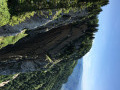
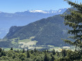
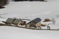
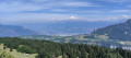
The Signal de Nave, starting from Autrans

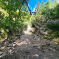
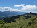
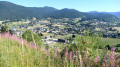
From Autrans to the Signal de Nave, with a snack at the Cabane de Nave.

Details

33663629
Creation:
Last update:
Last review:
  • Walking
    Activity: Walking
  • ↔
    Distance: 9.67 mi
  • ◔
    Average duration: 6h 15 
  • ▲
    Difficulty: Moderate

  • ⚐
    Back to start: Yes
  • ↗
    Ascent: + 2,110 ft
  • ↘
    Descent: - 2,087 ft

  • ▲
    Highest point: 5,226 ft
  • ▼
    Lowest point: 3,432 ft

Description of the walk

Park in one of the car parks in Autrans.

(S/E) Walk to the Grand Champ residence. Continue westwards to reach the junction with Rue les Épérouses. Take this road, then turn onto Rue du Bourg Dessous. Walk to Bourg de Dessous.

(1) Walk through the village, veering first left then right. Then take the Route Forestière de Nave. You’ll reach the Font Scellier fountain.

(2) Leave the road here, turn left, then head up the Pas de Montbrand track on the left. Join theGR®9before reaching the pass.

(3) Turn right onto this path, also known as the Sentier de Pierre Taillée. Follow it until you reach the Signal de Nave.

(4) Continue a few metres from the cliff until you reach a path junction in a clearing.

(5) Turn left to reach the Fontaine de Nave.

(6) Retrace your steps back to the crossroads.

(5) Carry on straight ahead to begin the descent. You’ll reach the junction with the path to the Cabane de Nave.

(7) Turn right onto this path to reach the hut very quickly.

(8) Return to the previous crossroads.

(7) Turn right onto the path and continue down the slope until you reach the Route Forestière de Nave further on.

(9) Take this road straight ahead, continuing on to return to the Font Scellier junction you passed on the way out.

(2) Turn left onto the Route Forestière des Épérières. One kilometre further on, you’ll reach the Grotte de la Ture.

(10) : Take the path marked in yellow and green heading south and continue along this path until you reach the Route du Bourg de dessus, then arrive at the initial junction at Bourg de dessous which you passed on the way out.

(1) Retrace your steps along the route you took on the way there to return to your chosen car park in Autrans (S/E)

Waypoints

  1. S/E : mi 0 - alt. 3,438 ft - Car park near the Résidence Grand Champ
  2. 1 : mi 0.5 - alt. 3,471 ft - Bourg de Dessous. Junction of the circular loop
  3. 2 : mi 2.3 - alt. 4,255 ft - Font Scellier spring
  4. 3 : mi 2.83 - alt. 4,380 ft - GR9
  5. 4 : mi 4.75 - alt. 5,217 ft - Signal de Nave
  6. 5 : mi 5.16 - alt. 5,007 ft - Northern boundary
  7. 6 : mi 5.31 - alt. 4,856 ft - Nave Spring
  8. 7 : mi 5.87 - alt. 4,892 ft - Cabane Crossroads
  9. 8 : mi 5.94 - alt. 4,915 ft - Nave Hut
  10. 9 : mi 6.58 - alt. 4,629 ft - Nave Forest Road
  11. 10 : mi 7.83 - alt. 4,337 ft - La Ture Cave
  12. S/E : mi 9.67 - alt. 3,442 ft - Car park near the Résidence Grand Champ

Notes

(8) Cabane de Nave, equipped with a stove, a table and several chairs; upstairs there is a sleeping area.

Worth a visit

Holiday ideas in Autrans-Méaudre – see here

Always be cautious and plan ahead when you're outdoors. Visorando and the author of this route cannot be held responsible for any accidents occurring on this route.

The GR® and PR® markings are the intellectual property of the Fédération Française de Randonnée Pédestre.

Reviews and comments

4.9 / 5
Based on 3 reviews

Reliability of the description
5 / 5
Ease of following the route
5 / 5
Route interest
4.7 / 5
Picson06230
Picson06230

Overall rating : 5 / 5

Date of your route : Jul 09, 2026
Reliability of the description : ★★★★★ Very good
Ease of following the route : ★★★★★ Very good
Route interest : ★★★★★ Very good
Very busy route : No

A really lovely walk starting from the treetop adventure park, as recommended by Frordi 01 (thanks to him!!), which avoids the tiring bit on the plateau during this hot weather.
Stunning views!!

Machine-translated

Fordi01
Fordi01

Overall rating : 4.7 / 5

Date of your route : May 01, 2025
Reliability of the description : ★★★★★ Very good
Ease of following the route : ★★★★★ Very good
Route interest : ★★★★☆ Good
Very busy route : No

There’s a lovely view when you reach the signpost, but there’s a lot of tarmac at the start. It might be best to park at the treetop adventure park car park and do the circular route.

Machine-translated

guybour69
guybour69

Overall rating : 5 / 5

Date of your route : May 15, 2023
Reliability of the description : ★★★★★ Very good
Ease of following the route : ★★★★★ Very good
Route interest : ★★★★★ Very good
Very busy route : No

A walk offering some stunning views and clearly described in the guidebook
Shortcuts are available if required: first, from Autrans, you can drive along the Naves forest road to the small car park at Fontaine Scellier. From there, you can avoid the detour to reach Bridge 3. To do this, continue along the tarmac road to a clearing where a path branches off to the left. It’s a rather steep climb, but it takes you onto the GR 9, where you can follow the guidebook route to the right.
For the descent, you can extend the route by heading to the Bec de l’Orient and descending either as indicated in the guidebook towards point 7, or, at the ‘cheminée’, head down via La Ture and the Grotte de la Ture before reaching Fontaine Scellier.

Machine-translated

Other walks in the area

For more walks, use our search engine .

The GPS track and description are the property of this route's author. Please do not copy them without permission.