


Refine your search for walks in Lane (rivière) - Affluent de l'Artuby
Lane (rivière) - Affluent de l'Artuby walks


 The Col de la Baïsse, the Castellaras and the Château des Quatre Tours
 Visorando Member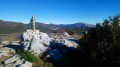
 7.46 mi
 +1,526 ft
 -1,503 ft
 4h 45
4h 45
 Moderate
 Departure from Andon (Alpes-Maritimes)
This hike is accessible to all. The highlight is the magnificent site of Castellaras, the only difficulty being the climb, which is nevertheless reasonable. The hike starts from the picturesque health resort of Thorenc. The route also offers views of Lake Thorenc and the Château des Quatre Tours. The variety of landscapes and paths is another interesting aspect of this hike. What's more, there are no navigation difficulties.
Valderoure route, returning via Malamaire
 8.94 mi
+1,650 ft
-1,647 ft
5h 35
Moderate
Departure from Valderoure (Alpes-Maritimes)
8.94 mi
+1,650 ft
-1,647 ft
5h 35
Moderate
Departure from Valderoure (Alpes-Maritimes)
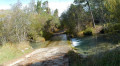
Starting from the charming village of Valderoure, this route with its varied landscapes will take you through a pine forest to the hamlet of Les Beaux. After crossing the Lane and Artuby rivers, you will pass through the hamlet of Malamaire before returning to Valderoure, still in the forest.
Le Castellaras and Lac de Thorenc starting from La Pinée
 9.76 mi
+2,405 ft
-2,385 ft
6h 35
9.76 mi
+2,405 ft
-2,385 ft
6h 35
 Difficult
Departure from Andon (Alpes-Maritimes)
Difficult
Departure from Andon (Alpes-Maritimes)
Another route leading to the ruins of Castellaras and Lac de Thorenc, which follows part of the existing route on Visorando. It starts from the D5, at a place called La Pinée, and is just as interesting.
Walks near Lane (rivière) - Affluent de l'Artuby
Le Mas - Amirat
 8.31 mi
+2,480 ft
-2,598 ft
6h 00
Moderate
Departure from Le Mas (Alpes-Maritimes)
8.31 mi
+2,480 ft
-2,598 ft
6h 00
Moderate
Departure from Le Mas (Alpes-Maritimes)
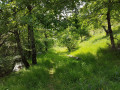
The first stage of the journey through the Haut Estéron region: the landscapes are magnificent and the area extremely wild; we didn’t come across a single other hiker. The trails are varied and well-marked. We’ll set off from the village of Le Mas to reach Amirat (lodge) via the Charamel mountain and the village of Les Mujouls.
Amirat - Saint-Auban
 9.15 mi
+2,989 ft
-2,461 ft
6h 50
Difficult
Departure from Amirat (Alpes-Maritimes)
9.15 mi
+2,989 ft
-2,461 ft
6h 50
Difficult
Departure from Amirat (Alpes-Maritimes)
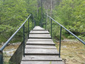
Second stage of the journey through the Haut-Estéron region. This stage takes you to Saint-Auban via the pretty villages of Gars and Briançonnet, then over the somewhat steep Col de l’Escoussier; a variety of landscapes and a trek through wild countryside await!
Saint-Auban - Le Mas
 8.61 mi
+1,444 ft
-1,827 ft
5h 15
Moderate
Departure from Saint-Auban (Alpes-Maritimes)
8.61 mi
+1,444 ft
-1,827 ft
5h 15
Moderate
Departure from Saint-Auban (Alpes-Maritimes)
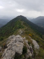
The final stage of the hike in the Haut-Estéron region; this route mainly follows tracks through the woodland before reaching the ridge of Mount Charamel, which is well worth the detour in its own right: the view is sublime. You then descend gently back down to the village of Le Mas.
 Croix de Verse via the Cheiron forest
 6.82 mi
+1,516 ft
-1,427 ft
5 hrs
Moderate
Departure from Alpes-Maritimes
6.82 mi
+1,516 ft
-1,427 ft
5 hrs
Moderate
Departure from Alpes-Maritimes
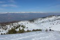
A beautiful snowshoe hike (or not in winter) with no difficulty and panoramic views of the Mercantour peaks and the French Riviera on a clear day.
After a pleasant first section in the Cheiron forest, you cross a small valley before climbing up to Plan des Baumetes and reaching the Crête du Cheiron at Croix de Verse (1,706 m).
360° view of the sea at Argentera!
From the Saint-Césaire ponds to the Ponadieu Arch
4.62 mi
+1,988 ft
-1,512 ft
3h 50
 Easy
Departure from Saint-Cézaire-sur-Siagne (Alpes-Maritimes)
Easy
Departure from Saint-Cézaire-sur-Siagne (Alpes-Maritimes)
This walk follows the route of the watercourse, offering magnificent views of the Grasse hinterland as it follows theGR®510route. You can see the village of Mons from here.
Please note that this walk is not circular; you will need to arrange for a vehicle to be waiting for you at the end of the walk in Saint-Vallier-de-Thiey.
Gueydan Bridge – Entrevaux via the summit of La Lette
 10.68 mi
+3,665 ft
-3,845 ft
8h 05
Difficult
Departure from Saint-Benoît (Alpes-de-Haute-Provence) (Alpes-de-Haute-Provence)
10.68 mi
+3,665 ft
-3,845 ft
8h 05
Difficult
Departure from Saint-Benoît (Alpes-de-Haute-Provence) (Alpes-de-Haute-Provence)
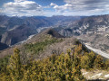
A beautiful, challenging route that keeps you on the ridgelines. The C-shaped configuration of the Var means that throughout this ascent you can admire the river’s banks on both the north and south sides. At the end of the hike, wander through the narrow streets lined with old walls in this magnificent village.
Siagne Canal from Saint-Mathieu to La Croisette Beach in Cannes
 14.61 mi
+226 ft
-801 ft
6h 55
Difficult
Departure from Grasse (Alpes-Maritimes)
14.61 mi
+226 ft
-801 ft
6h 55
Difficult
Departure from Grasse (Alpes-Maritimes)
In search of the route of the Siagne Canal between the Saint-Mathieu district in Grasse and Cannes.
This hike is over 20 km long but is not difficult.
The return journey will be from Cannes station, where you can take either the train or the bus to Grasse station.