From the Saint-Césaire ponds to the Ponadieu Arch

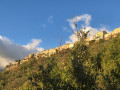
This walk follows the route of the watercourse, offering magnificent views of the Grasse hinterland as it follows theGR®510route. You can see the village of Mons from here.
Please note that this walk is not circular; you will need to arrange for a vehicle to be waiting for you at the end of the walk in Saint-Vallier-de-Thiey.

Details

12717436
Creation:
Last update:
Last review:
  • Walking
    Activity: Walking
  • ↔
    Distance: 4.62 mi
  • ◔
    Average duration: 3h 50 
  • ▲
    Difficulty: Easy

  • ⚐
    Back to start: No
  • ↗
    Ascent: + 1,988 ft
  • ↘
    Descent: - 1,512 ft

  • ▲
    Highest point: 2,356 ft
  • ▼
    Lowest point: 1,608 ft

Description of the walk

Park in the small car park below Les Bassins.

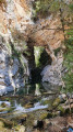
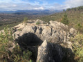
(S) Continue uphill along theGR®510. Leave theGR® at the hairpin bend to walk alongside the ponds on the left. Then rejoin theGR®, marked in red and white, and head due north to reach the natural rock face used for climbing.

(1) Continue along theGR® through the Bois des Malines to reach the junction at marker 76 shortly afterwards.

(2) Keep to the right on theGR® to reach the Vallon Rousset junction at marker 77.

(3) Cross the road and continue straight ahead into the Bois de Rousset to reach another junction at marker 78.

(4) Turn sharply left (90°), still on theGR®, and pass marker 79 whilst crossing the Ruisseau du Vallon de la Combe. Walk slightly uphill to reach the junction at marker 80.

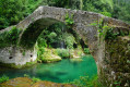
(5) Leave theGR® and take the path leading down to the left. This will take you to the Arche de Ponadieu.

(6) Turn back and head for the junction marked with signpost 80.

(5) Head straight ahead, crossing theGR®, to quickly reach the car park at the end of the route, which is situated at the end of the Chemin de la Siagne at marker 81 (E).


Waypoints

  1. S : mi 0 - alt. 1,857 ft - Car park by the ponds
  2. 1 : mi 1.04 - alt. 1,972 ft - Natural climbing wall
  3. 2 : mi 1.91 - alt. 1,985 ft - Marker 76
  4. 3 : mi 2.49 - alt. 1,972 ft - Marker 77
  5. 4 : mi 3 - alt. 1,975 ft - Marker 78
  6. 5 : mi 3.2 - alt. 1,985 ft - Marker 80
  7. 6 : mi 3.79 - alt. 1,608 ft - Arche de Ponadieu
  8. E : mi 4.62 - alt. 2,356 ft - Finish car park, marker 81

Always be cautious and plan ahead when you're outdoors. Visorando and the author of this route cannot be held responsible for any accidents occurring on this route.

The GR® and PR® markings are the intellectual property of the Fédération Française de Randonnée Pédestre.

Reviews and comments

4.2 / 5
Based on 3 reviews

Reliability of the description
4 / 5
Ease of following the route
4 / 5
Route interest
4.7 / 5
souppcl2
souppcl2

Overall rating : 4 / 5

Date of your route : Apr 28, 2023
Reliability of the description : ★★★★☆ Good
Ease of following the route : ★★★★☆ Good
Route interest : ★★★★☆ Good
Very busy route : No

We explored this walk as a recce for a group. We stopped at stage 1 and turned back. In this section, the GR 510 is very steep, with several places where there is a risk of slipping and suffering very serious, even fatal, falls. We do not recommend this walk for young children or large groups. Teenagers can do it if they are wearing proper footwear, not just trainers. We could see the Siagne Gorges only during the very first section. After that, the trees block the view.

Machine-translated

danielaime06
danielaime06
• Edited:

Overall rating : 4.3 / 5

Date of your route : Apr 16, 2023
Reliability of the description : ★★★★☆ Good
Ease of following the route : ★★★★☆ Good
Route interest : ★★★★★ Very good
Very busy route : No

Even on a spring Sunday, I didn’t come across a single hiker for two-thirds of the route, apart from near the Ponadieu arch, where there were a few groups.
This route is very pleasant, varied and quite hilly (in the first section). I’d recommend it to everyone, but make sure you wear suitable footwear, as some of the ascents and descents are stony and/or slippery.
I was a bit unsure at the start near the ponds; it would be useful to add a note in the section (S) along the lines of ‘stick as close as possible to the wall of the ponds’, as otherwise you risk getting lost in some rather dangerous areas.
As I couldn’t get a lift to St Vallier, I tried to do a round trip with a circular route to mix things up a bit. If you’re interested in this alternative route, it’s called “From the EDF reservoirs at Saint-Césaire to the Arche Ponadieu” and has the number 32712884

Thanks to the author, and happy hiking to you all

Machine-translated

resideo
resideo

Overall rating : 4.3 / 5

Date of your route : Sep 13, 2021
Reliability of the description : ★★★★☆ Good
Ease of following the route : ★★★★☆ Good
Route interest : ★★★★★ Very good
Very busy route : Yes

A lovely walk – easy and suitable for the whole family.

Machine-translated

Other walks in the area

For more walks, use our search engine .

The GPS track and description are the property of this route's author. Please do not copy them without permission.