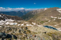
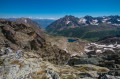
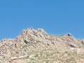
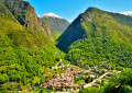
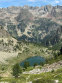
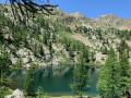
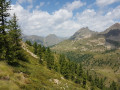
Lausfer Lakes and Peaks from the Isola 2000 road

A challenging and off-the-beaten-track hike, featuring a postcard-perfect ascent through larch trees, three magnificent lakes and a breathtaking 360° view from the summit. Remember to take a towel: a river crossing is almost essential depending on the season.

Details

3303499
Creation:
Last update:
Last review:
  • Walking
    Activity: Walking
  • ↔
    Distance: 7.48 mi
  • ◔
    Average duration: 7h 00 
  • ▲
    Difficulty: Difficult

  • ⚐
    Back to start: Yes
  • ↗
    Ascent: + 4,098 ft
  • ↘
    Descent: - 4,098 ft

  • ▲
    Highest point: 8,235 ft
  • ▼
    Lowest point: 4,121 ft

Photos

Description of the walk

Take the road to Isola 2000, and about 4–5 km past the village of Isola, you’ll come across marker 60 on your left. You can park on the hard shoulder on the right a few metres further up.

(S/E) Continue along the road heading due west for about 50 m. Turn right onto a track that climbs up the Guercha valley, towards the Lausfer lakes. Pass under the power line and continue along the winding track.

(1) Cross the Guercha torrent and carry on along a gentle, pleasant ascent with little change in elevation.

(2) You’ll pass a few houses set against a magnificent backdrop: numerous streams and waterfalls dot the ascent. Continue to the end of the track at marker 61. Keep heading north towards the lakes. Be careful to stay on the path, otherwise you’ll end up in a field of stinging nettles. From here onwards, the markings are often few and far between and not easy to spot. Keep your eyes peeled.

(3) You’ll need to cross the stream here, but the snowmelt makes it impassable if you want to stay dry. The yellow markings are clearly visible on either side of the stream, so the path is definitely there. Take off your shoes and wade across – that’s still the easiest option. I couldn’t find a safe, dry place to cross.
Continue to follow this stream.

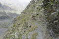
(4) From here, the gradient steepens and the terrain is quite rugged. Take care as you make your way over the scree; good footwear and walking poles are essential, particularly for the descent. The yellow markings are still not easy to spot, but you’ll eventually find them.

(5) The IGN map shows a fork here, but I didn’t see anything. Stay on the right path by following the markings. The pass isn’t far now!

(6) Here, at last, are the first two Lausfer Lakes. The path runs between them.

(7) The path isn’t very visible here, but it’s nothing you can’t manage. You can climb up to the upper lake via the left or the right – it doesn’t really matter. Go round it to the west, passing a bunker, to reach the path leading to the pass. Be careful – there’s still a bit of snow here in May.

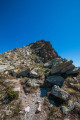
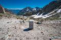
(8) You’ve now reached the Col du Lausfer, marked by marker 65 and a boundary stone. Italy is directly opposite, and you’ll see a path heading north towards the summit. It isn’t very far, and although it looks daunting from the pass, the path is perfectly passable. You’ll only need to use your hands once or twice, but it’s nothing too difficult. Stay on the path and keep an eye out for cairns in the scree sections. You’ll reach the summit very quickly.

(9) You’ve now reached the summit; enjoy the magnificent view before heading back down the same way to (S/E).
You can also take a short detour to Upper Lausfer Lake from the Col de Lausfer.

Waypoints

  1. S/E : mi 0 - alt. 4,137 ft - Car park after marker 60
  2. 1 : mi 0.76 - alt. 4,596 ft - Bridge at the - Guercha (torrent)
  3. 2 : mi 1.43 - alt. 5,052 ft - Guercha Soubeïrane
  4. 3 : mi 1.57 - alt. 5,161 ft - Fording
  5. 4 : mi 1.81 - alt. 5,535 ft - Lausfer Valley
  6. 5 : mi 2.77 - alt. 7,205 ft - Towards the lakes
  7. 6 : mi 3.2 - alt. 7,641 ft - Lower Lausfer Lakes or Variclès
  8. 7 : mi 3.25 - alt. 7,680 ft - Towards the pass
  9. 8 : mi 3.56 - alt. 7,943 ft - Upper Lake option - Col du Lausfer
  10. 9 : mi 3.73 - alt. 8,232 ft - Lausfer Peaks
  11. S/E : mi 7.48 - alt. 4,137 ft - Car park after marker 60

Notes

There are numerous streams along the entire route, but it is not known whether the water is safe to drink.

Please note: a wading crossing may be necessary depending on the season at (3); remember to bring a towel.

Much of the ascent is very steep and over loose, unstable scree; ensure you are properly equipped.

Reviews and comments

4.7 / 5
Based on 2 reviews

Reliability of the description
5 / 5
Ease of following the route
4 / 5
Route interest
5 / 5
toniomex
toniomex

Overall rating : 4.7 / 5

Date of your route : Oct 28, 2025
Reliability of the description : ★★★★★ Very good
Ease of following the route : ★★★★☆ Good
Route interest : ★★★★★ Very good
Very busy route : No

This is the second time I've done this hike this year, once in June to the pass, and yesterday to the summit. Very few people up to the lakes, and then a few people on the heights, mainly coming from the more accessible Italian side.
This hike is for experienced hikers, both in terms of following the route and the often difficult terrain.
Note: we descended via the Saboulé valley from the Saboulé pass, following the route available on the "open street map hiking" map. The path is very poorly marked, sometimes completely absent, there are no cairns, and it is a little complicated at around 2300m but it is passable (steeper slope); at this point we went around the small cliffs at the bottom, but I am not sure if we followed the trail that may have gone over the top. Alternatively, you can avoid this by taking the less steep slopes on the right bank of the valley, via the path crossing at around 2370m, which is worth exploring. This area should be avoided during grazing season if you want to avoid the patous (shepherd dogs) that guard this beautiful spot, as there is no way around them.

Machine-translated

Remi_22
Remi_22

Overall rating : 4.7 / 5

Date of your route : Jul 22, 2023
Reliability of the description : ★★★★★ Very good
Ease of following the route : ★★★★☆ Good
Route interest : ★★★★★ Very good
Very busy route : No

It’s a brilliant walk. Wild and off the beaten track. The views are magical and there are plenty of waterfalls along the trail. However, the route passes a sheepfold at point 3 and there are sheepdogs there, so you’ll need to go round via the river.

Machine-translated

Other walks in the area

For more walks, use our search engine .

The GPS track and description are the property of this route's author. Please do not copy them without permission.