Country:

 City:
City:


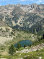
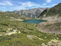
The route starts from the SP255 road, approximately 2.5 km from the Col de la Lombarde on the Italian side. There are several parking spaces at the side of the road near the small lake of Orgials Infériore.
(S/E) From the car park, follow the road north-west until you reach a hairpin bend (parking is also available at this point).
(1) Take the path that climbs to the right towards Passo Aver. The path climbs towards Rocca San Giovanni.
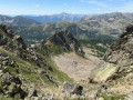
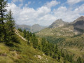
(2) Turn right towards the north-east after passing the small, unnamed pass at the foot of Rocca San Giovanni. There are two possible paths. A narrow , balcony-like path lined with rhododendrons, which is sometimes a little dizzying but remains level (the one shown on the map), and another, wider path that runs below it. Both lead to the foot of the couloir that climbs up to Colle Aver.
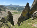
(3) At the foot of the couloir, where the two paths mentioned above meet, look out for the red markings painted on the rocks, which indicate a route up to the right to rejoin a path leading up to the pass.
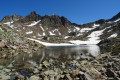
(4) After the pass, follow a path that quickly disappears into a scree slope. Make your way as you go, using the numerous cairns as guides, heading east towards Lago d’Aver Soprano, which you will skirt to the left.
(5) When you reach a signpost, follow the direction of Lago d’Aver Sottano, visible below.
(6) At another signpost by the lake, follow the signs for Colle Dei Morti after making a 360° turn to the west.
(7) From Colle Dei Morti, descend easily south-westwards along an old military track to join the SP255 road.
(8) Turn right and follow the road to the car park (S/E).


 Visorando Member
 Very difficult
 Easy
Easy 
 Moderate