


 Country:

 City:




At Isola, leave the M2205 and take the M97 towards Isola 2000. After about 4.2 km, a track branches off to the left. Park 200 m further up on the right.
(S/E) Return along the road to marker 60, at the track junction. Take this track and follow it uphill to the Guercha Soubeïrane junction, marker 61.
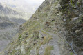
(1) Turn right onto the path, which quickly becomes difficult to follow due to damage caused by storms. Head up the right bank along the sheep tracks towards the waterfalls. Proceed up a steep slope between the rocks, sometimes using your hands for support. When the stream splits, follow the left-hand branch, which flows north to south, and cross it as you approach the Saboulé Hut.
(2) Take the path which then rejoins the standard route.
(3) Turn left onto this path and, after a few tight hairpin bends through the mountain pasture, reach the two Lower Lausfer Lakes.
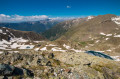
(4) Pass between the two lakes, then head right towards thethird. Go partially round it; note here that marker 65, shown on the map, has disappeared. Continue to the right to reach, a few metres further on, the Lausfer border pass, at marker 65a.
(5) Return to the previous junction (formerly marker 65) and continue straight ahead uphill. Pass close to several old military buildings and descend to the spillway of Upper Lausfer Lake.
(6) Follow the spillway and then continue uphill to the Saboulé border pass, marker 64.
(7) Ignore the path on the right heading towards the Sanctuary of Sainte-Anne, and continue north-west. Take care here as you are off the beaten track, but there are plenty of cairns to help you skirt the Vallon du Saboulé in almost a half-circle. To do this, follow the border, pass beneath the Roche du Saboulé, then climb to the secondary summit of the Tête Rougnouse de la Guercha.
(8) Continue along a rugged ridge where you’ll need to work your way round boulders. Take care here: the section becomes tricky; put your walking poles away and use your hands to avoid falling. Keep facing south, slightly below the ridge, to reach the summit of the Tête de Rougnouse de la Guercha.
(9) The descent is easier; follow the cairns on the north face of the ridge to rejoin the path heading towards the narrow pass of the Pas du Bœuf (Passo deï Bue).
(10) Please note that the well-maintained path is now very narrow, carved into the mountainside, and a handrail over a few metres provides some reassurance. Follow a series of hairpin bends to reach the scree slope and the military ruins, then climb back up to the Col de la Guercha, marker 63.
(11) Enter the Vallon de la Cabane Mouton by taking a poorly maintained path where the yellow markings have almost disappeared, but the hut is in sight. Follow the path to the Cabane Moutons at marker 62.
(12) Follow the valley floor to reach Guercha Soubeïrane.
(1) Follow the track you took on the way there in the opposite direction to return to the car park on the road to Isola (S/E).

 Visorando Member

 Difficult
 Moderate
 Easy

