Country:

 City:
City:


Parking is available in the town of Mittlach, opposite the Valneige Hotel on Rue Principale. Bus stop for route R012
(S/E) From the car park, cross the bridge over the Fecht and take the path on your right, marked with the GR®5’s Red Rectangle sign. Walk along a slightly shaded road, past some houses, then enter the forest until you reach a junction.
(1) Turn left onto the Wormsa path, continuing to follow the GR®5. The path is well shaded and, in places, stony, so sturdy footwear is required. After about 500 m heading due north, you’ll see a path coming from the right – this is the return route.
(2) Carry on straight ahead, following the Red Rectangle signposts, until you reach the junction with a path rising from the right, marked with a Red Saltire sign, which joins the GR®5 shortly after you pass the Wormsa waterfalls.
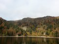
(3) Leave this path on your right (this is the way back) and continue left on the GR® to Fischboedle Lake:a lovely spot to take a break.
(4) Set off again towards thesecond lake via a path on the right (as you arrive). The path is a little more challenging. Please note: some ‘paths’ are deliberately blocked by tree trunks or large branches.
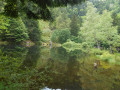
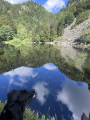
Follow the Red Rectangle markers carefully to reach Lake Schiessrothried. The lake is relatively exposed, so it can be difficult to stay there if it’s very hot.
(5) Enjoy the view of the Hohneck glacial cirque.
Retrace your steps back towards Fischboedle Lake and then to the junction with the path marked with Red Saltires.
(3) Do not rejoin the GR®5 that you took on the way out. Keep left on the wide track, following the Red Saltire signposts towards Metzeral. After about 1 km, pass a path branching off to the left, then another to the right about a hundred metres further on (IGN elevation 689).
(6) Continue downhill for nearly 1 km until you come to another path on the left, followed by another on the right.
(7) This is a narrow, little-used path. You’ll need to pay attention so as not to miss it. It takes you back to the path you took on the way there, crossing first through a section of woodland and then a field, before joining the GR®5 after a footbridge over the Wormsa.
(2) Back on the GR®5, turn left to retrace your steps along the route you took on the way out until you reach the car park (S/E).
 Visorando Member
 Very difficult
 Difficult