Country:

 City:
City:


Park in the village square.
(S/E) Walk 100 m north on the D937, towards Saint-Disdier, until you reach the first hairpin bend.
(1) Take the track in the middle of the bend. A few yellow markings help, but don’t expect too much.
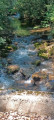
(2) Continue straight ahead along the track. A few streams cross it. Carry on, staying on the track, which becomes increasingly difficult to drive on and narrows.
(3) Head down to the left, keeping towards the Combe de l’Eau.
(4) Cross the small bridge over the Ribière and carry on straight ahead until you reach the D937 road. Turn left onto this road and follow it for a few metres.
(5) On the right, a small sign indicates the path to follow to climb up and join the D217 further up (there is a fountain 20 metres away on the right).
(6) Follow the D217 to the left for 50 m. First turn right then left, and continue south along the Chemin du Charnier for about 150 m. At a right-hand bend, leave this path and take another one on the left, still heading due south, and cross the Torrent des Adroits.
(7) Turn left, then right heading due east along a track, and continue to a junction with a cross-track.
(8) Leave the track and turn right. The path follows a well-marked mountain bike route and climbs up to Serre la Touisse.
(9) At the crossroads (elevation 1324), take the track on the left. Carry on, ignoring the small “Flouka” car park; the track becomes tarmac.
(10) After 150 m, leave the road and take the path down to the left, which leads to the D317. Follow it to the left, then, at the stop sign, turn right onto the D937 until you reach the original junction.
(1) Carry on along the road to reach the village square (S/E).
 Visorando Member
 Easy
Easy 
 Association / Club / Walk leader
 Difficult
 Very difficult
 Extremely difficult