


Here is a brief description from the resort’s website: https://www.anzere.ch/fr/experiences/activites-ete/randonnees-trails/tour-des-lapiaz/
Plenty of (free) parking spaces at the dam


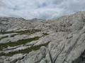
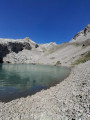
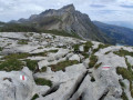
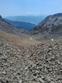
The walk starts and ends at the Tseuzier dam. It begins by skirting the lake, then continues uphill tothesmallLac de Téné. The ascent to the pass takes place on a route consisting entirely of rock (the glacier is no longer visible). The descent follows a different path, offering some stunning views, particularly along sections over the sharp limestone pavement (a geological formation).


 Country:
Switzerland
Country:
Switzerland

 City:
Ayent
City:
Ayent 


Here is a brief description from the resort’s website: https://www.anzere.ch/fr/experiences/activites-ete/randonnees-trails/tour-des-lapiaz/
Plenty of (free) parking spaces at the dam
Bisse du Ro and Tseuzier dam 10.26 mi
+4,908 ft
-4,908 ft
9h 00
Difficult
 Departure from Icogne (Valais)
The Bisse du Ro, starting from Crans-Montana
Departure from Icogne (Valais)
The Bisse du Ro, starting from Crans-Montana 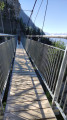 5.06 mi
+3,071 ft
-3,081 ft
5h 00
5.06 mi
+3,071 ft
-3,081 ft
5h 00
 Easy
Departure from Icogne (Valais)
Combe de Serin, Serin and return to Anzere via the Bisses
Easy
Departure from Icogne (Valais)
Combe de Serin, Serin and return to Anzere via the Bisses 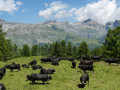 8.16 mi
+1,634 ft
-4,262 ft
5h 10
8.16 mi
+1,634 ft
-4,262 ft
5h 10
 Moderate
Departure from Arbaz (Valais)
Circular Tour of Sex Rouge including the Summit
Moderate
Departure from Arbaz (Valais)
Circular Tour of Sex Rouge including the Summit 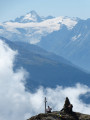 11.73 mi
+2,792 ft
-5,417 ft
7h 50
Difficult
Departure from Arbaz (Valais)
Bisse du Tsittoret
11.73 mi
+2,792 ft
-5,417 ft
7h 50
Difficult
Departure from Arbaz (Valais)
Bisse du Tsittoret 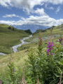 10.74 mi
+2,457 ft
-2,451 ft
7h 05
Moderate
Departure from Randogne (Valais)
Short loop around the Étang des Miriouges 1.56 mi
+312 ft
-308 ft
1h 00
Easy
Departure from Icogne (Valais)
Tsittoret Bisse (Crans Montana) 8.99 mi
+2,241 ft
-2,241 ft
6h 05
Moderate
Departure from Mollens (Valais)
Three Bisses Circular Route starting from Venthône
10.74 mi
+2,457 ft
-2,451 ft
7h 05
Moderate
Departure from Randogne (Valais)
Short loop around the Étang des Miriouges 1.56 mi
+312 ft
-308 ft
1h 00
Easy
Departure from Icogne (Valais)
Tsittoret Bisse (Crans Montana) 8.99 mi
+2,241 ft
-2,241 ft
6h 05
Moderate
Departure from Mollens (Valais)
Three Bisses Circular Route starting from Venthône  12.51 mi
+2,543 ft
-2,520 ft
8h 00
Difficult
Departure from Mollens (Valais)
12.51 mi
+2,543 ft
-2,520 ft
8h 00
Difficult
Departure from Mollens (Valais)
For more walks, use our search engine .
The GPS track and description are the property of this route's author. Please do not copy them without permission.
Scan this QR code with your smartphone's camera.
To open this route on your smartphone, you must have the Visorando app installed. If not, got to the Apple Store (iPhone) or Google Play Store (Android) to download the app.
 Visorando Member
