


Tsittoret Bisse (Crans Montana)


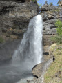
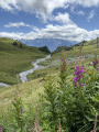
For fans of bisses (Swiss irrigation channels). A very lovely hike covering part of the Tsittoret bisse. We avoided the first section of the bisse, which we’d been told was steep, by starting our walk from a place called l’Aminona. The walk is generally accessible as it follows the channels, though there are a few fairly steep flights of steps. A few beautiful waterfalls and magnificent views will make this walk truly special. A lovely mix of shaded and rocky areas will help you adapt to this walk whatever the weather. We made a detour towards the Petit Mont Bonvin and returned via the Tièche valley to complete a circular walk. (No. 101211191)
Details
–
-
 Activity: Walking
 -
 Distance: 8.99 mi
 -
 Average duration: 6h 05
 -
 Difficulty: Moderate
 -
-
 Back to start: Yes
 -
 Ascent: + 2,241 ft
 -
 Descent: - 2,241 ft
 -
-
 Highest point: 6,804 ft
 -
 Lowest point: 4,970 ft
-
 Country:
Switzerland
Country:
Switzerland
-
 Area: Alps
 -
 City:
Mollens
City:
Mollens -
 Start/End: N 46.332028° / E 7.525845°
 -


 Hour-by-hour weather


Waypoints
- S/E : mi 0 - alt. 4,987 ft
- S/E : mi 8.99 - alt. 4,970 ft
Other walks in the area
Three Bisses Circular Route starting from Venthône
 Visorando Member
 12.51 mi
+2,543 ft
-2,520 ft
8h 00
12.51 mi
+2,543 ft
-2,520 ft
8h 00
 Difficult
 Departure from Mollens (Valais)
Bisse du Tsittoret
 10.74 mi
+2,457 ft
-2,451 ft
7h 05
Moderate
Departure from Randogne (Valais)
10.74 mi
+2,457 ft
-2,451 ft
7h 05
Moderate
Departure from Randogne (Valais)
The Bisse du Ro, starting from Crans-Montana
 5.06 mi
+3,071 ft
-3,081 ft
5h 00
5.06 mi
+3,071 ft
-3,081 ft
5h 00
 Easy
Departure from Icogne (Valais)
Easy
Departure from Icogne (Valais)
Bisse du Ro and Tseuzier dam
10.26 mi
+4,908 ft
-4,908 ft
9h 00
Difficult
Departure from Icogne (Valais)
Short loop around the Étang des Miriouges
1.56 mi
+312 ft
-308 ft
1h 00
Easy
Departure from Icogne (Valais)
Lake Téné circular walk
 7.97 mi
+3,724 ft
-3,724 ft
6h 55
Difficult
Departure from Ayent (Valais)
7.97 mi
+3,724 ft
-3,724 ft
6h 55
Difficult
Departure from Ayent (Valais)
Vercorin - Grimentz
 9.96 mi
+3,251 ft
-2,349 ft
7h 25
Difficult
Departure from Chalais (Canton du Valais) (Valais)
9.96 mi
+3,251 ft
-2,349 ft
7h 25
Difficult
Departure from Chalais (Canton du Valais) (Valais)
Vercorin - Chalais
 7.61 mi
+531 ft
-3,189 ft
4h 00
Moderate
Departure from Chalais (Canton du Valais) (Valais)
7.61 mi
+531 ft
-3,189 ft
4h 00
Moderate
Departure from Chalais (Canton du Valais) (Valais)
For more walks, use our search engine .
The GPS track and description are the property of this route's author. Please do not copy them without permission.

