


mude

 Visorando Member
Sign up:
Published route(s)
 Lake Téné circular walk
 7.97 mi
 +3,724 ft
 -3,724 ft
 6h 55
6h 55
 Difficult
 Departure from Ayent (Valais)
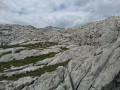
The walk starts and ends at the Tseuzier dam. It begins by skirting the lake, then continues uphill tothesmallLac de Téné. The ascent to the pass takes place on a route consisting entirely of rock (the glacier is no longer visible). The descent follows a different path, offering some stunning views, particularly along sections over the sharp limestone pavement (a geological formation).
Circular route to the Cabane des Aiguilles Rouges via Lac Bleu
 8.65 mi
+3,914 ft
-3,894 ft
7h 25
Difficult
Departure from Evolène (Valais)
8.65 mi
+3,914 ft
-3,894 ft
7h 25
Difficult
Departure from Evolène (Valais)
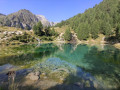
A lovely circular hike with magnificent scenery. Among the highlights of the hike are theview of the Aiguilles Rouges (a striking rocky landscape), theview of the glaciers throughout the descent, thefragrantforestsof larch and European larch, and a brief stop at Lac Bleu with its intense blue colour (and its many tourists)