Country:
 City:


The route starts and ends at the car park of the Château de la Grève, near Saint-Martin-des-Noyers. In the car park, a large sign describes the route.
The signposts are yellow.
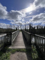
(S/E) Make your way to the far end of the car park and head south-west. Follow the path, which crosses wooden footbridges. Join the D52 and follow it to the right for about 500 metres, taking a path screened by a hedge.
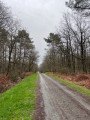
(1) Leave the roadside and turn right onto a forest track.
(2) At the first junction, turn right. Stay on the main path, close to the edge of the woodland, and ignore all the side paths on the left.
(3) Cross a small tarmac road, carry on straight ahead and ignore the paths branching off to either side. About 800 m after the road, you’ll reach a junction.
(4) Then take a path on the left. Just before the D52, follow a path on the right which has been marked out to avoid walking on the road.
(5) After about 250 m, turn left and cross the D52. First turn right then left (car park) and take a lovely avenue lined with tall trees. You’ll reach a small road; follow it to the right.
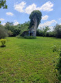
(6) At the end, cross the D29 (which is clear on both sides) and first turn right then left to take a shaded path. Winding your way through the fields, then follow the Bois de la Grave on your right for about 300 metres. Then turn right and enter the woods via a footbridge. A few metres further on, you’ll come across one of the sources of the Yon (an area surrounded by fences with a well; benches).
(7) At this point, there are two options:
- for the short route (8 km), walk past the spring, head right and you’ll soon reach the rest of the route.
- for the long route (11 km), turn left before the spring. At the next junction (marker 94), go straight on. Head west-south-west and follow the Yon on your left. Further on, the path turns right, moves away from the river and heads north.
(8) At a junction, turn slightly to the right and head slightly uphill. At the next junction (marker 99), continue straight on to return to the spring, then carry on straight along the main path (east-southeast).
(9) Ignore a path coming from the right and turn left onto the signposted path. Leave the woods and arrive at the D52.
(10) Cross the road, follow it to the right and immediately turn left onto a private track open to walkers, as indicated by a sign.
(11) When the path turns left, just before a farmyard, turn right onto a track lined with small trees. Cross the D29, go through a forest gate and continue along the path opposite.
(4) At the junction you passed on the way there, carry straight on.
(3) Cross the road and carry on straight ahead.
(2) As you come out of the right-hand bend, take a path on the left.
(1) Turn left and follow the route you took on the way there in the opposite direction until you reach the Château de la Grève car park (S/E).

 Tourist office
 Easy


 Visorando Member