Lake Charvin

From the Sous l’Aiguille car park in Manigod, climb to Lac Charvin via the Aulp de Fier d’en Haut. Return via the Col des Porthets, the Aulp de Marlens, the Chalets des Fontanettes and then the Sur le Freu mountain hut.

Details

n°108477644
Creation:
Last update:
Last review:
–
  • Walking
    Activity: Walking
  • ↔
    Distance: 8.12 mi
  • ◔
    Average duration: 6h 55 
  • ▲
    Difficulty: Difficult

  • ⚐
    Back to start: Yes
  • ↗
    Ascent: + 3,691 ft
  • ↘
    Descent: - 3,691 ft

  • ▲
    Highest point: 6,798 ft
  • ▼
    Lowest point: 3,848 ft

Photos

Description of the walk

Park at the Charmette car park, also known as “Sous l’Aiguille” on the walking trail signs.

(S/E) Head towards Lac Charvin via Sous le Freu, following the path along the right bank of the Fier.

(1) Cross the stream to reach the left bank and continue the climb.

(2) Carry straight on to follow a path that serves as a shortcut, avoiding a hairpin bend; rejoin the original path and continue the route to the left. You’ll reach a junction.

(3) Let the return path branch off to the right, cross a ford and arrive at the Aulp de Fier from above.

(4) Continue along the path to reach Lac Charvin: be aware that there may be a herd guarded by mountain dogs.

(5) Continue towards the Col des Porthets: the final 50 metres to the pass are very steep with a slight slope.

(6) Descend to the Aulp de Marlens. You’ll reach a junction.

(7) Ignore the path on the left leading to Mont Charvin and head straight on to reach the Aulp de Marlens: there may be a herd guarded by Patou dogs. Refreshments may be available during the high season.

(8) Take the track down to Les Fontanettes.

(9) Follow the track back up to reach the Sur le Freu mountain hut.

(10) Turn right to reach the Passage du Freu quickly.

(11) Descend a short , very steep and unsecured section, which remains passable and poses little danger but requires caution. Then continue along the hillside to rejoin the ascent path.

(3) Head left and follow the same path in the opposite direction to return to the car park (S/E).

Waypoints

  1. S/E : mi 0 - alt. 3,848 ft - Sous l’Aiguille car park
  2. 1 : mi 0.47 - alt. 4,272 ft - Crossing the Fier
  3. 2 : mi 0.87 - alt. 4,672 ft - Shortcut
  4. 3 : mi 1.17 - alt. 5,062 ft - Sous le Freu – junction of the circular loop
  5. 4 : mi 1.91 - alt. 5,758 ft - The Aulp de Fier from above
  6. 5 : mi 2.95 - alt. 6,631 ft - Lake Charvin - Lac du Mont Charvin
  7. 6 : mi 3.34 - alt. 6,768 ft - Col des Porthets - Col des Porthets
  8. 7 : mi 3.71 - alt. 6,194 ft - Junction
  9. 8 : mi 4.32 - alt. 5,446 ft - The Aulp de Marlens - Aulp de Marlens
  10. 9 : mi 5.07 - alt. 4,865 ft - Les Fontanettes - les Fontanettes
  11. 10 : mi 6.44 - alt. 5,538 ft - Sur le Freu mountain hut
  12. 11 : mi 6.55 - alt. 5,509 ft - Passage du Freu
  13. S/E : mi 8.12 - alt. 3,848 ft - Sous l’Aiguille car park

Notes

Hike completed in late September 2026.

Although the hike was originally planned as a day trip, we decided to camp under the stars at Lac Charvin.
On the way up from Annecy, we stopped in Thône to stock up on provisions for the camp.

Overall, a relatively straightforward route but with some steep climbs and descents with a steep gradient (+30%).

There are a few water sources along the route where you can top up your supplies: the Aulp de Fier from above, Lac Charvin, and the Aulp de Marlens.
We set off with 1.5 litres of water and a filter bottle per person.

Route profile:

  • a few steep sections
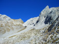
  • scree slopes that aren’t always stable
  • crossing through mountain pastures
  • fords (dry when we crossed)
  • direction not always clear.

Depending on the season (closes at the end of September), the Aulp de Marlens (8) offers farm produce and a generous selection of food to enjoy on the premises: reblochonnade, a platter of local cheeses and charcuterie – credit cards accepted.

Worth a visit

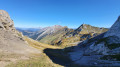
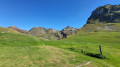
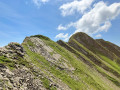
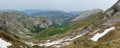
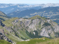
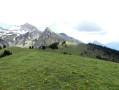
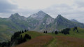
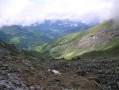
Lovely views of the mountain pastures during the ascent and descent.
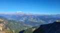
Magnificent view of Mont Blanc from the far end of Lac Charvin.

Other walks in the area

For more walks, use our search engine .

The GPS track and description are the property of this route's author. Please do not copy them without permission.