La Blonnière

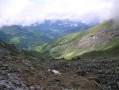
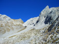
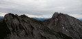
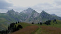
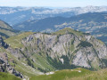
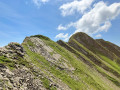
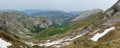
An alpine hike to the Pointe de Merdassier which will give you a taste of alpine hiking with short traverses across slabs and boulders. You’ll be rewarded with stunning scenery in good weather.

Details

n°96
Creation:
Last update:
Last review:
  • Walking
    Activity: Walking
  • ↔
    Distance: 5.49 mi
  • ◔
    Average duration: 5h 50 
  • ▲
    Difficulty: Difficult

  • ⚐
    Back to start: Yes
  • ↗
    Ascent: + 3,757 ft
  • ↘
    Descent: - 3,714 ft

  • ▲
    Highest point: 7,769 ft
  • ▼
    Lowest point: 4,052 ft

Photos

Description of the walk

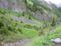
(S/E) Set off from the Comburce car park. From there, take the main path which climbs through the forest. On leaving the forest, continue along this same path, passing a junction on your right, until you reach a shepherd’s hut which is almost at the end of this main path.

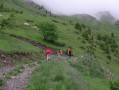
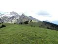
(1) Go round the back of the hut and head uphill, following a very narrow path on the left across the mountain pastures. This path climbs quite steeply. Reach the highest point at an altitude of 2,369 metres.

(2) To descend, retrace a short section of the path you have just taken in the opposite direction, then head down a little further to your right across small slabs and rocky outcrops until you reach a narrow gully. Follow this down until you rejoin the main path from the start of the walk. Follow it downhill until you reach the car park (S/E).

Waypoints

  1. S/E : mi 0 - alt. 4,052 ft - Comburce car park
  2. 1 : mi 1.49 - alt. 5,423 ft - Climb to the left to the summit
  3. 2 : mi 2.78 - alt. 7,766 ft - Head down to the right
  4. S/E : mi 5.5 - alt. 4,124 ft - Comburce car park

Notes

Be sure to check the weather forecast before setting off.

Reviews and comments

3.3 / 5
Based on 4 reviews

Reliability of the description
2.3 / 5
Ease of following the route
3 / 5
Route interest
4.5 / 5
Le bois dormant
Le bois dormant

Overall rating : 2 / 5

Date of your route : Jul 14, 2022
Reliability of the description : ★☆☆☆☆ Very disappointing
Ease of following the route : ★☆☆☆☆ Very disappointing
Route interest : ★★★★☆ Good
Very busy route : No

The route is very poorly signposted, and the patous (sheep-herding dogs) are not easy to avoid. Please be careful: as this route isn’t signposted on site, it can become dangerous if you stray from the path. On the other hand, we had a lovely encounter with a herd of chamois.

Machine-translated

Kurt Gersen
Kurt Gersen

Overall rating : 4 / 5

Date of your route : Aug 25, 2021
Reliability of the description : ★★★☆☆ Average
Ease of following the route : ★★★★☆ Good
Route interest : ★★★★★ Very good
Very busy route : No

Just a quick correction: the starting altitude is 1,191 metres from the car park.
There are no particular difficulties in getting up to the hut; you simply need to follow the track.
Since 2012, the path up must have been moved; it’s now situated about fifty metres before the shepherd’s hut.
Watch out for the Patou, which will bark at you to let you know it’s there.

This narrow path climbs straight up the slope and, 150 metres further on, veers to the right onto a more or less marked track.
When you’re not sure which way to go, at around 2,100 metres, turn left (before a stony cirque) and head towards the peaks, following the sheep tracks and keeping an eye out for the few cairns still standing.
This walk is not very busy; I only came across three mountaineers once I reached the top – they’d come up from the other side.
The chamois are there as always.
I’d love to do it again this winter on snowshoes or skis, and even again next summer.
One of the quietest spots in La Clusaz, far from the overcrowded valleys.
The descent follows roughly the same path if you can find your way, but now I know the route.
Thank you for the description, which enabled me to set off on this valley. I’ll be showing it to my friends.

Machine-translated

queyrubay
queyrubay
• Edited:

Overall rating : 3.3 / 5

Date of your route : Oct 15, 2018
Reliability of the description : ★★☆☆☆ Disappointing
Ease of following the route : ★★★☆☆ Average
Route interest : ★★★★★ Very good

We lost our way on the ascent through the rocky outcrops and scree, whilst the southernmost path runs through the mountain pastures. We strongly recommend taking this southern path both on the way up and on the way down. In foggy conditions, the northern path is not easy to follow.

Machine-translated

jo.drevet
jo.drevet

Overall rating : 3.7 / 5

Date of your route : Oct 31, 2013
Reliability of the description : ★★★☆☆ Average
Ease of following the route : ★★★★☆ Good
Route interest : ★★★★☆ Good

The route description after the hut was incomplete and did not help us to locate the very poorly marked path. As a result, we did not head quite so far towards the centre, but instead went across a scree slope. And, because of the snow at higher altitudes, we found ourselves at a small dead-end pass above the Col des Aravis road, but were unable to reach our intended summit.
We spotted a herd of 36 chamois which fled as we approached.
We’ll try again next year, perhaps on snowshoes for the first part of the route.

Machine-translated

Other walks in the area

For more walks, use our search engine .

The GPS track and description are the property of this route's author. Please do not copy them without permission.