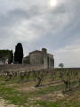
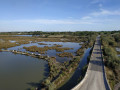
La Vaunage starting from Calvisson

A lovely mountain bike ride starting from “Calvisson la Vaunage” with a few alternative routes.
Interesting but very stony.

Details

5132282
Creation:
Last update:
Last review:
  • Mountain biking
    Activity: Mountain biking
  • ↔
    Distance: 11.55 mi
  • ◔
    Duration according to the author: 1.5 hrs 
  • ▲
    Difficulty: Moderate

  • ⚐
    Back to start: Yes
  • ↗
    Ascent: + 997 ft
  • ↘
    Descent: - 991 ft

  • ▲
    Highest point: 692 ft
  • ▼
    Lowest point: 174 ft
  • ⚐ Country: France
  • ⚐ City: Calvisson (30420)
  • ⚑
    Start/End: N 43.786529° / E 4.191843°
  • ❏
    IGN map(s): Ref. 2842OT

  • ◶
    Type of surface:
  •  
     
     
     15% Road  80% Byway  5% Path
  • ⇧
    Bike carrying: Yes
  • ▲
    Difficulty: Moderate
  • Hour-by-hour weather

Description of the route

Start from the Place du 8 Mai in the centre of Calvisson.

(S/E) With your back to the car park, head left towards the exit from Calvisson and carry on straight on until you reach the main road (D107).

(1) Take the Chemin d’Ounèze opposite, then turn left at the Fork in the road. Walk alongside the vineyard, continue along the road, go round the right-angled bend to the left and reach a three-way junction.

(2) Turn onto the path on the right and follow it, ignoring any tracks to the left or right. You’ll reach a T-junction after leaving the valley.

(3) Turn right (it climbs a little), pass two very beautiful drystone shelters and don’t forget to look up to enjoy the magnificent view of the Vaunage on your right. Continue to the watchtower, go round the back to the left and follow the stony but easy-going path along the ridge, ignoring the paths branching off to the left and right. You’ll reach a small pass.

(4) Head down to the right, towards Saint-Étienne d’Escattes, along a very stony path. Generally follow the bottom of the valley to the village. At the fork, turn right and head towards the church.

(5) Walk behind the church and follow the Vidourle cycle path for 600 m.

(6) Turn left onto a path leading to a house running alongside the road (private property), then turn immediately right onto the path bordered by a dry-stone wall. As you enter the woods, ignore a turn-off to the left and stay on the main path for about 1.6 km.

(7) At the road, turn left, then quickly leave the road and take the path on the left which runs alongside vineyards on your right.

(8) At the bottom of the vineyards, turn left onto the road, which turns into a track. Continue to the junction leading to the horse boarding stable (Mas du Puech Long).

(9) Keep to the right and continue along this track, ignoring those to the left and right, then pass in front of a cattle ranch at Terme Blanc.

(10) At the fork in the road with a house opposite and various sculptures, carry on straight ahead, ignoring the other paths. You’ll reach the village of Congeniès, which you cross whilst admiring these authentic village houses.
Follow Rue de la Vermeillade (a narrow street) until the first turn-off on the left (marker), a few metres before the square.

(11) Turn left, follow Rue du Temple and, at the Fork in the road after the temple, veer left. At the end of this small road, turn right onto Chemin de Bragassargues, which joins the main road. Follow it to the left for about 500 metres until you reach the second turn-off on the right (gate).

(12) Go through the gate and immediately take thesecond path on the right.

(13) Just before the descent, follow the single track to the left. Continue through the forest, then take a stony path to the right. Ignore the paths to the left and right and pass in front of the Mas de la Treille (ruins).

(14) In the valley, turn right and keep going along a stony path (it’ll stay like this for a while).

(15) At the Fork in the road, carry on to the right to join a wider path (PR®) a little further up. Pass beneath the windmills (you can reach them a little further on by heading up to the left) and reach the village of Calvisson via the road, taking the opportunity to admire the authentic village houses. Head down towards the Grande Rue, leaving the town hall on your left. At the roundabout, head back up towards the Place du 8 Mai, turning left at the no-entry sign (S/E).

Waypoints

  1. S/E : mi 0 - alt. 177 ft - Place du 8 Mai
  2. 1 : mi 0.34 - alt. 207 ft - Main road
  3. 2 : mi 1 - alt. 256 ft - Vineyards to the left and right
  4. 3 : mi 1.85 - alt. 518 ft - Hairpin bend, climb above the Vaunage
  5. 4 : mi 4.03 - alt. 502 ft - Head towards Saint-Étienne d’Escattes
  6. 5 : mi 5.24 - alt. 285 ft - Church of Saint-Étienne d’Escattes
  7. 6 : mi 5.47 - alt. 282 ft - Take the path to the left, then immediately to the right
  8. 7 : mi 6.24 - alt. 364 ft - A narrow path through the vineyards
  9. 8 : mi 6.66 - alt. 413 ft - Road, turn left
  10. 9 : mi 7.08 - alt. 374 ft - Hairpin bend to the right
  11. 10 : mi 8.78 - alt. 420 ft - Maison des Sculptures
  12. 11 : mi 9.27 - alt. 246 ft - Rue du Temple on the left
  13. 12 : mi 9.82 - alt. 266 ft - Path on the right (gate)
  14. 13 : mi 10.19 - alt. 305 ft - Path on the left
  15. 14 : mi 10.55 - alt. 397 ft - Path on the right
  16. 15 : mi 10.89 - alt. 400 ft - At the fork in the road, take the right-hand path; yellow markings
  17. S/E : mi 11.55 - alt. 177 ft - Place du 8 Mai

Notes

No water, the path is often very stony; you’ll need to carry your bike 2 or 3 times as the single track is too narrow.

Always be cautious and plan ahead when you're outdoors. Visorando and the author of this route cannot be held responsible for any accidents occurring on this route.

The GR® and PR® markings are the intellectual property of the Fédération Française de Randonnée Pédestre.

Reviews and comments

3.9 / 5
Based on 3 reviews

Reliability of the description
4 / 5
Ease of following the route
3.3 / 5
Route interest
4.3 / 5
Eric 30740
Eric 30740

Overall rating : 4.3 / 5

Date of your route : Jul 07, 2024
Reliability of the description : ★★★★★ Very good
Ease of following the route : ★★★★☆ Good
Route interest : ★★★★☆ Good
Very busy route : No

A very pleasant route. A few steep slopes at the start. Beautiful views over the plain.
The final section of the route between Congénies and Calvisson is tricky (multiple tracks, quite a bit of carrying the bike); a GPS is essential.

Machine-translated

jeanmi30
jeanmi30

Overall rating : 4 / 5

Date of your route : Oct 20, 2023
Reliability of the description : ★★★★☆ Good
Ease of following the route : ★★★☆☆ Average
Route interest : ★★★★★ Very good
Very busy route : No

The final section of the walk between Congénies and the mills at Calvisson:
there are numerous paths leading off in all directions; it’s impossible to manage without a GPS or thorough reconnaissance if you’re leading a group.
A lovely walk, with beautiful views along the entire route.

Machine-translated

Mandrou
Mandrou

Overall rating : 3.3 / 5

Date of your route : Oct 06, 2021
Reliability of the description : ★★★☆☆ Average
Ease of following the route : ★★★☆☆ Average
Route interest : ★★★★☆ Good
Very busy route : Yes

Interesting, but there are lots of possible variations along the route

Machine-translated

Other walks in the area

For more walks, use our search engine .

The GPS track and description are the property of this route's author. Please do not copy them without permission.