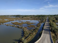
Vestric Pond

A family walk starting from the entrance to Vergèze and heading to the Étang de Vestric. Mixed terrain (paths and roads).

Details

262659
Creation:
Last update:
Last review:
  • Mountain biking
    Activity: Mountain biking
  • ↔
    Distance: 6.68 mi
  • ◔
    Duration according to the author: 1 hr 
  • ▲
    Difficulty: Easy

  • ⚐
    Back to start: Yes
  • ↗
    Ascent: + 46 ft
  • ↘
    Descent: - 46 ft

  • ▲
    Highest point: 82 ft
  • ▼
    Lowest point: 36 ft
  • ⚐ Country: France
  • ⚐ City: Vergèze (30310)
  • ⚑
    Start/End: N 43.740586° / E 4.226666°
  • ❏
    IGN map(s): Ref. 2842OT, 2943OT

  • ◶
    Type of surface:
  •  
     
     
     33% Road  34% Byway  33% Path
  • ⇧
    Bike carrying: Not specified
  • ▲
    Difficulty: Not specified
  • Hour-by-hour weather

Description of the route

Park in the car park by the cemetery at the entrance to Vergèze.

(S) From the car park, with your back to the cemetery, set off along the path that joins the D139 (Avenue de la Source). Cross the road (take care) and take the cycle path opposite. It runs parallel to the D139 as far as the Chemin de la Monnaie. Cross the road again and turn left towards the bridge.

(1) Turn right and go under the N113 bridge towards the Perrier factory, then turn left along the vineyards onto the Chemin de Claux Carretons.
At the end of the track, turn right onto the road between the vineyards and the housing estate, then at the junction turn right onto Chemin des Poissonniers.

(2) At the roundabout, go straight ahead and then turn right to follow the signs for Étang de Vestric (yellow signposting) via Chemin Carrière du Moulin.

(3) After the sewage treatment works, turn left onto the path towards the lake (yellow signposts).

(4) Go through the barrier and follow the path through the vegetation. Turn left and rejoin the tarmac path to the lake.

(5) Walk round the pond on the left-hand side. Once you have walked round the pond, head back along the path in the opposite direction to return to the starting point (S/E).

Waypoints

  1. S/E : mi 0 - alt. 82 ft - Cemetery car park
  2. 1 : mi 0.75 - alt. 56 ft - Pass under the N113
  3. 2 : mi 1.96 - alt. 49 ft - Roundabout
  4. 3 : mi 2.37 - alt. 46 ft - Turn left after the sewage treatment plant
  5. 4 : mi 2.71 - alt. 43 ft - Passing through the gate
  6. 5 : mi 3.01 - alt. 43 ft - Start of the circular pond loop - Vistre (fleuve)
  7. S/E : mi 6.68 - alt. 82 ft - Cemetery car park

Notes

Have a quick snack by the pond to cool off.

Reviews and comments

4 / 5
Based on 3 reviews

Reliability of the description
4 / 5
Ease of following the route
3.7 / 5
Route interest
4.3 / 5
GEPE002
GEPE002

Overall rating : 4.7 / 5

Date of your route : Jan 16, 2025
Reliability of the description : ★★★★★ Very good
Ease of following the route : ★★★★★ Very good
Route interest : ★★★★☆ Good
Very busy route : No

A straightforward walk, ideal for getting back into the swing of things, for example.
At the start and finish, instead of following the road, you can cut through the Perrier woodland without any risk of getting lost, as it’s clearly marked out; it’s more enjoyable and much better for dog owners!
If you’re doing the walk in summer, you’ll need to set off very early in the morning as it gets very sunny!
Enjoy the walk

Machine-translated

Annette JUNGK
Annette JUNGK

Overall rating : 3.3 / 5

Date of your route : Jan 29, 2024
Reliability of the description : ★★★☆☆ Average
Ease of following the route : ★★★☆☆ Average
Route interest : ★★★★☆ Good
Very busy route : No

Setting off from Vergèze, I had a bit of trouble finding the cycle path. At the entrance to Vestric, there were no signs apart from a Yellow Cross and nothing else to explain the way. Despite this, it was a lovely route and there’s a beautiful lake in Vestric. A lovely winter ride.
Annette J.

Machine-translated

Jeanmarc30
Jeanmarc30

Overall rating : 4 / 5

Date of your route : Feb 06, 2023
Reliability of the description : ★★★★☆ Good
Ease of following the route : ★★★☆☆ Average
Route interest : ★★★★★ Very good
Very busy route : No

A very easy walk along paths through vineyards and meadows, with a bit of road but very pleasant;
ending at Vestric Pond, which is magnificent – a shame it was so windy.

Machine-translated

Other walks in the area

For more walks, use our search engine .

The GPS track and description are the property of this route's author. Please do not copy them without permission.