Country:
 City:
City:



Start from Chemin de la Grande Roubine; park under the four-lane motorway bridge.
(S/E) Take the path running alongside the canal, which is closed off by a barrier. Pass in front of the ‘Mas de la Comtesse’ ranch, then continue to the lock where the Vidourle meets the Canal du Rhône à Sète. Go round the lock and cross via the metal footbridge to follow the Canal du Rhône à Sète.
(1) Before the bridge, take the track on the left towards Lunel, go up onto the bridge and continue along the wide track to the roundabout.
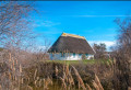
(2) Take thesecond exit on the right onto the track towards Lunel. Carry on for a few kilometres and take the opportunity to see the Lunel huts (old fishermen’s huts). Pass the pumping station and continue along the Canal de Lunel. Ignore the paths on the right leading towards the road.
(3) After the small bridge, turn right onto a wide track, then turn left. Continue towards the roundabout, cross it carefully and take the path opposite (immediately after the four-lane road).
(4) Turn left, then right a little further on (note: road-widening works are underway, so the route may be subject to some changes) and continue along this poorly signposted track. Cross the field (for 20 m), then join another track. Take this track on the left.
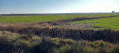
(5) Turn left and continue for a short distance along this track, which takes you through fields of asparagus, lavender and fruit trees. You’ll reach a road.
(6) Carry on to the left, noting the many farmhouses on either side. After La Fangue, join a track on the right at the ‘S’ bend in the road.
(7) Turn right towards Mas du Juge. Continue along this track, passing the Mas du Juge (a very important farmhouse that hosts numerous events), and carry on along the road until you reach the junction with the Marsillargues road (D34).
(8) Take a sharp right-hand bend and cross the bridge over the Vidourle.
(9) Just after the treetop adventure course, turn right onto the wide white track. Stay on the upper section of the Vidourle flood defences. Pass above the Mas de Barbut and, when you reach the ruins of a small building, head down onto the road.
(10) Turn right and continue along this road until it ends at Mas de Terre de Port.
(11) Follow the track to the left and carry on to the large metal gate.
(12) Take the path on the right (PR®), skirting large cereal fields, until you reach the small wooden footbridge leading to the Rhône–Sète Canal on the opposite bank to the outward journey.
(13) Turn left and continue along the canal.
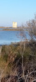
(14) Cross the bridge over the Canal de la Vistre, then pass under the road bridge of a four-lane road. A little further on, you’ll see the Tour Carbonnière on your left (which is well worth a detour for a 360° view of the lakes from the top). At the next bridge, pass underneath it.
(15) Immediately afterwards, turn left onto the track leading up towards the Tour Carbonnière (on your right at the junction).
(16) Head left to cross the bridge. Just before the roundabout at the bottom of the bridge, take the track on the right and head towards the canal bank.
(17) Take the path on the left which runs alongside the Canal du Rhône à Sète once more. Follow the canal on your right-hand side, pass under the bridge over the four-lane road, then the track curves slightly to the left and leads to a barrier, followed by some houses. Follow the canal for a short while as it heads towards Aigues-Mortes and then on to the sea.
(18) Before the bridge, take the path on the left which climbs towards the four-lane road and continue to the roundabout.
(19) Take thefirst exit on the right and join the four-lane road, keeping well to the right (heavy traffic). Cross the bridge and continue to the Flamant roundabout. Go three-quarters of the way round it to take the Chemin de la Pataquière.
(20) Immediately turn left onto the road running alongside the four-lane carriageway and follow it until you reach a street on the left just after the bend.
(21) Follow this road, head towards the canal, turn left and you’ll reach the car park under the bridge (S/E).


 There were plenty of mistakes on this route, which was originally planned to be around 40 kilometres but ended up being… 72 km. At point 5, we couldn’t find the way to rejoin the route (no doubt due to recent development work), so we took a long detour towards Lunel to reach points 8 and 9. At point 14, we were again forced to make a return trip along a path that had recently been cleared of undergrowth but which ended in a dead end. The bridge that is supposed to take you to the other side of the canal is inaccessible. At this point, we turned back to rejoin the road towards La Grande Motte. All in all, it turned out to be a very tiring outing.
 Visorando Member
 Moderate