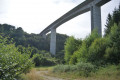
The Clidane Valley

From the village of Bourg-Lastic, the route descends into the gorges to explore the Ruisseau de la Clidane and its viaduct, which supports the A89 motorway. This pleasant walk through the forest offers beautiful views of the Sancy massif.

Details

n°25951857
Creation:
Last update:
  • Walking
    Activity: Walking
  • ↔
    Distance: 5.86 mi
  • ◔
    Average duration: 3 hrs 
  • ▲
    Difficulty: Moderate

  • ⚐
    Back to start: Yes
  • ↗
    Ascent: + 705 ft
  • ↘
    Descent: - 725 ft

  • ▲
    Highest point: 2,539 ft
  • ▼
    Lowest point: 2,198 ft

Photos

Description of the walk

In Bourg-Lastic, on the D2089, 63 km west of Clermont-Ferrand, park near the church

(S/E) With your back to the starting point sign at 12 Route de Tulle, head right for 50 metres and turn left onto Rue des Dillures.

(1) When you reach the campsite, turn right onto a wide dirt track.

(2) Cross a stream, then head left uphill through the forest until you reach the road.

(3) Turn right, then take the first path on the left, which passes under the motorway viaduct three times and descends into the Clidane valley.

(4) Turn left, walk past an abandoned mill (Moulin du Saleix) and turn left as you head uphill. Follow this path alongside the Clidane.

(5) Carry on straight ahead, leaving the bridge on your right, and head back up to the small tarmac road.

(6) Head right and continue straight on along a wider road (view of the Sancy massif). After 100 m, turn left, go under the cattle underpass, head down to the right and join the departmental road (D987).

(7) Cross with care and continue straight ahead along a wide track, which you’ll leave to the left to take a forest lane. A path on the left leads to a memorial to the Resistance in Auvergne.

(8) Retrace your steps and rejoin the route by turning left. Continue until you reach a road.

(9) Cross with care and, at the esplanade (retention basins), turn left. Walk up the path and continue straight ahead along Rue des Peupliers as far as the post office.

(10) Return to the main road (Route de Tulle) on the left, walk past the church and head back to the starting point (S/E).

Waypoints

  1. S/E : mi 0 - alt. 2,523 ft - Église Saint-Fargeon (Bourg-Lastic)
  2. 1 : mi 0.31 - alt. 2,500 ft - Camping
  3. 2 : mi 0.81 - alt. 2,270 ft - Stream
  4. 3 : mi 1.62 - alt. 2,503 ft - Road
  5. 4 : mi 2.57 - alt. 2,221 ft - Junction
  6. 5 : mi 3.24 - alt. 2,224 ft - Bridge - Clidane (rivière) - Affluent du Chavanon
  7. 6 : mi 3.92 - alt. 2,516 ft - Tarmac road
  8. 7 : mi 4.32 - alt. 2,480 ft - D987 road
  9. 8 : mi 4.9 - alt. 2,520 ft - Resistance Memorial
  10. 9 : mi 5.05 - alt. 2,474 ft - Road
  11. 10 : mi 5.63 - alt. 2,526 ft - Main street
  12. S/E : mi 5.86 - alt. 2,523 ft - Église Saint-Fargeon (Bourg-Lastic)

Notes

For your safety, always carry a bottle of water, a hat, warm and waterproof clothing, and wear suitable walking shoes.

Depending on weather conditions, some routes are not recommended in bad weather (fog) or are impassable, or even off-limits, during the winter season.

Some sites are fragile; please stay on the designated paths. Avoid picking wild flowers and disturbing wildlife. Please pick up your rubbish.

On some routes, pets are not allowed.

Reviews and comments

3.6 / 5
Based on 4 reviews

Reliability of the description
4.3 / 5
Ease of following the route
4.5 / 5
Route interest
2 / 5
User 16793033
• Edited:

Overall rating : 2.5 / 5

Date of your route : Sep 21, 2026
Reliability of the description : ★★★★☆ Good
Ease of following the route : Not used / Not applicable
Route interest : ★☆☆☆☆ Very disappointing
Very busy route : No

You should remove this route.
It’s IMPOSSIBLE.
In fact, near the ‘mill’, there are four huge dogs ready to devour you!
We had to turn back.
But it seems you’re not taking advice on board, as previous comments had already highlighted this problem (unfortunately, we only saw them afterwards).
We even went to the town hall to report it, but it wasn’t open.

Machine-translated

User 28584240
• Edited:

Overall rating : 3 / 5

Date of your route : Feb 27, 2026
Reliability of the description : Not used / Not applicable
Ease of following the route : Not used / Not applicable
Route interest : ★★★☆☆ Average
Very busy route : No

When we arrived at what appeared to be an abandoned mill at the bottom of the descent under the viaduct, we were greeted by three farm dogs running loose with no one around to control them. With three children under the age of five, we decided to turn back, and that was the end of our trip.

Machine-translated

Melanie19
Melanie19
• Edited:

Overall rating : 4 / 5

Date of your route : Feb 17, 2025
Reliability of the description : ★★★★★ Very good
Ease of following the route : ★★★★★ Very good
Route interest : ★★☆☆☆ Disappointing
Very busy route : Yes

A boring walk – no lovely scenery at all, just walking. Halfway through the walk, my friend and I came across a farm where there were dogs running loose that nearly jumped on us. The dogs were quite aggressive; we were really scared and had to grab a stick to scare them off. The owner didn’t do anything. I won’t be doing that walk again.

Machine-translated

Chrisophrorando
Chrisophrorando
• Edited:

Overall rating : 3.3 / 5

Date of your route : May 15, 2024
Reliability of the description : ★★★★☆ Good
Ease of following the route : ★★★★☆ Good
Route interest : ★★☆☆☆ Disappointing
Very busy route : No

a rather uninteresting walk

Machine-translated

Other walks in the area

For more walks, use our search engine .

The GPS track and description are the property of this route's author. Please do not copy them without permission.