Mid-altitude landscapes starting from Apchat

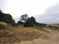
This walk across the plateaus between Lembron and Cézalier offers the chance to explore the mid-altitude landscapes around the villages of Ardes-sur-Couze, Bord and Apchat.

Details

1416750
Creation:
Last update:
Last review:
  • Walking
    Activity: Walking
  • ↔
    Distance: 6.42 mi
  • ◔
    Average duration: 3h 35 
  • ▲
    Difficulty: Easy

  • ⚐
    Back to start: Yes
  • ↗
    Ascent: + 699 ft
  • ↘
    Descent: - 709 ft

  • ▲
    Highest point: 2,598 ft
  • ▼
    Lowest point: 2,005 ft

Photos

Description of the walk

Starting point: A75, Exit 17, Saint-Germain-Lembron. Take the D214 towards Ardes; on entering Ardes: car park after the market hall, Place du Foirail.

Yellow signposting

(S/E) From the car park, walk down the street towards the village, turn right onto Rue du Chapiot, then right again onto Route de Teyne. At the junction in front of the retirement home, continue to the left.

(1) In the housing estate, at the Fork in the road, keep straight on along the path and continue to the hamlet of Zanières la Mave (Route de Teyne).

(2) At the junction (with a cross on the left), follow the road opposite (D28).

(3) At the crossroads, turn left towards Bord, and walk through the hamlet (bakery, well and picnic table).

(4) As you leave the hamlet, take the path on the left (GRP® Autour d’Issoire).

(5) At the crossroads, turn right. Stay on the GRP®.

(6) At the crossroads, turn left and carry on straight ahead to the village of Apchat, continuing to follow the GRP®.

(7) At the entrance to the village, turn right towards the centre.

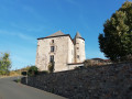
(8) At the fortified house and the junction with aPR®, turn left. At the well, cross the road and take the path opposite.

(9) At the crossroads (with a picnic table nearby), rejoin theGRP®, take the path on the right and carry on straight ahead.

(10) At the junction with the road, turn left towards Ardes. Leave theGRP®. At the entrance to the village of Ardes, turn left onto Avenue du Maréchal Leclerc, then onto Rue des Ecoles, which continues from there. Continue straight on along Rue de la Poste until you reach Rue du Commerce (at the market hall), turn left and head for the car park (S/E).

Waypoints

  1. S/E : mi 0 - alt. 2,119 ft - Place du Foirail car park
  2. 1 : mi 0.42 - alt. 2,178 ft - Teyne housing estate
  3. 2 : mi 1.55 - alt. 2,411 ft - Zanières hamlet, La Mave
  4. 3 : mi 2.23 - alt. 2,562 ft - Road junction, on the left
  5. 4 : mi 2.65 - alt. 2,533 ft - Exit at the hamlet of Bord, on the left
  6. 5 : mi 3.05 - alt. 2,467 ft - Crossroads, turn right
  7. 6 : mi 3.34 - alt. 2,388 ft - Crossroads, turn left
  8. 7 : mi 4.36 - alt. 2,280 ft - Entrance to the village of Apchat
  9. 8 : mi 4.52 - alt. 2,316 ft - PR junction, on the left
  10. 9 : mi 4.78 - alt. 2,303 ft - Iron cross, on the right
  11. 10 : mi 5.66 - alt. 2,149 ft - Junction with the road, on the left
  12. S/E : mi 6.42 - alt. 2,119 ft - Place du Foirail car park

Always be cautious and plan ahead when you're outdoors. Visorando and the author of this route cannot be held responsible for any accidents occurring on this route.

The GR® and PR® markings are the intellectual property of the Fédération Française de Randonnée Pédestre.

Reviews and comments

4.6 / 5
Based on 3 reviews

Reliability of the description
4.7 / 5
Ease of following the route
5 / 5
Route interest
4 / 5
jgueraud
jgueraud

Overall rating : 4.3 / 5

Date of your route : Aug 03, 2024
Reliability of the description : ★★★★★ Very good
Ease of following the route : ★★★★★ Very good
Route interest : ★★★☆☆ Average
Very busy route : No

A nice walk, but too much driving

Machine-translated

bcg243
bcg243

Overall rating : 4.3 / 5

Date of your route : Mar 10, 2024
Reliability of the description : ★★★★☆ Good
Ease of following the route : ★★★★★ Very good
Route interest : ★★★★☆ Good
Very busy route : No

A pleasant walk along country paths with views of typical mid-mountain scenery. There is a short stretch of tarmac on the Rézentières section towards the Apchat junction. The route is perfectly clear and easy to follow.

Machine-translated

63Vincent
63Vincent
• Edited:

Hello again,
I forgot to mention that I’m working with my IGN map and your instructions. And it’s going really well.
Thanks
63Vincent

Machine-translated

63Vincent
63Vincent

Overall rating : 5 / 5

Date of your route : Sep 30, 2018
Reliability of the description : ★★★★★ Very good
Ease of following the route : ★★★★★ Very good
Route interest : ★★★★★ Very good

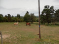
Today, we saw some lovely scenery and caught a glimpse of the wildlife park with the giraffes. It’s a very well-explained walk. It’s dry, which is a shame!!! because I think we might find some mushrooms
It matches everything you’ve noted down.
Thank you.
63Vincent

Machine-translated

Other walks in the area

For more walks, use our search engine .

The GPS track and description are the property of this route's author. Please do not copy them without permission.