Country:
 City:


From Château-Gombert or Plan de Cuques, take the Chemin de la Grave (La Montade area). Park at the end of the track by a gate and a DFCI track, where there are plenty of angled parking spaces available.
(S/E) Go through the gate and continue until you reach the junction with the path leading to the Vallon de Mauvelle.
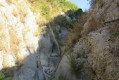
(1) Turn right onto the unmarked path that leads into the valley. Cross a few rocky sections (see the ‘Practical Information’ section). You’ll come to a fork in the road.
(2) Turn left. Climb up the rock face using the ladder provided. A little further on, you’ll come across an old car wreck. Walk past a water retention basin. The path then widens and opens out into a clear area.
(3) Turn right onto the wide path, then take thefirst stony path leading uphill to the right. You’ll reach a game reserve (fenced enclosures), then the large Caban house. Turn left onto the Caban DFCI track. Keep to the right. Continue along the track until you reach fire tank no. 600.
(4) Here, there are several options:
- to avoid climbing to the summit of the Tête du Jacquot, take the path that branches off to the right behind the tank. This path runs below the Tête du Jacquot,
- continue along the track to the left of the tank to reach the Tête du Jacquot lookout point. Then turn back and, at a cairn on the left, join a cross-country path cut through the vegetation which links up with the descending path.
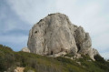
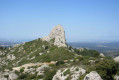
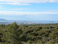
- Walk along the back of the cistern, then climb up to the Tête du Jacquot. There is no distinct track, but the ground has little vegetation and is therefore passable. A cairn marks the summit. Descend south-south-west along a more distinct track which joins a path; take this path to the left. This stony path descends steadily, offering beautiful views of Marseille and the Chaine de l’Étoile.
In any case, head for the gas pipeline route marked by the classic yellow post.
(5) Then cut across the track, veering slightly to the left. Continue the descent until you reach the Jas de Louisson. Turn left at the Mas. Further down, the path joins a DFCI track. Take this to the right for a few metres until you reach a path junction.
(6) Take this path to the left, beginning a steep descent which levels out and continues pleasantly. Cross a large pine forest at a place called La Bordille. You’ll reach the DFCI track.
(7) Turn left onto the track and return to the original junction at the Vallon de Mauvelle.
(1) Follow the route back in the opposite direction to return to the car park at the gate of the DFCI track (S/E).

 Visorando Member
 Easy

 Difficult