The Aiguillon de Brasse

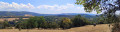
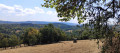
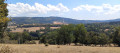
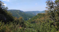
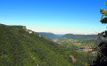
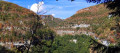
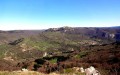
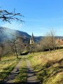
Explore the Gorges de Nouailles. Picturesque paths, running along wild ledges and winding through a beautiful, sun-drenched forest, will lead you through peaceful clearings and offer magnificent panoramic views over the Loue valley. Along the way, you’ll discover the Moine de la Vallée, the Aiguillon de Brasse and the majestic Roche de Haute-Pierre.

Details

103019792
Creation:
Last update:
Last review:
  • Walking
    Activity: Walking
  • ↔
    Distance: 2.98 mi
  • ◔
    Average duration: 1h 50 
  • ▲
    Difficulty: Easy

  • ⚐
    Back to start: Yes
  • ↗
    Ascent: + 554 ft
  • ↘
    Descent: - 531 ft

  • ▲
    Highest point: 2,415 ft
  • ▼
    Lowest point: 1,959 ft

Photos

Description of the walk

Car park at the ecomuseum in Aubonne, in the hamlet of La Creuse, marked with yellow-and-blue signs.

(S/E) Head down towards the departmental road, turn left and walk carefully along it ( cars approach too quickly) for 300 metres. When the road curves slightly to the left, cross it – still taking care – to reach a small car park on the other side of the road and a path leading down into the meadow. At the gate, squeeze through the small gap between the two trees to avoid having to open it. Walk straight down through the pasture for about fifty metres towards a signpost.

(1) Leave the path on your left and continue straight on across the pasture to the edge of the field below, where you’ll find another gap between two trees and rejoin the departmental road at a small car park. Head down to the left for about 50 metres towards the ‘Route des Gorges’ signpost.

(2) Cross the road carefully and climb the hillside via the ‘Sentier de la Côte Verse’. You’ll soon reach a first, unprotected viewpoint over the Gorges de Nouailles. Stay on this well-marked path at all times. The path soon runs alongside the ledges overlooking the gorges, then leads you to the Aiguillon de Brasse via a few hairpin bends – a secure viewpoint offering a 180° view, stretching from Mont Pelé to the Moine de la Vallée and the lower reaches of the Loue. A short path, opposite the viewing point, takes you on a round trip to an unprotected viewpoint overlooking the village of Mouthier and the Roche de Haute-Pierre. Return to the viewing point.

(3) Continue along this path winding along the ridge towards the Sources de la Loue through a beautiful, light-filled forest, skirting the edge of pastures and peaceful clearings. You’ll soon pass under a high-voltage power line with a view over the valley. Shortly afterwards, the path veers down to the left, passing at the foot of some beautiful rock formations, before joining a wider track, a former royal road (signpost).

(4) Continue to the right (towards La Creuse). In places, look out for the marks left by the iron-rimmed wheels of our ancestors’ carts in the stone. You’ll come to a gravel track (Chemin de la Brasse-Dessus) and turn right. Soon, on the left, you’ll see a pasture with an old shed: head towards the building through the metal gate.

(5) Walk past the shed and follow the edge of the pasture on your right until you reach a marker post and a stony path that descends to the left into the woods. You’ll come to a ‘strip’ of pasture and find, on the right, a zigzagging gap in the fence. Continue along the edge to the right for about thirty paces, then head down to the left into the woods via a path running alongside the barbed wire. You’ll emerge onto a vast pasture with a beautiful, unobstructed view of the neighbouring hills. Walk along the edge to the right for about twenty paces to find a rustic bench, ideal for a break whilst enjoying the scenery.

(6) From the bench, head diagonally to the right towards the ‘Brasse-Dessous’ signpost in the middle of the pasture. Then head towards the telephone pole below (towards Source de la Loue via the right bank). Head down towards the edge of the woodland opposite to find a metal footbridge and a path crossing some wasteland, then entering the woods and quickly joining a wider forest track. Head down to the left until you reach the ecomuseum car park (S/E).

Waypoints

  1. S/E : mi 0 - alt. 2,028 ft - La Creuse: Bee Ecomuseum
  2. 1 : mi 0.29 - alt. 2,054 ft - Pasture
  3. 2 : mi 0.49 - alt. 1,959 ft - Car park. Gorges de Nouailles – Crossing the D67
  4. 3 : mi 1.23 - alt. 2,336 ft - Aiguillon de Brasse
  5. 4 : mi 1.92 - alt. 2,352 ft - Former royal route
  6. 5 : mi 2.38 - alt. 2,405 ft - Metal gate
  7. 6 : mi 2.54 - alt. 2,313 ft - The Brasse pastures
  8. S/E : mi 2.98 - alt. 2,028 ft - La Creuse: Bee Ecomuseum

Notes

(!) Despite its short distance, this walk can be challenging for inexperienced or unfit walkers. It requires sure-footedness to navigate these beautiful, steep paths running along the cliff edges. The route includes ledge paths and unsecured viewpoints, as well as rocky and slippery sections in places, running along slopes close to the cliffs. Sturdy footwear is essential and the use of walking poles is recommended.

The Côte Verse trail (2) is described on a sign as ‘a mountain route, partly in poor condition, exposed to rockfalls. Do not attempt this route in bad weather. Take care!’. It’s fine in dry weather, though there are a few challenging sections.

Avoid in wet weather: the steep section between (2) and (3) will be slippery.

Not recommended for young children

Please remember to close the gates behind you!

Worth a visit

During the walk:

The Nouailles Gorges are among the most beautiful natural sites in the Haut-Doubs. Carved by the River Loue into a deep limestone canyon, they feature spectacular cliffs, an unspoilt forest and a wild atmosphere. This listed site is particularly popular with walkers for its remarkable landscapes and numerous viewpoints over the valley.

The Moine de la Vallée is an impressive natural rock formation whose silhouette resembles that of a hooded monk gazing out over the Loue valley. Shaped by erosion over thousands of years, it is one of the iconic geological features of the Nouailles Gorges

La Roche de Hautepierre: formerly known as Roche du Soleil, ‘for it is upon this rock that the sun, as it rises above our horizon, casts its very first rays and bids its final farewell; and as it sets, it is through this rock—by the pale or red hue with which it colours it—that it foretells to the inhabitants whether the following day will bring clear skies or rain.’

The Bee Ecomuseuminvites you to discover the fascinating world of bees. An educational and interactive exhibition allows you to observe a colony through glass-fronted hives and traces the evolution of beekeeping, from traditional hives to modern designs. The guided tour (30 to 50 minutes) concludes with a tasting of bee products: honey, pollen, royal jelly, mead, sweets, candles… A shop is open all year round, whilst the exhibition is open from 15 April to 15 October.

Nearby:

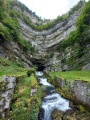
The source of the Loue is one of Franche-Comté’s most famous natural sites. It gushes forth at the foot of an impressive limestone cliff some 100 metres high, at the bottom of a vast rocky cirque. Listed among the region’s major natural sites, this place offers a remarkable spectacle in every season.

Mouthier-Haute-Pierre, nestled in the heart of the Loue Valley, is one of the most beautiful villages in the Haut-Doubs. Dominated by imposing limestone cliffs, it charms visitors with its winegrowers’ houses, its ancient Benedictine abbey founded in the 9th century, and its rich wine-growing heritage. As the starting point for numerous walks, the village offers an exceptional natural setting combining heritage, cliffs and the river.

The Haute-Pierre viewpoint is one of the finest vantage points in the Loue Valley. Perched atop an impressive limestone cliff, it offers a spectacular panorama of Mouthier-Haute-Pierre, the Nouailles Gorges and the forests of the Haut-Doubs.

Other walks in the area

For more walks, use our search engine .

The GPS track and description are the property of this route's author. Please do not copy them without permission.