The Nouailles Gorges, the Source de la Loue and Notre-Dame des Anges

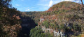
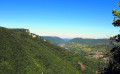
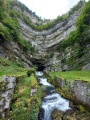
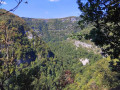
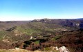
This walk offers a superb exploration of the Nouailles Gorges and the source of the Loue. The descent to the source is particularly spectacular: wild, steep and punctuated by magnificent views over the gorges, it is the highlight of the route. The path runs at the foot of the cliffs and beneath rocks sculpted by the river. This descent, which can be tricky at times, is therefore only suitable for hikers with sure-footedness and requires great caution. After the Notre-Dame des Anges chapel, the route continues through pastures and woodland before returning to the ledges overlooking the gorges.

Details

106282664
Creation:
Last update:
Last review:
  • Walking
    Activity: Walking
  • ↔
    Distance: 5.18 mi
  • ◔
    Average duration: 2h 55 
  • ▲
    Difficulty: Moderate

  • ⚐
    Back to start: Yes
  • ↗
    Ascent: + 640 ft
  • ↘
    Descent: - 640 ft

  • ▲
    Highest point: 2,326 ft
  • ▼
    Lowest point: 1,736 ft

Photos

Description of the walk

Car park at the top of the Gorges de Nouailles, on the D67, 3.5 km on the right coming from Mouthier. Yellow-red and yellow-blue markings; some sections are unmarked.

(S/E) Carefully walk down the departmental road for 200 metres, keeping to the left-hand side of the road. Before reaching a low stone wall, take the steps on the left (route no. 5, circular route), heading towards ‘Source de la Loue’. You’ll soon come to your first viewpoint over the gorges (wooden railings) with picnic tables. Continue down the path, taking great care, past a ruin. The descent is dotted with superb views of the gorges and, towards the bottom, passes beneath rocks hollowed out by the river. You will arrive at the Source de la Loue.

(1) Head back up to the left along the concrete path, passing in front of the Chalet de la Loue (café-restaurant). Walk round it.

(2) Head off to the far left (towards Notre-Dame-des-Anges) along the grassy path, passing behind the chalet and climbing through a beautiful pine forest. At the first fork, continue climbing to the right to rejoin a wider farm track, which you follow to the right until you reach the pastures and a metal gate – be sure to close it behind you.

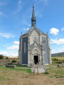
(3) You’ll immediately spot the marker post in the pasture on the left. Step over the electric fence and climb up towards the chapel. Pay a visit to the angels – the chapel is open. Make the most of the benches for a picnic break whilst taking in the scenery of our Comtois hills.

(4) Leave the chapel via the path that leads back down towards the village. At the fork, by the first house, head left, leaving the signposted route to take the little road that winds peacefully through the pastures, accompanied by the curious gaze of our good old Montbéliarde cows. Turn left at the next fork. You’ll soon enter the forest, rejoining the signposted route at the ‘Le Chanois’ signpost.

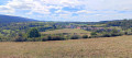
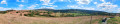
(5) Continue straight down the slope. The small road becomes tarmac and crosses a stony track on your right. About thirty paces further on, at the ‘Pré Rouge’ signpost, turn sharp left towards ‘La Creuse’. You’ll come back to the edge of the cliffs and a path running perpendicular to them. Head down to the right. More beautiful views of the Nouailles Gorges, overlooked by the Moine de la Vallée and the Aiguillon de Brasse.

(6) You’ll reach a pasture and a fence, passing through the gap between two trees. Walk the length of the pasture until you reach a signpost. Turn sharply left, heading downhill, to reach the edge of the woodland and another gap between the trees, leading to a lovely stony path that winds through the copse to the road and the car park on the left (S/E).

Waypoints

  1. S/E : mi 0 - alt. 1,962 ft - The Nouailles Gorges - Loue (rivière)
  2. 1 : mi 1.29 - alt. 1,745 ft - Source de la Loue (Ouhans)
  3. 2 : mi 1.7 - alt. 1,903 ft - Chalet de la Loue
  4. 3 : mi 2.24 - alt. 2,070 ft - La Combe
  5. 4 : mi 2.41 - alt. 2,136 ft - Chapelle Notre-Dame des Anges (Ouhans)
  6. 5 : mi 3.86 - alt. 2,306 ft - Le Chanois
  7. 6 : mi 4.93 - alt. 2,060 ft - La Creuse
  8. S/E : mi 5.18 - alt. 1,962 ft - The Nouailles Gorges

Notes

Section (1) – (2): ‘Mountain route. Narrow path along the cliff edge, exposed to falling rocks and trees. Do not attempt this route in bad weather or when the ground is wet. Take care!’ warns a sign at the start of the route. Not suitable for children or those prone to vertigo.

(3) The owner, who is presumably not very welcoming, has not provided a proper access route. Or perhaps I simply didn’t spot it… If there are cows in the pasture, be careful not to get ‘zapped’ by a small electric shock!

(!) The route includes ledge paths and unsecured viewing points. The paths are rocky and slippery in places. Sturdy footwear is essential and the use of walking poles is recommended.

Worth a visit

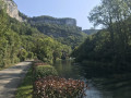
(S/E) TheNouailles Gorges: carved out by the River Loue through the limestone of the Jura Mountains, the gorges offer a spectacular and wild landscape, set amongst cliffs, forests and the river. They are home, in particular, to the Source de la Loue, one of the Haut-Doubs’ most iconic natural sites.

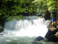
(1) The Source of the Loue: at the bottom of an impressive ravine, the Loue emerges from a vast cave at the foot of a limestone cliff over 100 metres high. This spectacular resurgence is fed by an extensive underground network, notably by the sinkholes of the Doubs. The site, much loved by the painter Gustave Courbet, is one of the Haut-Doubs’ most iconic natural landscapes.

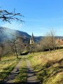
(4) Notre-Dame des Anges Chapel: built between 1864 and 1875 on the hill overlooking the source of the Loue, this chapel was erected as a token of gratitude to the Virgin Mary, whom the villagers thanked for sparing the village from various misfortunes, particularly during the French Revolution. Decagonal in shape, it houses nine statues of angels and a statue of the Virgin Mary.

Other walks in the area

For more walks, use our search engine .

The GPS track and description are the property of this route's author. Please do not copy them without permission.