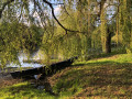
A circular walk around the Sèvre, its hillsides and vineyards, starting from the Port de la Ramée

This circular walk, starting from the lovely Port de la Ramée in the town of Vertou, takes us from paths along the banks of the Sèvre to hillsides and woods, before returning via superb vineyards, a point of interest, and the riverbank.

Details

22764906
Creation:
Last update:
Last review:
  • Walking
    Activity: Walking
  • ↔
    Distance: 6.48 mi
  • ◔
    Average duration: 3h 05 
  • ▲
    Difficulty: Moderate

  • ⚐
    Back to start: Yes
  • ↗
    Ascent: + 157 ft
  • ↘
    Descent: - 135 ft

  • ▲
    Highest point: 135 ft
  • ▼
    Lowest point: 13 ft
  • ⚐ Country: France
  • ⚐ City: Vertou (44120)
  • ⚑
    Start/End: N 47.155542° / W 1.437912°
  • ❏
    IGN map(s): Ref. 1223SB, 1224SB, 1323SB, 1324SB
  • Hour-by-hour weather

Photos

Description of the walk

Starting from the Port de la Ramée in Vertou: from Vertou, take the D59 towards Saint-Fiacre, then the D359 towards La Haie-Fouassière. At La Ville Henri, turn right onto the Route de la Ramée, then take the Impasse de la Ramée. A car park and picnic tables await you.

(S/E) Take the path westwards towards the road bridge linking Vertou to Saint-Fiacre. As you approach the bridge, use the pedestrian crossing and cross the road (take care) to continue along the river.

(1) Confluence of the Sèvre Nantaise and the Maine. Continue on and go round the Hauts-Thébaudières site to reach Route de la Ville Bachelier.

(2) Turn left for 200 m and, at the cross, turn right onto theGRP® Red and Yellow marked path, which leads to La Billiardière, crossing the M59 at La Grande Noë (take care), then Pas Baril to reach the La Billiardière roundabout. Continue to follow theGRP® markings at every junction.

(3) Turn right, keeping to the safe side of the M105 for 500 m, then veer right towards La Verrie for 200 m.

(4) Turn right, first between houses, then onto a lovely wooded path. When you reach the junction with a road, continue for a few dozen metres, leave the road and veer left and right along the lane beside the vineyards, taking care not to follow the dirt track on the left.

(5) Continue along the vineyards and then into the woods to reach La Bouteillerie, keeping to the left until you reach Rue du Patis. Turn right to cross Route de la Haie-Fouassière straight ahead, then follow the path through the woods to emerge onto Route de la Ramée.

(6) Turn right onto the road and, after 150 m, turn left onto the path in the middle of the field. Follow this path with the vineyards on your left and the quarry, which you go round, until you reach the Route de la Haie-Fouassière.

(7) Take the road to the right, taking care to stay safe, for 300 m. Just after the entrance to the quarry, level with the road to the village of Pibrac, head up the path on the right alongside the quarry for about 400 m. Keep to the right, still following the edge of the site, to reach a sewage treatment plant and the River Sèvre.

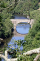
(8) Return along the Sèvre Nantaise via the shaded path which leads back to the port of La Ramée (S/E).

Waypoints

  1. S/E : mi 0 - alt. 16 ft - Port de la Ramée - La Sèvre nantaise
  2. 1 : mi 0.53 - alt. 16 ft - Confluence of the Sèvre Nantaise and the - Maine (rivière)
  3. 2 : mi 1.39 - alt. 115 ft - Section of the GR de Pays
  4. 3 : mi 2.75 - alt. 102 ft - M105 on the right
  5. 4 : mi 3.11 - alt. 115 ft - On the right
  6. 5 : mi 3.57 - alt. 131 ft - Along the vineyards
  7. 6 : mi 4.38 - alt. 125 ft - Turn right
  8. 7 : mi 4.9 - alt. 59 ft - Turn right
  9. 8 : mi 5.69 - alt. 26 ft - Path along the - La Sèvre nantaise
  10. S/E : mi 6.48 - alt. 20 ft - Port de la Ramée - La Sèvre nantaise

Notes

No toilets or drinking water points: I looked, but!

Worth a visit

Enjoy the paths and the shade along much of the route.

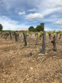
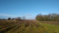
After points (6) and (7), take the time to photograph the vineyard.

Reviews and comments

4.6 / 5
Based on 3 reviews

Reliability of the description
4.7 / 5
Ease of following the route
4.7 / 5
Route interest
4.3 / 5
gabyh
gabyh

Overall rating : 4 / 5

Date of your route : Nov 03, 2025
Reliability of the description : ★★★★☆ Good
Ease of following the route : ★★★★☆ Good
Route interest : ★★★★☆ Good
Very busy route : Yes

good route

Machine-translated

Kaminev
Kaminev

Overall rating : 4.7 / 5

Date of your route : Sep 03, 2023
Reliability of the description : ★★★★★ Very good
Ease of following the route : ★★★★★ Very good
Route interest : ★★★★☆ Good
Very busy route : No

There’s a short, slightly dangerous stretch of road just before the quarry, but it’s a really lovely walk and much of it is in the shade

Machine-translated

thierry musquer
thierry musquer

Overall rating : 5 / 5

Date of your route : Feb 21, 2023
Reliability of the description : ★★★★★ Very good
Ease of following the route : ★★★★★ Very good
Route interest : ★★★★★ Very good
Very busy route : No

A lovely walk with a stunning view over the Goulaine marshes, despite the lack of sunshine that day.
A few slightly stony sections amongst the vineyards.
Brant geese, ducks and swans were spotted.

,__

Machine-translated

Other walks in the area

For more walks, use our search engine .

The GPS track and description are the property of this route's author. Please do not copy them without permission.