


Refine your search for walks in La Rippe
La Rippe walks
 From Bonmont Golf Club to Ferme Courtois
 Visorando Member
 14.96 mi
 +1,772 ft
 -2,195 ft
 5 hrs
 Moderate
 Departure from Chéserex (Vaud)
Horse riding excursion starting at Bonmont Golf Club and ending at Sauverny.
 The Dôle loop starting from Fleutron
 Tourist office
 13.29 mi
+4,003 ft
-3,996 ft
9h 35
 Very difficult
Departure from Divonne-les-Bains (Ain)
Open from 16 April to 30 November, subject to snow conditions.
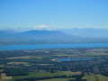
A challenging and immersive hike to the summit of La Dôle (1,677 m). From Le Fleutron, the route alternates between deep forests, open ridges and high-altitude pastures. After crossing the French-Swiss border, you will reach one of the iconic peaks of the Swiss Jura, offering a 360° panorama of Lake Geneva, the Alps and Mont Blanc.
This demanding but spectacular route crosses unspoilt natural areas in the heart of the Haut-Jura Regional Nature Park and the Haute Chaîne du Jura National Nature Reserve. Dogs are not allowed, even on a lead. Please respect the regulations in force to preserve this remarkable environment (see the practical information section).
La Dôle, starting from Divonne-Les-Bains
14.12 mi
+4,514 ft
-4,511 ft
10h 25
 Difficult
Departure from Divonne-les-Bains (Ain)
A beautiful Franco-Swiss hike to the Dôle, offering magnificent panoramic views of the Jura to the north, Lake Geneva to the south, the northern Alps and, consequently, Mont Blanc.
La Dôle via Les Sonnailleys
 5.56 mi
+1,430 ft
-1,414 ft
3h 50
Moderate
Departure from Divonne-les-Bains (Ain)
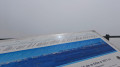
One of many routes to reach this distinctive summit with its radar station visible from anywhere in the Lake Geneva basin. Magnificent panorama from the Eiger to the Écrins, via Mont Blanc and Lake Geneva (orientation table). Chamois galore for early risers, rarer during the day due to high visitor numbers.
Marked route, also accessible in winter with snowshoes or cross-country skis, with a few variations.
La Dôle circular from La Greffière
 7.75 mi
+2,008 ft
-1,982 ft
5h 20
Moderate
Departure from Divonne-les-Bains (Ain)
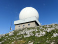
Near La Greffière, I suggest you head for the summit of La Dôle whilst walking around it.Along the way, there are magnificent landscapes to discover, and with a bit of luck you might spot a few chamois.
Chalet de la Vesancière
8.48 mi
+1,742 ft
-1,739 ft
5h 25
Moderate
Departure from Vesancy (Ain)
A lovely, easy walk taking you through the Jura forests and mountain pastures above Vesancy, a charming historic village in the Pays de Gex.
Please note! Hiking is not permitted between 15 December and 30 June
Circular La Dôle from Les Dappes via Le Vuarne and Couvaloup de St-Cergue
8.50 mi
+2,116 ft
-2,096 ft
5h 45
Moderate
Departure from Prémanon (Jura)
This beautiful hike will take you to the summit of La Dôle at an altitude of 1,677 metres, where you can enjoy breathtaking views. A steep path through the mountain pastures will lead you to this unmistakable peak with its dome housing the Geneva airport radar. On the descent, you will no doubt see herds of chamois frolicking in the scree below the summit ridge. The rest of the route takes you along dirt tracks, roads and grassy paths over much less rugged terrain, but often offering magnificent views.
 La Dôle via the Col de Porte
3.72 mi
+1,407 ft
-1,411 ft
2 hrs
Moderate
Departure from Prémanon (Jura)
This route respects the work of the piste groomers in winter. It is a magnificent walk which, from the arrival at the Col de Porte, allows you to admire the view of Lake Geneva and the Alps, including Mont Blanc, for the rest of the route.
La Dôle from Les Dappes
 4.16 mi
+1,424 ft
-1,427 ft
3h 10
Moderate
Departure from Prémanon (Jura)
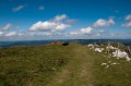
Without doubt, the shortest path up to the summit of La Dôle (1677m altitude) from the French side of the border. In good weather, the views are breathtaking and go on for over 250km: from the Swiss Alps to Mont Blanc and on to the Vanoise and the Ecrins, all of this with plunging views down over Geneva and its lake.
Mont Mourex
6.06 mi
+823 ft
-827 ft
3h 30
 Easy
Departure from Divonne-les-Bains (Ain)
Panoramic view of Lake Geneva, the Alps, the high Jura mountains and the Pays de Gex
Circular route around La Dôle
 9.86 mi
+2,438 ft
-2,425 ft
6h 40
Moderate
Departure from Saint-Cergue (Vaud)
Circular route from the village of Saint-Cergue to La Dôle, 1,677m, the second highest peak in the Swiss Jura. Ascent via the summit of La Barillette then the Col de Porte. Descent via the Chalet de la Dôle and the Le Vuarne valley.
There are numerous options to shorten the entire circular loop, as it consists of three separate circular loops. Can be done in summer or winter (snowshoes).
The Belvédère des Dappes
 2.95 mi
+935 ft
-935 ft
4 hrs
Moderate
Departure from Les Rousses (Jura)
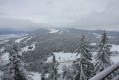
A pleasant route through the Massif des Tuffes to explore the highest point of the Les Rousses alpine ski resort.
La Givrine – l'Arzière via Vermeilley
 7.01 mi
+889 ft
-879 ft
4h 00
Moderate
Departure from Saint-Cergue (Vaud)
A lovely circular walk starting from the Givrine train stop on the Nyon–Saint-Cergues–Morez line. A gentle stroll through the pastures of the Swiss Jura, a stone’s throw from the French border, which presents no particular difficulty. Many sections are tarmac-surfaced, but you can walk on the short grass at the side of the path at any time.
Le Creux du Croue - Le Noirmont
 9.61 mi
+2,024 ft
-2,018 ft
6h 10
Moderate
Departure from Saint-Cergue (Vaud)
A walk through unspoilt nature, across meadows, woods and scree slopes, following beautiful valleys with views of the Alps. The highlight of this walk is, of course, the Creux du Croue, a deep and magnificent depression.
The Marais des Bidonnes
 1.95 mi
+23 ft
-23 ft
0h 55
Easy
Departure from Divonne-les-Bains (Ain)
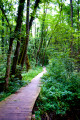
A pleasant walk along boardwalks through a marshy area with themed information panels about the local flora and fauna.
Starting from the hamlet known as ‘Les Îles’, an educational trail runs alongside the Crans Canal. This canal, also known as the Coppet Canal, has been used since 1265 to divert part of the waters of the Versoix towards Bogis and Commugny in Switzerland. The rich variety of flora and fauna (reeds, alders, oaks, lungwort, etc.) found here is highlighted by themed information boards. As you cross the Bidonnes marsh on wooden footbridges, you may spot beavers. Finally, an observation deck offers a superb view of this fragile ecosystem, where a herd of hardy cows helps to prevent natural reforestation.
More walks in La Rippe
Select a point of interest below: