Pointe du Dérochoir

An extraordinary hike through a very rocky landscape. Exceptional scenery and views throughout the route. This route includes dangerous sections and is reserved for experienced hikers.

Details

139733
Creation:
Last update:
Last review:
  • Walking
    Activity: Walking
  • ↔
    Distance: 6.99 mi
  • ◔
    Duration according to the author: 6 hrs 
  • ▲
    Difficulty: Very difficult

  • ⚐
    Back to start: Yes
  • ↗
    Ascent: + 3,967 ft
  • ↘
    Descent: - 3,967 ft

  • ▲
    Highest point: 7,838 ft
  • ▼
    Lowest point: 4,157 ft

Photos

Description of the walk

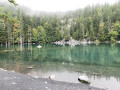
Access: from Annemasse (Geneva), take the A40 ‘Autoroute Blanche’, exit 21 (Fayet-Passy); follow signs for Passy and head up to the Plateau d’Assy. Continue to Plaine-Joux. Drive through the hamlet of Plaine-Joux and then turn right (at the Chalet de la Réserve) towards Lac Vert, where you can park.

(S) From the car park (altitude approx. 1,260 m), take the path that starts to the left of the building, then head up towards Le Châtelet. Turn right as soon as you can, then right again, so as to join the Route du Châtelet, which you follow to the right.

(1) Turn left just before the restaurant (signposted ‘Le Dérochoir’).

(2) At the first junction (Les Cornes, 1,472 m), turn right (signposted ‘Le Dérochoir’). You’ll soon be treated to a lovely view of the Rochers des Fiz, notably the Marteau.

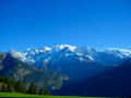
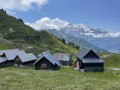
Join a track and follow it to the right. Pass through Ayères des Rocs (1,641m) and you’ll soon reach the superb hamlet of Ayères des Pierrières (1,637m). The view of Mont Blanc is truly magnificent.

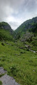
(3) As you leave the hamlet, turn left (signposted for the Dérochoir). The path climbs slowly but steadily, first across grassy slopes, then, quite quickly, the rocks become more numerous and the vegetation sparser. Follow the red markings on the rocks.

The path gradually draws closer to the rock faces and you can already see the gigantic scree slope of the Dérochoir. You’ll zigzag between the boulders to get closer to a rocky peak; the route isn’t always obvious (steep terrain) so be sure to follow the red markings closely.

You’ll reach a narrow pass (a small valley) which you cross by passing between the Fiz cliffs and the aforementioned peak, part of whose north face is almost smooth.
This rocky landscape is exceptional; behind you, the view is superb. After a very ‘rocky’ climb, continue over almost flat ground. A few more sections through the rocks and you’ll leave the gorge behind for less rugged terrain.
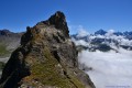
Climb a little further, then the path veers right across stony ground to reach the foot of the cliff. To the left, there’s a superb view of the Pointe du Dérochoir, which is today’s destination.

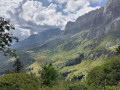
(4) Next, tackle the climb up the Dérochoir. Whilst not difficult, this section does require a degree of caution, particularly if the ground is slippery; progress is aided by metal handrails, ropes, a few ladders and metal steps. There’s a very beautiful view of the cliffs to the right, with the Marteau taking centre stage and the Aiguille Verte in the distance.

Reach the Passage du Dérochoir (or pass), at 2,200 metres. A breathtaking panorama!

(5) Continue a very short distance westwards along the ridge towards the Col de la Portette (signposted). The path gradually descends along the hillside; pass beneath the Pointe du Dérochoir to reach another scree slope.

(6) Climb up this scree slope (which is quite steep!) to reach the western ridge.

(7) Follow it southwards along a ridge with beautiful schist slabs. Avoid the first rise by keeping to the right, skirting the foot of the rock face over grassy ground; take care, as it’s exposed.

This is followed by a stony outcrop with a short descent; head left to climb the second rise as best you can (opt for the slightly grassy section, which is less treacherous than the unstable schist).

The ridge becomes easier to walk on and you reach the foot of the main rise; a few more easy climbing steps and you’ll reach the rocky summit ridge of the Pointe du Dérochoir at 2,411m (you can continue a little further east, but be careful – it’s very exposed).

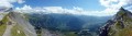
The 360° panorama is quite simply magnificent; Mont Blanc is the undisputed star of the show; there’s a lovely view of the Pointe de Platé to the west.

(8) The return journey follows the same route back to Lac Vert.

Waypoints

  1. S/E : mi 0 - alt. 4,157 ft - Lac Vert (Passy)
  2. 1 : mi 0.66 - alt. 4,639 ft - Turn left just before the restaurant - Refuge du Chatelet
  3. 2 : mi 0.94 - alt. 4,843 ft - Les Cornes
  4. 3 : mi 1.6 - alt. 5,358 ft - Ayères des Pierrières hamlet
  5. 4 : mi 2.56 - alt. 6,834 ft - Foot of the cliff
  6. 5 : mi 2.72 - alt. 7,274 ft - Passage du Dérochoir (ou col)
  7. 6 : mi 3.17 - alt. 7,192 ft - Scree slope to climb
  8. 7 : mi 3.34 - alt. 7,759 ft - West Ridge
  9. 8 : mi 3.49 - alt. 7,838 ft - Pointe du Dérochoir
  10. S/E : mi 6.99 - alt. 4,157 ft - Lac Vert (Passy)

Notes

IGN map 3530 ET
It is advisable to set off early in the morning so that you can park easily and cross the Passage du Dérochoir at a leisurely pace.
Please note: This route is only suitable for those who do not suffer from vertigo.

Worth a visit

Panorama from the Passage du Dérochoir (5) Grand Pré with the Sales chalets in the distance, the Fiz to the right (Frête Basse, Le Marteau, the Crête des Hippocampes, the Pointes d’Ayères, Pointe de la Ratelière, Pointe d’Anterne, Tête à l’Âne and the Pointe de Sales), the Aiguille Verte, the Mont Blanc range, the Passy valley, the Aravis, the Pointe du Dérochoir, the Platé desert (Europe’s largest sharp limestone pavement), etc...

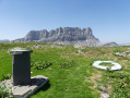
Pointe and Platé Desert, the Sales chalets, Le Marteau, Pointe d’Ayères (among others)

Reviews and comments

3.8 / 5
Based on 3 reviews

Reliability of the description
3.7 / 5
Ease of following the route
3.5 / 5
Route interest
4.3 / 5
Pierre viso
Pierre viso

Overall rating : 4 / 5

Date of your route : Jul 14, 2022
Reliability of the description : ★★★★☆ Good
Ease of following the route : ★★★☆☆ Average
Route interest : ★★★★★ Very good
Very busy route : No

No worries for most people – it’s a route that’s definitely worth doing.
We preferred, however, to do a circular route past the Pointe du Dérochoir via the Col de Portette.
As for Pointe du Dérochoir, we tackled the long and gruelling climb up the scree slopes, then passed the narrow, exposed ledge on the right.
We then turned back as the rest of the route seemed far too risky without the proper equipment. Particularly the section where you just have to ‘do your best’!
The view was nevertheless fantastic on both sides.
Thanks
Pierre

Machine-translated

josettechagnon
josettechagnon

Sorry, I can’t give my opinion just yet as I’m planning to go on this walk in August.
Thanks for the information.
Kind regards

Josette Chagnon

Machine-translated

DomPian
DomPian

Overall rating : 4.3 / 5

Date of your route : Aug 05, 2017
Reliability of the description : ★★★★☆ Good
Ease of following the route : ★★★★☆ Good
Route interest : ★★★★★ Very good

A lovely walk with superb views of the Mont Blanc massif. Bring some short ropes for belaying on the final section before the pass.

Machine-translated

Visophi
Visophi

Overall rating : 3 / 5

Date of your route : Aug 29, 2016
Reliability of the description : ★★★☆☆ Average
Ease of following the route : Not used / Not applicable
Route interest : ★★★☆☆ Average

Hello,
Personally, whilst ibex are often seen on the scree slope on their way up to the ridge, I’ve never actually made it all the way to the top. Are there any markings or cairns, or do you really just have to rely on your sense of direction?

Machine-translated

Other walks in the area

For more walks, use our search engine .

The GPS track and description are the property of this route's author. Please do not copy them without permission.