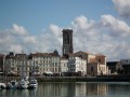
The Pointe du Chay circular walk starting from Aytré station

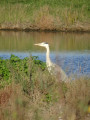
A walk starting very close to the city of La Rochelle. You may still be lucky enough to see herons up close between points (5) and (6).
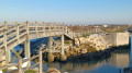
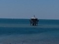
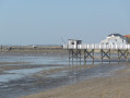
You’ll also see the region’s iconic fishing huts at the bridge (9) and on Aytré Beach.
From the top of the Pointe du Chay, there’s a lovely panoramic view of the Île d’Oléron, the Île d’Aix, the Île de Ré and the Bay of La Rochelle.

Details

67354370
Creation:
Last update:
Last review:
  • Walking
    Activity: Walking
  • ↔
    Distance: 6.01 mi
  • ◔
    Average duration: 2h 45 
  • ▲
    Difficulty: Easy

  • ⚐
    Back to start: Yes
  • ↗
    Ascent: + 26 ft
  • ↘
    Descent: - 26 ft

  • ▲
    Highest point: 36 ft
  • ▼
    Lowest point: 3 ft
  • ⚐ Country: France
  • ⚐ City: Aytré (17440)
  • ⚑
    Start/End: N 46.127315° / W 1.127437°
  • ❏
    IGN map(s): Ref. 1329ET
  • Hour-by-hour weather

Photos

Description of the walk

Start from Aytré Plage station.
- Access by TER train, on the line between La Rochelle and Rochefort.
- By car: park in the station car park.

(S/E) With your back to the station, turn right onto the path – initially tarmac – which runs between the houses; you’ll soon reach Boulevard de la Mer. Turn right, keeping to the wide pavement on the right, until you reach a roundabout preceded by a bus shelter.

(1) Walk past the bus shelter on the right and take the dirt track that leads down into the Marais Doux. Ignore the first path on the left and continue to the right, then straight on through the marsh until you reach a road. Walk parallel to this road, heading off to the left.

(2) The path is now right on the edge of the road. There is a campsite on the other side of the road. When you reach the Pont de la Pierre, do not cross the bridge but carry on straight ahead until you reach a level crossing.

(3) Carry on straight ahead after the level crossing. Turn left along the car park and go round the back of the sailing club.

(4) On the left, take the footbridge for pedestrians and cyclists and carry on straight ahead. Walk past a wastewater treatment plant on the right. If you wish, you can walk round one of the plant’s ponds (information boards). Carry on straight ahead until you reach the tennis courts.

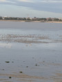
(5) After the tennis courts, turn right and continue along this path for approximately 2.5 km. Note a renaturalised oyster farming area on the right. Here you can spot birds such as egrets and herons. The path leads out onto a road next to a restaurant. Cross this road.

(6) Climb the few steps leading up to the sea wall. Walk along the sea wall, keeping to the right, until you reach a boat launch. Leave the launch on your left and follow the tarmac road for 50 m.

(7) A wide path climbs to the left towards Pointe du Chay. Take this path. Halfway along, a gate marks the boundary of private property. Take the path on the left which runs alongside the fence of this property and you’ll reach a blockhouse.

(8) Turn right. Walk behind the blockhouse and follow the path marked by two wires on the right and left. Do not stray from the path. There is a beautiful panoramic view of the islands and the Bay of La Rochelle.
Leave the cliff edge and head back down a path alongside a fence, keeping the fence on your left. When you reach a tarmac road, turn left and walk for about a hundred metres until you reach another boat launch.

(9) Turn right onto the coastal path, cross a wooden humpback bridge (see photo) and continue to the end of the path.

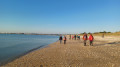
(10) Walk past the small sailing club building on your left (open in season). Head down to the beach and walk back to the starting point along the sand for about 1.5 km.

(11) Turn right to cross the railway line at the level crossing. Immediately turn right again to reach Aytré Plage station (S/E).


Waypoints

  1. S/E : mi 0 - alt. 10 ft - Gare d'Aytre.-Plage
  2. 1 : mi 0.27 - alt. 10 ft - Bus shelter before a roundabout
  3. 2 : mi 0.82 - alt. 10 ft - Path alongside the road
  4. 3 : mi 1.22 - alt. 13 ft - Level crossing
  5. 4 : mi 1.62 - alt. 7 ft - Bridge
  6. 5 : mi 2.09 - alt. 10 ft - Tennis courts - Gare d'Angoulins-sur-Mer
  7. 6 : mi 3.21 - alt. 13 ft - Angoulins Beach Seawall
  8. 7 : mi 3.45 - alt. 10 ft - Junction on the path
  9. 8 : mi 3.66 - alt. 36 ft - Pointe du Chay
  10. 9 : mi 4.1 - alt. 13 ft - Boat launch ramp
  11. 10 : mi 4.82 - alt. 16 ft - Sailing Club
  12. 11 : mi 5.95 - alt. 16 ft - Level crossing
  13. S/E : mi 6.01 - alt. 10 ft - Gare d'Aytre.-Plage

Notes

It’s best to be between the markers (10) and the finish line at low tide so you can walk on firm sand.
You’ll often have to share the path with cyclists. But don’t let that put you off – you’re not on a cycle path but on a shared route. It’s up to everyone to adapt.
Some sections of the route (between (9) and (10)) can be very busy in summer or on Sundays when the weather is fine.
Due to a series of rockfalls from the cliff, there may be access restrictions at Pointe du Chay. Stay on the path marked by wire ropes. Do not go near the edge of the cliff. The view is already stunning from the path; you won’t see any more from the edge. This is for your own safety.

Worth a visit

You can get something to eat or drink at the two establishments on Angoulins Beach. Check their opening days (they’re closed in the depths of winter).
You can park in the car park at Aytré station, but it’s best to use the much larger beach car park (go past the level crossing).
You can also reach the starting point by train (regular service between La Rochelle and Rochefort), getting off at Aytré.

Reviews and comments

4 / 5
Based on 3 reviews

Reliability of the description
4 / 5
Ease of following the route
4 / 5
Route interest
4 / 5
Jean-Jacques Mongeaud

Overall rating : 4 / 5

Date of your route : Nov 17, 2025
Reliability of the description : ★★★★☆ Good
Ease of following the route : ★★★★☆ Good
Route interest : ★★★★☆ Good
Very busy route : No

A short circular of barely 10 km, unless you go via Pointe de l'Écureuil. If the tide is low, you can enjoy watching the many wading birds that gather there on the way back. A pleasant walk.

Machine-translated

did760
did760
• Edited:

Overall rating : 4 / 5

Date of your route : Mar 17, 2025
Reliability of the description : Not used / Not applicable
Ease of following the route : Not used / Not applicable
Route interest : ★★★★☆ Good
Very busy route : No

A pleasant route through the oyster beds and along the coast, past the fishing huts.
At La Barbette, we spotted lots of birds, including greylag geese.
It’s a shame we can no longer go as far as Pointe du Chay; the path is closed from point 7, so we rejoined the route at point 9 via the road.

Machine-translated

josiane cousin
josiane cousin

Overall rating : 4 / 5

Date of your route : Jan 15, 2025
Reliability of the description : ★★★★☆ Good
Ease of following the route : ★★★★☆ Good
Route interest : ★★★★☆ Good
Very busy route : No

Hello, access to Pointe du Chay is currently closed.

Machine-translated

Other walks in the area

For more walks, use our search engine .

The GPS track and description are the property of this route's author. Please do not copy them without permission.