Country:
 City:
City:


Starting point and access: Place Félix Éboué.
- Metro - Lines 6 and 8 (Daumesnil station). Take Exit 2 onto Rue Claude Decaen.
- Bus - Lines 29, 46, 64 and 71.
On this route, you will occasionally come across aGR®® or a GRP®®. In the description below, the relevant signposting is only mentioned where necessary.
(S) Upon exiting the metro station, go straight ahead to Place Félix Éboué, then Avenue de Daumesnil. Pass by the Church of the Holy Spirit (a visit is recommended).
(1) Turn immediately right into Rue Cannebière. At the end, at the back of the church, turn left into Rue Claude Decaen. Continue straight ahead downhill.
At the traffic lights, turn right onto Rue de Fécamp. At the next junction, go straight on. At the end, turn left into Rue des Meuniers. Cross Avenue du Général Bizot at the traffic lights, continue straight ahead, pass the steps leading up to the footbridge on your right and go down a flight of steps leading to the old Petite Ceinture railway line.
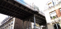
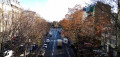
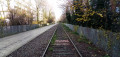
(2) Then turn left and follow the old railway line along a hard-standing path. Continue straight ahead, crossing Rue Claude Decaen, Rue de Picpus and Avenue de Daumesnil in turn (on the right, a view of Place de la Porte Dorée).
Then walk along the left-hand side of the small vegetable gardens set out along the old Bastille railway line. Cross Rue de Montempoivre and Rue du Sahel and continue along the old track for a further 150 m or so.
(3) As the path ends in a dead-end further on, take the exit on the right and emerge onto a cobbled street (Villa du Bel Air) at number 15. Follow this street to the right and walk alongside the fence of the old railway line on your right. At the end, turn left onto the Sentier de la Lieutenance. Go down a flight of steps, come out onto Boulevard Soult and follow it to the left for about a hundred metres.
At No. 101, turn left onto Sentier des Merisiers. Follow this narrow path to the end (half-timbered house). Then turn left onto Rue du Niger and, at the junction immediately ahead, turn right onto Villa du Bel Air.
When you reach a bridge over the old railway line, cross straight ahead (do not go under the bridge) and go down a flight of steps on the right. Then cross Avenue de Saint-Mandée at the pedestrian crossing and go back up a flight of steps. Continue along Rue du Gabon (red and white markings). Cross Rue Montéra. At the end, turn left into Rue de la Voûte and go under the Petite Ceinture bridge.
(4) Continue along the street as it bends left, then take thefirst left into the picturesque Impasse Canart. Retrace your steps and follow Rue de la Voûte to the right.
(4) When the street turns right, veer left to climb a flight of steps (Passage de la Voûte). Go under a red arch depicting a cat and emerge onto Cours de Vincennes.
First turn right then left to cross the tram tracks. Then turn left then right to cross Cours de Vincennes at the traffic lights, followed by the tram tracks. Continue straight ahead onto Rue du Général Niessel.
At the next junction, note the only level crossing within Paris city limits on your right, and turn left onto Rue de Lagny. Go straight on at the next two junctions and pass by the apse of Saint-Gabriel Church. Cross Rue Mounet Sully and continue for about fifty metres.
(5) Then turn right into Square Sarah Bernhardt. Walk past the base of the obelisk. Shortly afterwards, go down the steps on the left and continue along a wide, shaded gravel path. Walk past a playground on your left, then turn right towards the toilets. Take a small path that goes round to the right of a small stage decorated with a lyre player. At the corner of this small structure, turn right and leave the square.
Follow the street to the right (Rue de Buzenval, signposted further on). At the junction, turn left onto Rue de la Plaine. Then take the first right, into Passage Maigrot-Delaunay (a private road but open to pedestrians; note the colourful wall of a school). At the end, cross Rue des Grands Champs and follow it to the left.
After about fifty metres, turn right into Square Emily Dickinson. Cross the square, exit onto Rue des Ormeaux and follow it to the right. At the end, make the first turn left then right to cross Rue d’Avron at the pedestrian crossing, and follow it to the left. Turn into the first street on the right, Rue Planchat, and immediately ignore Rue des Haies on the right.
(6) At the junction, turn right into Rue des Vignoles. Follow this street, taking your time to explore the charming perpendicular cul-de-sacs: Impasses Rolleboise and Poule on the right, then Impasses des Souhaits on the left.
Cross Rue de Buzenval, then take a detour to the left into Impasse Saint-Pierre. Continue along Rue des Vignoles, cross Rue de la Réunion and then Sentier de la Pointe on the left. Take a detour to the right into Impasse Satan (small garden at the end) and finish on Rue des Vignoles.
At the T-junction, turn right onto Rue des Orteaux. After about 40 metres, turn right into Passage Dieu, which soon bends to the left. Make a U-turn to the right into Impasse Saint-Paul and continue to the end of the passage.
(7) Then turn left into an unmarked street (Rue des Haies; cabaret-theatre on the left). At the junction, turn right, cross Rue des Pyrénées and follow Rue des Orteaux. At the next set of traffic lights, turn left, cross Rue des Maraîchers, go under the Petite Ceinture bridge and immediately turn left into Rue Courat.
When Rue Courat turns right, turn left into Rue Albert Marquet. At the next junction, go straight on into Rue Florian. Take thefirst right, Rue Galleron. When this turns left, continue straight on, go down a flight of steps, walk past a small sports ground on your right and follow a cobbled alleyway (Passage des deux Portes).
At the end, turn left and follow Rue Saint-Blaise slightly uphill, with the Church of Saint-Germain de Charonne clearly in view. Cross Rue de Bagnolet and climb the steps leading to the foot of the church (a visit is recommended).
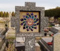
(8) Opposite the church entrance, look for the entrance to the adjoining cemetery on the left. Walk up a cobbled path and turn into thefirst path on the left. Note a plaque on the left commemorating the federates shot in 1871. At the end of the path, turn right. At the opposite corner, turn right again and pass by the foot of the statue of Bègue, known as Magloire. Continue straight ahead and find the exit on the left (note the lovely view of the church on the right).
Follow a cobbled alleyway on the right (not signposted). At the end, turn left into Rue des Prairies. Follow this street, ignoring all the side streets. When you reach Place Émile Landrin, turn right, cross Rue de la Cour des Noues and continue along Rue du Cher. At the T-junction, turn left onto Rue Belgrand until you reach Place Gambetta (cross the street at the traffic lights for direct access to the metro) (E).
To get back home:
- Metro - Lines 3 and 3bis.
- Bus - Lines 26, 60, 61, 64, 69 and 102.




 A very beautiful hike, definitely worth discovering. Magnificent locations, very well-explained route. Would do it again. Very pleased with this discovery. Thank you
 Visorando Member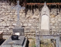
 Moderate