La Mouche in Le Clerjus

Let’s set off to explore the village of Le Clerjus, just a few kilometres from Bains-les-Bains. Come and enjoy the fresh air amongst streams, ponds and magnificent forests. Le Clerjus is a small rural village where you’ll be surprised by its authentic heritage (crosses, calvaries, historic sites, viewpoints…) and discover a preserved haven of peace.

Details

n°35403096
Creation:
Last update:
Last review:
  • Walking
    Activity: Walking
  • ↔
    Distance: 2.17 mi
  • ◔
    Average duration: 1h 20 
  • ▲
    Difficulty: Easy

  • ⚐
    Back to start: Yes
  • ↗
    Ascent: + 344 ft
  • ↘
    Descent: - 318 ft

  • ▲
    Highest point: 1,378 ft
  • ▼
    Lowest point: 1,017 ft
  • ⚐ Country: France
  • ⚐ City: Le Clerjus (88240)
  • ⚑
    Start/End: N 47.960183° / E 6.321677°
  • ❏
    IGN map(s): Ref. 3419O
  • Hour-by-hour weather

Description of the walk

‘Green Ring’ signposting along the entire route

From Bain-les-Bains, take the D164 towards Magnoncourt. Turn right halfway along onto the D12. Drive to the Salle des Fêtes in Le Clerjus.

(S/E) With your back to the village hall, follow the ‘Green Ring’ signposting, then turn left onto Rue des Écoles. Admire the church at Clerjus on your left, rebuilt in 1823 on the site of the original 12th-century church. Then turn right onto the Grande Rue and turn left onto the Chemin de la Croix de Mission. Ignore the first junction and continue to the Croix des Gaudines, erected in memory of a mission in 1873.

(1) Take the stony path on the left. Continue across the fields to the edge of the woodland, walking alongside the ruins of an old wall. Walk down the slope to the road.

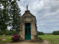
(2) Turn left to see a shrine dedicated to Notre-Dame des Charbonniers on the right.
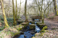
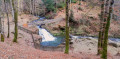
Then head towards La Chaudeau. You can take a look to your left to see a replica of the Grotto of Lourdes dedicated to the Blessed Virgin. Otherwise, carry on and take the first road on the left next to the ‘Chambre d’hôte du Martin-Pêcheur’ to walk along the banks of the Semouse. Next, turn left at the Chaudeau Chapel and, as you pass, admire the ruins and old metalworks. Follow the Semouse until you reach the first dead end.

(3) Carry on straight ahead. You’ll come to a second dead end.

(4) Turn left and head back up towards the village along the edge of the cemetery, following Rue de la Chaudeau and continuing straight ahead until you reach the village hall (S/E).

Waypoints

  1. S/E : mi 0 - alt. 1,293 ft - Village Hall
  2. 1 : mi 0.3 - alt. 1,365 ft - Croix des Gaudines
  3. 2 : mi 0.91 - alt. 1,040 ft - D20. Towards the bank of the - Semouse (rivière)
  4. 3 : mi 1.64 - alt. 1,198 ft - Dead end
  5. 4 : mi 1.79 - alt. 1,247 ft - Turn left at the fork
  6. S/E : mi 2.17 - alt. 1,293 ft - Village Hall

Notes

Thank you to the Club Vosgien and the ASCL Le Clerjus for organising this walk and for the work carried out by their teams throughout the year to mark out and maintain these paths.

Worth a visit

(1) The Croix des Gaudines, erected in memory of a mission in 1873.

(2) A shrine dedicated to Our Lady of the Coal Miners.

(2) A replica of the Grotto of Lourdes, built by Mr Charles Der Buyer in 1926 in memory of his wife, née Hélène De La Salle, who died in 1927.

Reviews and comments

5 / 5
Based on 1 review

Reliability of the description
5 / 5
Ease of following the route
5 / 5
Route interest
5 / 5
User 26613083

Overall rating : 5 / 5

Date of your route : Sep 21, 2026
Reliability of the description : ★★★★★ Very good
Ease of following the route : ★★★★★ Very good
Route interest : ★★★★★ Very good
Very busy route : No

A very lovely route that alternates between countryside and woodland, with flat sections and some fairly steep sections through the woods, but the path is very well maintained. There are a few lovely surprises along the way (which I’ll keep to myself so you can discover them for yourselves), and even the section following the River Semouse is pleasant.
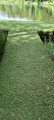
You just need to be careful when you reach the river – I spent a bit of time looking for the crossing, which is actually on a grass-covered bridge just straight ahead on the right, though it’s not very easy to spot.

Machine-translated

Other walks in the area

For more walks, use our search engine .

The GPS track and description are the property of this route's author. Please do not copy them without permission.