Country:
 City:
City:


From Bains-les-Bains, take the D164 towards Saint-Loup-sur-Semouse. Before reaching this town, turn left onto the D12, continuing to Le Clerjus.
Blue Disc markings along the entire route
(S/E) With your back to the Le Clerjus village hall, take the Chemin des Prés Valle and, after 150 m, turn left to stay on this path. Turn right past the ‘Les Biques’ sign to join a path across the fields, passing by the bottom of La Fosse. Continue straight on until you reach the Ruisseau du Hallot. Cross it and you’ll arrive at a crossroads.
(1) Take the path on the left and cross the stream. Continue to follow the signposts for approximately 900 m until you reach the next crossroads.
(2) Turn right, crossing fields and woods, and carry on straight ahead until you reach a road.
(3) Cross the road and head straight on up towards La Rochère. You’ll reach a crossroads where you can admire the Croix Jacquot.
(4) Turn right onto the road, then turn left towards the Lodge de la Rochère before reaching a crossroads.
(5) Turn right onto the stony path and carry on straight ahead, following the signposts. You’ll pass the Croix Germain, known as the ‘plague victims’ cross’, and 100 metres further on, on the left, the Croix Colnot. Keep going straight ahead until you reach the two buildings.
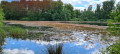
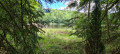
(6) Carry on straight ahead along the road that continues from the track. At the crossroads, turn left twice. The local track leads to the hamlet of Corbéfaing. There, you can explore a 14-hectare natural lake, bordered by a rugged forest. This site is maintained by a fishing association. It is home to enormous, well-looked-after carp (swimming and fishing prohibited).
(7) After the pond, continue along this path for 250 metres and turn right onto a stony track leading back towards the Croix Jacquot.
(5) Keep to the right towards the cross.
(4) Turn right again, then go straight on to reach the hamlet of Le Noirmont, 1.5 km away, by following the path that continues from the track. When you reach the village, take the path on the left towards La Rochère. First turn right then left until you reach a junction with a footpath.
(8) Turn right onto this path, which passes close to the Étang de Dé (on the right). Continue for 500 metres and turn left, at a right angle, at the junction of the paths. Carry on straight ahead until you reach the forest road near the Étang de la Picarde.
(9) Turn left to stay on the track until the next junction. On this path, you can see the Croix Nicolas Colin on your right. Continue along this stony ‘Bon Père’ path. Cross the Chemin du Noirmont and carry on until you reach the oratory.
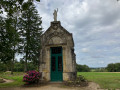
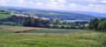
(10) On the left, you can see the Saint Pierre Fourier oratory. Carry straight on to reach a crossroads. There’s a lovely view over the village.
(11) Located at the junction of the roads – one leading to Bains station, the other to Xertigny – stands a statue of the Virgin Mary holding the Baby Jesus in her arms. Carry straight on along the Route de Saint-Loup, then the Rue de la Cote, to return to the starting point, keeping straight ahead the whole time (S/E).


 Tourist office
 Easy
Easy 
 Visorando Member