Hills and valleys in the Plogastel-Saint-Germain countryside

A long walk through the countryside around Plogastel-Saint-Germain, taking in cultivated hills and wooded valleys.

Details

n°3184507
Creation:
Last update:
Last review:
  • Walking
    Activity: Walking
  • ↔
    Distance: 6.94 mi
  • ◔
    Average duration: 3h 35 
  • ▲
    Difficulty: Average

  • ⚐
    Back to start: Yes
  • ↗
    Ascent: + 433 ft
  • ↘
    Descent: - 433 ft

  • ▲
    Highest point: 486 ft
  • ▼
    Lowest point: 256 ft

Photos

Description of the walk

Park in the car park situated between the post office and the church in Plogastel-Saint-Germain.

(S/E) Leave the car park opposite the restaurant ‘Le Kastel’, head up the street of the same name on the left and turn right into Rue de la Fontaine. Note the beautiful sundial on the house currently being restored on your right.

The route is signposted with mountain bike marker posts for the “Route des Vallées de Plogastel”.

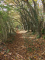
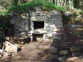
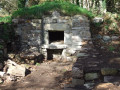
Follow this lovely sunken path which turns right and leads to a wash house that is still well maintained. Continue along the same path.

(1) Turn right and cross a stream over large flat stones (dry at the end of June) and continue towards the hamlet of Kervil, which you go round on the left to reach the D140.

(2) Follow this road to the right with care for about 400 metres, pass two houses on the left and turn right onto another sunken lane, which you follow until you reach a small road.

(3) Turn left towards the D784, follow the disused road on the left, then cross carefully towards Le Moustoir. Carry on straight ahead along the grassy track, ignoring the one on the left. In the valley, turn left, cross a road and head for Kervigodou Huella farm. Turn left into the shaded lane and pass the entrance to Kerluen farm.

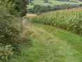
(4) Before the houses in the hamlet of Toul Réo, take a sharp right-hand bend onto a stony track which continues as a path running alongside fields, leading down to the D57.

(5) Head back up this road, keeping to the left. – lorries from the Gourlizon quarry regularly pass through here during the week. Continue along the D57 and turn left onto a small road which joins the D784 at the hamlet of Kérandoaré.

(6) Carefully follow the D784 for about 200 metres, then turn right onto a sunken track. Pass Quilliou-Bihan and continue straight on towards the hamlet of Kermoguer.

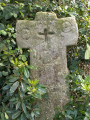
(7) Turn left (at a beautiful monolithic cross), pass a house and turn right onto a tree-lined dirt track leading back to the D784.

(8) Cross with extreme caution (see instructions in the practical information section). Continue along the path that passes through Kerfioret, then follow the road to the left which runs alongside a stream that becomes the Rivière de Pont-l’Abbé.

(9) Opposite the Briec Bihan farm, turn left, then right at the first road, which continues as a stony track below a woodland. Pass, on your right, a footpath leading out of the woodland.

(10) Follow the wide path which branches off to the left and goes round a house.
At the mountain bike signpost, head straight up the path which leads to a road at the top, near a car park for the sports facilities. Turn right and start heading down this road.

No signposting

(11) Turn left into Impasse des Genêts and continue along the footpath, which rejoins the street you left earlier.
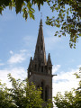
Near a three-way junction, turn right into Impasse de l’Église (view of the church tower). Opposite the church, turn left to return to the Post Office car park (S/E).


Waypoints

  1. S/E : mi 0 - alt. 358 ft - Post Office car park - Église Saint-Pierre (Plougastel-Saint-Germain)
  2. 1 : mi 0.52 - alt. 367 ft - Turn right (stream)
  3. 2 : mi 0.88 - alt. 397 ft - Turn right onto the D140
  4. 3 : mi 1.67 - alt. 466 ft - Junction with the D784
  5. 4 : mi 2.82 - alt. 443 ft - Junction before Toul Réo
  6. 5 : mi 3.29 - alt. 338 ft - Junction with the D57
  7. 6 : mi 3.94 - alt. 446 ft - Junction with the D784
  8. 7 : mi 4.72 - alt. 397 ft - Kermoguer junction
  9. 8 : mi 5.05 - alt. 404 ft - A tricky crossing of the D784
  10. 9 : mi 5.94 - alt. 279 ft - Junction opposite Briec Bihan
  11. 10 : mi 6.49 - alt. 256 ft - Turn left at the junction after the copse near the - Rivière de Pont-l'Abbé (fleuve)
  12. 11 : mi 6.69 - alt. 325 ft - Impasse des Genêts
  13. S/E : mi 6.94 - alt. 358 ft - Post Office car park - Église Saint-Pierre (Plougastel-Saint-Germain)

Notes

(10) Important note: When crossing the D 784, there is no visibility due to the bend in the road and there may be heavy traffic. Furthermore, there are no signs to alert drivers to the presence of walkers, as is sometimes the case.
If you are in a group, one person should cross alone first, taking care, and then signal to the rest of the group that they should not hesitate to cross in single file.

Worth a visit

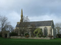
(S/E) Saint-Pierre Church, rebuilt between 1878 and 1880.

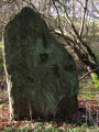
(7) A fine monolithic cross from the Early Middle Ages with a cross in the centre.

A hilly route through well-preserved countryside.

Reviews and comments

4.3 / 5
Based on 2 reviews

Reliability of the description
4 / 5
Ease of following the route
4.5 / 5
Route interest
4.5 / 5
LecozDjipi
LecozDjipi

Overall rating : 4 / 5

Date of your route : Jul 29, 2024
Reliability of the description : Not used / Not applicable
Ease of following the route : ★★★★☆ Good
Route interest : ★★★★☆ Good
Very busy route : No

A lovely route. A bit too much tarmac for my liking, but very quiet, apart from the D784 after point 6. Unfortunately, there’s no alternative.

Between points 3 and 4, the route has been diverted and no longer passes through the Kervigoudou Huella farm. You need to turn left at the junction with the road to Rulann Névez. The path skirts a huge field (of wheat in July 2024) and eventually joins the sunken lane towards Kerluen and Toul Réo. The mountain bike signposting has been updated accordingly, although the purple route past the farm still appears on the IGN map.

Worth doing again in winter for different scenery, though it will no doubt be very muddy in places.
JP

Machine-translated

FLOCH
FLOCH ★

Thank you for this feedback and for clarifying that point.
I’ll amend my route and description.
It just goes to show how the terrain can change. It’s a shame, as this path used to be a way round the D74.
Kind regards

Machine-translated

bpja
bpja

Overall rating : 4.7 / 5

Date of your route : Oct 13, 2020
Reliability of the description : ★★★★☆ Good
Ease of following the route : ★★★★★ Very good
Route interest : ★★★★★ Very good
Very busy route : Yes

A countryside route with small valleys and narrow paths – a lovely walk
At number 6, at the bend, we were unable to turn right to follow the edge of the field; the path is no longer accessible.
We carried on to the D 784 and turned right, walking along the side of the road for about 100 metres (take care) before rejoining the path on the right just past No. 6.

Machine-translated

Other walks in the area

For more walks, use our search engine .

The GPS track and description are the property of this route's author. Please do not copy them without permission.