


 Country:
 City:


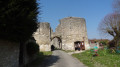
The route starts at the end of the Mail Nord, near the Poterne, where you can park.
(S/E) Set off towards Fricambault along the Mail Est (which continues on from the Mail Nord). At the end, go down the stairs on the left and join Rue de Fricambault.
(1) Follow it to the right until the end, crossing the River Essonne, and you’ll reach a junction.
(2) Turn right onto Rue d’Yèvre, then left onto Place de l’Abbaye and take Impasse Saint-Pierre to reach the alley of the same name.
(3) Follow this, which climbs quite steeply. At the end, head left (Chemin du Prieuré) until you reach Rue de Yèvre. Return to the junction you’ve already passed by turning left.
(2) Turn right onto Rue de Chantaloup and head for the next street on the left.
(4) Walk up this street (Rue du Chapeau Rouge) to No. 32. Just after this, turn into the narrow lane leading uphill on the right. At the top, turn left (Rue Haute du Parc), ignore Rue du Château d’eau on the right and continue to No. 31 Rue des Jardins.
(5) Opposite No. 31, turn right and go straight on along the path, then follow the fitness trail. This leads into the Natura 2000 area. You’ll come to a fork just after the bend on the right.
(6) Keep to the right and you’ll come out onto a cross-road with a small car park. Follow it to the left, skirting the wooded area until you reach the end of the field where the road turns right.
(7) Carry on straight ahead along the track running alongside the woodland until you reach its corner.
(8) Turn left to enter the woodland towards the River Oeuf. Cross the bridge and, further on, turn right to reach the road. Continue to the left, then, at the three-way junction, turn right to reach the Notre-Dame de Bon Secours Chapel and its fountain.
(9) Then return to the previous junction and carry on, turning right (Chemin de Bondaroy) towards Saint-Grégoire Church. Just before the sign marking the entrance to the town of Bondaroy, turn left onto the path leading to the church.
(10) Then follow thePR®-GR® downhill and enter the forest. Walk past the river, keep to the right until the end of the slope, then continue straight ahead to the road (Rue de la Bonne Dame) and reach the junction near the castle.
.(11) Carry on to the left along Rue Jean de la Taille, passing in front of Bondaroy Castle, and continue along this street until you reach the town hall.
(12) Take Rue de l’Église on the left, ignore the entrance to the cemetery on the right, then, at the second junction, turn right opposite No. 7, to go up a small passageway with steps and reach a side street opposite No. 45 (Rue Saint-Aignan).
(13) Turn left and continue to the social centre car park. At the far end of the car park, near No. 9, head down to the left along the small path which soon leads to a minor road (Chemin de Bondaroy).
(14) Follow it to the right, then continue along the Sentier de Bondaroy and then the Ruelle du Val Saint-Jean, which takes you straight back to the starting point (S/E).

 Visorando Member

 Association / Club / Walk leader
 Easy
 Local authority

