La Franquevillette

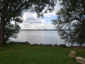
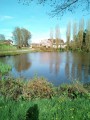
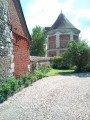
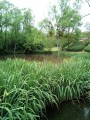
Starting from Longboël Park, this easy walk will take you across the fields to take a break or enjoy a snack by the peaceful Franquevillette lake. Along the way, you’ll catch a glimpse of the magnificent Château du Chant d’Oisel.

Details

n°74765462
Creation:
Last update:
Last review:
  • Walking
    Activity: Walking
  • ↔
    Distance: 5.11 mi
  • ◔
    Average duration: 2h 25 
  • ▲
    Difficulty: Easy

  • ⚐
    Back to start: Yes
  • ↗
    Ascent: + 66 ft
  • ↘
    Descent: - 66 ft

  • ▲
    Highest point: 538 ft
  • ▼
    Lowest point: 482 ft

Photos

Description of the walk

Park in the car park at Parc de Longboël. 

(S/E) Take Rue du Froc aux Moines towards the fire station and carry on to the end. 

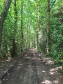
(1) Turn left onto the path.

(2) Take care when crossing Rue de la Lande (D13) and continue along the path opposite. As you go, admire the Château de Champ d’Oisel on your left and carry on until you reach the junction with Chemin de la Bergerie.

(3) Turn right onto it and join the Route de Paris (D6014). 

(4) Cross with great care and continue along the path opposite leading to La Bergerie. 

(5) Turn left in front of the farm. At the junction, keep left onto Chemin de la Bergerie and head towards the housing estate via the street of the same name. 

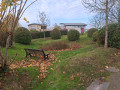
(6) At the end of the path, take Rue de la Bergerie on the right. Follow this street to the next junction, turn right onto Rue du Clos Vivier and you’ll reach the rest area by the pond:mown grass, benches, litter bins and a cycle rack are available. 

(7) Continue along the route until you reach the ‘Stop’ sign marking the junction with Rue du Bois d’Ennebourg. 

(8) Turn left and walk to the bend on the right. 

(9) Take Rue de l’Anneau on your left and, at the next junction, turn right to return to Route de Paris (D6014). 

(10) Cross the road with the same care andcontinue straight ahead along Rue du Boc, which is a very long street. 

(11) Pass Rue des Champs on your right and carry on straight ahead: you will see the Château du Chant d’Oisel again on your right. Head for the junction at Mare Verboc.

(12) Cross Rue des Andelys at the pedestrian crossing, then turn left towards Romilly-sur-Andelle. Continue until you reach Parc de Longboël. 

(13) Cross Rue des Andelys again at the pedestrian crossing and enter the park to enjoy the facilities on offer. Then leave the park via the car park exit (S/E). 

Waypoints

  1. S/E : mi 0 - alt. 502 ft - Longboël Park car park
  2. 1 : mi 0.32 - alt. 528 ft - End of the street, turn left onto the path
  3. 2 : mi 0.71 - alt. 535 ft - D13
  4. 3 : mi 1.15 - alt. 535 ft - Junction with Chemin de la Bergerie
  5. 4 : mi 1.66 - alt. 505 ft - Route de Paris
  6. 5 : mi 1.88 - alt. 499 ft - Ferme de la Bergerie
  7. 6 : mi 2.33 - alt. 512 ft - Rue de la Bergerie
  8. 7 : mi 2.58 - alt. 495 ft - Clos Vivier pond
  9. 8 : mi 2.76 - alt. 518 ft - Rue du Bois d’Ennebourg
  10. 9 : mi 3.02 - alt. 512 ft - Rue de l’Anneau
  11. 10 : mi 3.37 - alt. 531 ft - Route de Paris
  12. 11 : mi 4.08 - alt. 522 ft - Crossroads, go straight on
  13. 12 : mi 4.54 - alt. 509 ft - Mare Verboc
  14. 13 : mi 5.05 - alt. 502 ft - Longboël Park
  15. S/E : mi 5.11 - alt. 502 ft - Longboël Park car park

Notes

(7) Rest area by the Clos Vivier pond.

(12) Verboc Pond.

(12) 98, Rue de l’Église: take a short detour to sample the delicious cream puffs from the Choko-Pain bakery.

(13) Allée de la Maupassière: there’s a Panier Sympa mini-market here.

(13) Allée de la Maupassière: a local market takes place every Saturday morning.

Worth a visit

Notre-Dame Abbey in Fontaine-Guérard (7 km)
CD 714, 27380 Radepont

The former Levavasseur spinning mill (8 km)
27360 Pont-Saint-Pierre

Panorama des Deux Amants (11 km)
Route des Deux Amants, 27380 Amfreville-sous-les-Monts

Angélique’s Gardens (8 km)
2692 Route de Lyons, 76520 Montmain.

The Poses Lock (10 km)
4 Rue des Ecluses, 27380 Amfreville-sous-les-Monts

The Côte Sainte Catherine Viewpoint (12 km)
Route de la Corniche, 76240 Bonsecours

Le Jardin Plume (12 km)
790 Rue de la Plaine, 76116 Auzouville-sur-Ry

Martainville Castle (14 km)
Route du Château, 76116 Martainville-Épreville

Reviews and comments

4.5 / 5
Based on 2 reviews

Reliability of the description
5 / 5
Ease of following the route
4.5 / 5
Route interest
4 / 5
Julien76520
Julien76520

Thank you for your feedback; it’s encouraging...

Machine-translated

User 2271794

Overall rating : 4.3 / 5

Date of your route : Nov 09, 2026
Reliability of the description : ★★★★★ Very good
Ease of following the route : ★★★★☆ Good
Route interest : ★★★★☆ Good
Very busy route : No

A pleasant and relaxing walk suitable for all walkers. An easy-to-follow route. A peaceful walk through plains and along minor country roads, ideal for enjoying the countryside scenery.

Machine-translated

GALOCHE76
GALOCHE76

Overall rating : 4.7 / 5

Date of your route : Mar 06, 2026
Reliability of the description : ★★★★★ Very good
Ease of following the route : ★★★★★ Very good
Route interest : ★★★★☆ Good
Very busy route : No

An easy route mainly through fields (which were being treated when we visited...).

Machine-translated

Other walks in the area

For more walks, use our search engine .

The GPS track and description are the property of this route's author. Please do not copy them without permission.