


 Country:
 City:
City:


Head to Rambouillet and turn onto Rue du Château d’Eau. Park at the Étang d’Or car park. You can also follow the signs for Camping Huttopia.
(S/E) Leave the car park and follow Route de l’Étang d’Or, leaving Camping Huttopia on your left. Pass the Carrefours d’Or and Laisse-Courre junctions.
(1) At the Carrefour du Hameau, turn left onto Route du Coin du Bois. Pass the Carrefours du Coin du Bois, de Sonchamp and de la Mares aux Saules, and head towards the Poteau des Trois Seigneurs.
(2) Continue straight on along the Route du Coin du Bois, passing the crossroads at Lambesc, Poteau Bongard, Charbonniers and Chêne Quinquet.
(3) Before the Carrefour du Parc in Fougères, turn left onto the Route du Pavillon. At the Carrefour du Pavillon, cross the D906, taking care of the traffic, and continue straight ahead along the Route du Pavillon, which leads to the Étang de la Tour.
(4) At the Étang de la Tour car park, continue along the track that runs alongside the lake on its right bank. Pass the second car park whilst continuing to follow the lake. Pass the canoe and kayak school.
(5) At the end of the path, you’ll come out onto the D73; follow it to the left (Route de l’Étang de la Tour, also known as Route Saint-Georges). At the Fork in the road, take the right-hand branch.
(6) At the three-way junction, turn left onto the Chemin de la Patte d’Oie and continue to the next crossroads.
(7) Turn left onto Route de Rambouillet. Use the cycle and pedestrian lane on the right-hand side of the road. At the end of the cycle path, follow Rue de la Grange Colombe (which continues from Route de Rambouillet) and carry on to the next junction.
(8) Turn right, then after about a hundred metres, take the tarmac cycle path on the left along Chemin de la Grange Colombe, leaving the car park on your right.
(9) At the three-way junction with Route de la Patte d’Oie, turn left and go under the railway bridge. Join the cycle path, Chemin de la Patte d’Oie, about 200 metres ahead on the right, and follow it to the Croix Saint-Jacques, at the end of the cycle path.
(10) Turn left, take the D910 and cross the bridge over the N10. Just after the bridge and the motorway exit, rejoin the cycle path on the right, taking care to watch out for traffic. The path runs alongside the D910 and then the N10.
(11) The cycle path veers to the right and runs alongside the D937, which is a motorway exit towards Rambouillet. Carry on straight ahead.
(12) At the large crossroads where the Maison Forestière de la Grille de Versailles is located, continue along the cycle path, which turns right to run alongside the Route de Saint-Léger (D936).
(13) At the Maison Forestière de la Grille aux Lapins, carry straight on along the cycle path, pass the Maison Forestière de la Porte de Houdan and arrive at the ‘Stop’ sign on the cycle path. Cross the Route de Saint-Léger (D936), taking care to watch out for traffic, and rejoin the cycle path opposite to follow the Route de Saint-Léger (D936) on your left.
(14) At the end of the cycle path, at the Route Forestière du Vau Larcher, turn round and rejoin the cycle path in the opposite direction. Continue to the Grille aux Lapins Forest House.
(13) At the Maison Forestière de la Grille aux Lapins, cross the Route de Saint-Léger (D936) at the pedestrian crossing, taking care to watch out for traffic. Go through the gate and continue straight on along the Route de la Grille de Versailles, towards Rambouillet Castle.
After passing through the second gate, turn right and stay on this track. At the junction with the tarmac road called La Maison Forestière du Corps de Garde, turn left onto the track leading to La Maison Forestière du Corps de Garde.
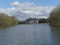
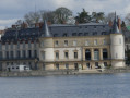
(15) When you reach the crossroads, turn right onto the Route de Guéville, which runs alongside the lake at Rambouillet Castle, separated by a hedge, and continue to the next crossroads.
(16) Turn left, go through another gate and continue straight on along the Tapis Vert track, which runs alongside the lakes at Rambouillet Castle. Watch out for walkers. Pass the statues and continue alongside the lakes, turning left then right, and follow theGR®1markings.
(17) When you reach the park’s exit gate, go through it and turn right onto Rue Georges Lenôtre. At the traffic lights, turn left and continue along Rue Georges Lenôtre.
(18) At the traffic lights, turn left onto Rue Raymond Patenôtre, then immediately right onto Avenue Georges Pompidou. Take the cycle path.
(19) At the junction with Rue des Éveuses, turn right onto Rue des Éveuses. Continue straight on and go under the N10 bridge.
(20) Just after the bridge, turn right onto Rue du Château d’Eau and carry on straight ahead. The road runs alongside the N10 before curving to the left. Carry on straight ahead until you reach the Étang d’Or and the car park (S/E).

 Visorando Member

 Difficult
 Easy
Easy 
 Tourism professional
