The Rambouillet Forest and its lakes, starting from La Grande Hogue

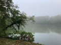
A very pleasant route for exploring the Rambouillet Forest and two magnificent lakes: the Étang d’Or and the Étang de la Tour.

Details

n°20325162
Creation:
Last update:
Last review:
  • Touring/Gravel
    Activity: Touring/Gravel
  • ↔
    Distance: 9.17 mi
  • ◔
    Duration according to the author: 1.5 hrs 
  • ▲
    Difficulty: Easy

  • ⚐
    Back to start: Yes
  • ↗
    Ascent: + 59 ft
  • ↘
    Descent: - 59 ft

  • ▲
    Highest point: 571 ft
  • ▼
    Lowest point: 509 ft

Photos

Description of the route

Take the D906 towards Rambouillet, then turn onto the Route du Coin du Bois after the bend on the left as you leave the hamlet of La Grande Hogue. Continue to the Carrefour de Saint-Benoît; the car park is on the left.

(S/E) From the car park, head to the Carrefour de Saint-Benoît and turn left onto the Route du Coin du Bois.

(1) At the Parc des Fougères junction, carry on straight ahead until you reach the D27, after passing the junctions at Chêne Quinquet, Les Charbonniers, Poteau Bongard and Lambesc.

(2) At Poteau des Trois Seigneurs, cross the D27 with care and carry on straight ahead.

(3) At the Carrefour du Hameau, turn right onto the Route de l’Étang d’Or and continue along the cycle route.
Pass the Carrefour du Laissez-Courre and head towards the Carrefour d’Or.

(4) Carry on straight ahead until you reach the car park next to the campsite.

(5) Turn right and continue along the cycle route on the right bank of the Étang d’Or.

(6) At the end of the Étang d’Or, turn left onto Route des Éveuses and pass the Carrefour des Éveuses.

(7) At the Carrefour de la Louvière, turn right onto Rue du Petit Gril, which runs alongside the racecourse.

(8) At the next junction, turn right onto Rue du Champ de Courses to reach the D27, Rue du Poteau des 3 Seigneurs.

(9) Cross this road and continue straight ahead onto Rue Félix Lorin.

(10) At the end of the street, turn right onto the D906, Rue de l’Étang de la Tour.

(11) At the roundabout, carry on straight ahead along Rue de l’Étang de la Tour. On leaving Rambouillet, use the cycle lane.

(12) At the Carrefour du Pavillon, turn left onto Route du Pavillon, towards the Maison Forestière de l’Étang de la Tour. Once you reach the car park, take the track on the right bank of the Étang de la Tour and continue to the next car park. Turn right and you’ll soon reach the Carrefour de la Tour.

(13) Turn right onto the D73, Route de Saint-Georges.

(14) At the Carrefour des Hogues, continue left onto the D906, towards Limours, and use the cycle lane. After about 600 m, you’ll reach La Petite Hogue; turn right onto the track, Route des Enclaves. Continue straight on to reach the Carrefour Saint-Benoît and its car park (S/E).

Waypoints

  1. S/E : mi 0 - alt. 568 ft - Car park at the Saint-Benoît crossroads
  2. 1 : mi 0.33 - alt. 568 ft - Carrefour du Parc in Fougères
  3. 2 : mi 1.94 - alt. 551 ft - The Trois Seigneurs signpost
  4. 3 : mi 3.25 - alt. 538 ft - Carrefour du Hameau
  5. 4 : mi 3.95 - alt. 535 ft - Carrefour d’Or
  6. 5 : mi 4.17 - alt. 522 ft - Huttopia Campsite - Étang d'Or
  7. 6 : mi 4.63 - alt. 515 ft - Routes des Éveuses - Drouette (rivière)
  8. 7 : mi 5.03 - alt. 525 ft - Carrefour de la Louvière
  9. 8 : mi 5.53 - alt. 528 ft - Rue du Champ de Courses
  10. 9 : mi 5.95 - alt. 548 ft - Rue Félix Lorin
  11. 10 : mi 6.12 - alt. 558 ft - D906 road
  12. 11 : mi 6.61 - alt. 551 ft - Rue de l’Étang de la Tour
  13. 12 : mi 7.64 - alt. 558 ft - Carrefour du Pavillon - L'Étang de la Tour
  14. 13 : mi 8.17 - alt. 561 ft - Carrefour de la Tour
  15. 14 : mi 8.64 - alt. 561 ft - D906
  16. S/E : mi 9.17 - alt. 568 ft - Car park at the Saint-Benoît crossroads

Notes

Picnic areas at the Étangs d’Or and the Étang de la Tour.
There are no shelters.
There is no drinking water supply.
No special equipment is required other than that needed for cycling.

Worth a visit

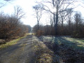
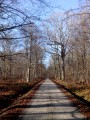
A wooded area with a variety of tree species.
Espace Rambouillet, featuring the wildlife park, the treetop walk and the birds of prey aviaries.
The Étang d’Or.
The Rambouillet Racecourse.
The Étang de la Tour.

Reviews and comments

3.7 / 5
Based on 2 reviews

Reliability of the description
4.5 / 5
Ease of following the route
4 / 5
Route interest
2.5 / 5
titi_rando
titi_rando

Overall rating : 3 / 5

Date of your route : Aug 12, 2023
Reliability of the description : ★★★★☆ Good
Ease of following the route : ★★★☆☆ Average
Route interest : ★★☆☆☆ Disappointing
Very busy route : No

Route completed, but only partially (see below), in the opposite direction and starting from point 8.

I wouldn’t recommend this particular route, because of the sections between 12 and 8 and between 3 and 1: the suggested route is really odd (you’re stuck on roads for miles on end!)
I followed marsupilami_888’s advice for much better alternatives; for example, I personally quickly left the straight road shortly after passing the Espace Rambouillet

As for the rest, the two lakes are lovely and you can reach them via the many paths through the Rambouillet Forest without being bothered by passing cars

In short, do go there, but not like that

Machine-translated

marsupilami_888
marsupilami_888

Overall rating : 4.3 / 5

Date of your route : Apr 17, 2022
Reliability of the description : ★★★★★ Very good
Ease of following the route : ★★★★★ Very good
Route interest : ★★★☆☆ Average
Very busy route : No

We walked the entire suggested route, enjoying a lovely picnic at the Étang d’Or.
This first section was lovely, although a bit straight! As a result, it was perfectly suited to young children, pushchairs, wheelchairs, etc.
We didn’t enjoy the second part as much, especially from point 8 onwards, where there was quite a lot of motorised traffic.
We didn’t understand why we were suggested this route, through the built-up area, rather than following part of the GR 1, which runs closer to the edge of the forest… Both paths lead to the Étang de la Tour, the second stop on the walk.
We plan to do this walk again soon, but after the Étang d’Or, we’ll try the GR 1 for the second half!
Thanks all the same for this route!

Machine-translated

Other walks in the area

For more walks, use our search engine .

The GPS track and description are the property of this route's author. Please do not copy them without permission.