Country:

 City:


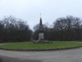
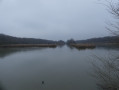
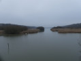
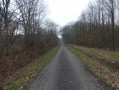
Head to Les Bréviaires, next to the Étangs de Hollande. In the village of Les Bréviaires, take the D61, Route du Matz, then the Route de Vilpert, which continues from there. Pass through the village of Le Matz, staying on the D61. About 400 m after Le Matz, turn left onto the Route Forestière de la Billette and continue to the Croix de Vilpert, where the car park is located.
(S/E) From the Croix de Vilpert car park, follow the Route Forestière de la Billette eastwards until you reach the junction with the D61. Turn right onto the Route de Vilpert (D61), pass through Le Matz without leaving the road, then continue along the same road through Les Bréviaires on the Route du Matz. At the T-junction, turn left onto the Route des Haras (D60).
(1) At the Y-junction, take the right-hand track, Chemin du Moulin, and at the next junction, turn left onto Chemin de la Canarderie, which runs between Étang de Corbet and Étang de Pourras.
(2) Carry on straight ahead, cross the Route Forestière de Corbet and, at Le Corbet, turn right to reach the D191. At the junction, turn left onto Route de Mantes (D191), pass a forest track then a small road on your left, and reach a crossroads with a car park.
(3) Turn right at a sharp angle onto Route Goron and continue straight on. Pass the junctions at Poteau des Cuisines, Trou au Loup and Tournant, keeping straight on all the way, until you reach the Carrefour des Essarts.
(4) Turn right onto Route Royale de Versailles and, at the next junction, turn left onto Route de la Haie aux Vaches, which curves to the left. Immediately afterwards, turn right onto Rue de la Forêt, pass through the village of Saint-Hubert, staying on the same road until you reach the D191.
(5) Turn left onto the Route de Mantes (D191), taking care with the traffic. Cross the bridge over the N10.
(6) Immediately after, at the roundabout, turn right onto Rue de l’Artoire. Cross the bridge over the railway line, then turn left towards Les Essarts-le-Roi and continue straight on.
(7) At the second junction, before entering Les Essarts-le-Roi, turn right onto the cycle path, Route Forestières des Cinq Cents Arpents. The path is initially straight and runs along the edge of fields and woods.
(8) Enter the woodland and follow the cycle path as it veers to the right. The path winds its way whilst remaining more or less at a distance from the forest road. Carry on straight ahead without leaving the path until you reach the Carrefour de Cambude.
(9) Carry on along the cycle path, which veers slightly to the left.
(10) At the Carrefour la Petite Houssière junction with a car park, leave the Route des Franchisés on your right and turn right onto the D202, Route des Essarts, until you reach the junction with the D91.
(11) Turn right onto Rue de Dampierre (D91), heading towards Cernay / Les Vaux-de-Cernay. Continue along this road without leaving it – Route des Cascades, D91 – until you reach the Petit Moulin.
(12) Take the opportunity to make a detour to the right and visit the Moulin des Roches, the waterfalls and the rocks at Les Vaux-de-Cernay.
Then carry on and head up to the Calvaire des Pucelles with its picnic area. Watch out for traffic on the D91, as the road is narrow and winding.
(13) At the junction with the D906, turn right and take the cycle path that runs alongside the D906. Pass the Maison Forestière de la Dallonnerie, set back on the right, then the D61 on the left towards La Celle-Les-Bordes.
(14) At the next junction, turn right onto the D61 towards Saint-Benoît.
(15) At the entrance to the village, turn left onto Rue de la Croix Picard, then right onto Rue du Chemin Vert, and left onto Rue de Vieille Église, towards Les Brulins.
(16) Pass the Carrefour la Haie aux Prêtres, then the hamlet of Les Brûlins, and reach a four-way junction approximately 150 metres before the cemetery at Vieille-Église-en-Yvelines.
(17) Turn left onto Route d’Auffargis and drive through the village of Vieille-Église-en-Yvelines without leaving the road.
(18) At the T-junction, turn left onto Route de l’Étang de la Tour, then right onto Route de Rambouillet. Continue straight on along Rue de la Grange Colombe, which is a continuation of the road, and after the hamlet of La Guitonnerie, take the cycle path on the right and continue straight on. About 100 m after the end of the cycle path, turn right just after No. 73.
(19) Pass the car park on your right and take the cycle path on the left which leads into the woodland. Cross the Route du Patis and, at the next junction, turn left onto the Route de la Patte-d’Oie. Go under the railway bridge and continue for approximately 200 m.
(20) Turn right onto the cycle path and continue straight on until you reach the Croix Saint-Jacques, where the cycle path ends.
(21) Turn left onto Rue de Chartres, a two-way street ; take care of the traffic, cross the bridge over the N10 and, immediately afterwards, turn right , taking care of vehicles coming from the N10 exit on your right
At the Y-junction, turn left onto Route de la Croix Saint-Jacques and carry on straight ahead without leaving the lane. Pass the Carrefour de la Touche and, after the Carrefour de la Renardière, continue for about 150 metres and rejoin the cycle path on your right.
(22) At the Carrefour de Maintenon, turn right and continue along the cycle path. This runs parallel to the Route de Rambouillet on your left. Pass the Carrefours de la Bosse, du Chêne Henri and des Six Pieds, and you will reach the Croix de Vilpert (S/E).

 Visorando Member
 Moderate


 Easy