
From Maintenon to Saint-Prest via the V40/V41

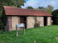
This route allows us to discover the role of the River Eure in life in days gone by: economically, with the mills; in everyday life, with the numerous wash houses; and historically, with Maintenon Castle and the Vauban Aqueduct in Maintenon. All this whilst passing through pretty villages.

Details

n°109880561
Creation:
Last update:
Last review:
–
  • Touring/Gravel
    Activity: Touring/Gravel
  • ↔
    Distance: 18.96 mi
  • ◔
    Duration according to the author: 2 hrs 
  • ▲
    Difficulty: Moderate

  • ⚐
    Back to start: Yes
  • ↗
    Ascent: + 66 ft
  • ↘
    Descent: - 69 ft

  • ▲
    Highest point: 423 ft
  • ▼
    Lowest point: 338 ft
  • ⚐ Country: France
  • ⚐ City: Maintenon (28130)
  • ⚑
    Start/End: N 48.585363° / E 1.591889°
  • ❏
    IGN map(s): Ref. 2016SB, 2116O

  • ◶
    Type of surface:
  •  
    ■ 100% Road
  • Hour-by-hour weather

Photos

Description of the route

Travel to Maintenon by train. If travelling by car, head towards the railway station and park in the station car park, which is a pay-and-display facility. The route starts from the station car park.

(S/E) From the Maintenon station car park, follow the Chemin de l’Aqueduc (one-way).

(1) At the T-junction, turn left (Route de Gallardon) towards Golf de Maintenon. Continue straight on without leaving the D18.

(2) At the three-way junction, ignore the railway bridge on the left and take the right-hand lane,the D1922, towards Chartres. Continue straight on without leaving the D1922. Pass through the hamlets of Les Noues, La Fosse Moreau, Chimay and Le Hasay. Pass the four mills on your right-hand side: the former Moulin de Dionval, the former Moulin de Breuil, the Moulin de Chartainvilliers and the former Moulin de Soulaires. Continue along the D19 as it runs straight on to Jouy.

(3) For a pleasant break, turn right onto Rue du Bout aux Anglois and stop by the waterside at La Digue. Set off again in the opposite direction.

(3) At the T-junction, turn right (Avenue de la Digue) to rejoin the route. Pass through Saint-Cyr and Sainte-Julitte, passing Jouy station on your left.

(4) At the bend to the right, carry on straight ahead along Rue des Larris and follow the D136. Pass the hamlet of La Garenne on your left and the old Moulin de la Roche on your right. Carry on straight ahead along Rue des Chintres, and continuing on, Rue Robert Raynaud, then Rue de la Pierre Percée.

(5) At the junction, carry on along theD13412 to the right, down Rue de la Roguenette, towards Chartres. Carry on straight ahead, ignoring the roads to the right and left.

(6) In Saint-Prest, at the junction, turn right onto Rue de Fontaine Bouillant.

(7) At a place called Le Gorget, turn round and head back along the same route you took on the way there

(1) To follow the direction of traffic, pass under the aqueduct arch. At the roundabout, turn right onto Avenue du Général de Gaulle, continue up to the railway station and turn right to reach the Maintenon station car park (S/E).

Waypoints

  1. S/E : mi 0 - alt. 397 ft - Car park - Gare de Maintenon
  2. 1 : mi 0.16 - alt. 361 ft - Return route - Aqueduc de Maintenon
  3. 2 : mi 1.28 - alt. 344 ft - Right-hand lane: the D19.2 - Canal Louis XIV
  4. 3 : mi 5.44 - alt. 374 ft - Saint-Cyr and Sainte-Julitte - Gare de Jouy
  5. 4 : mi 6 - alt. 374 ft - Rue des Sheep Pastures
  6. 5 : mi 7.77 - alt. 387 ft - D13412, Rue de la Roguenette, towards Chartres - Eure (rivière)
  7. 6 : mi 8.46 - alt. 387 ft - Rue de Fontaine Bouillant - Gare de La Villette-St-Prest
  8. 7 : mi 9.4 - alt. 417 ft - A place known as Le Gorget
  9. S/E : mi 18.96 - alt. 397 ft - Car park at Maintenon station

Notes

On this route, the V40/V41 is a shared-use path up to (7) and then becomes a cycle path. On weekdays, there is little traffic.

No specialequipment is required , other than that needed for acycleride .

There are no water points along the route.

After (5), there are picnic tables.

Otherwise, there are benches here and there along the route.

Worth a visit

Between (2) and (5), the route passes through charming villages such as Saint-Piat, Jouy and Saint-Prest.

(1) The Maintenon Aqueduct:during the reign of Louis XIV, the Maintenon Aqueduct project, begun in 1886 by Vauban, was intended to carry water from the River Eure over more than 80 kilometres to supply the fountains at the Palace of Versailles. Originally, a triple row of arches, 70 metres high, was planned. Unfortunately, due to the wars of the time, epidemics and the financial cost of the project, the works were abandoned in 1695. To this day, only the first row of arches is visible from the Château de Maintenon, the adjoining streets, along the footpaths and from the banks of the Eure which run alongside the estate. It is also known as the Vauban Aqueduct.

Maintenon Castle.

Other walks in the area

For more walks, use our search engine .

The GPS track and description are the property of this route's author. Please do not copy them without permission.