From the port of Varennes-sur-Loire to the port of Chouzé-sur-Loire

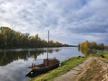
A return trip via the towpath on the right bank of the Loire, starting from the port of Varennes-sur-Loire and ending at the port of Chouzé-sur-Loire, to enjoy the left bank of the Loire from Montsoreau to Candes-Saint-Martin, the confluence with the Vienne, the islands and the ‘boires’ (former oxbow lakes) and the port of Chouzé-sur-Loire.

Details

n°69093721
Creation:
Last update:
Last review:
–
  • Walking
    Activity: Walking
  • ↔
    Distance: 8.26 mi
  • ◔
    Average duration: 3h 50 
  • ▲
    Difficulty: Moderate

  • ⚐
    Back to start: Yes
  • ↗
    Ascent: + 13 ft
  • ↘
    Descent: - 13 ft

  • ▲
    Highest point: 112 ft
  • ▼
    Lowest point: 95 ft

Photos

Description of the walk

Port de Varennes car park in Varennes-sur-Loire. It is marked as ‘Port de Montsoreau’ on the IGN map, with a sign reading ‘Port de Varennes’ on the road, and is situated on the right bank of the Loire just before the entrance to the village of Chouzé. Accessible via the D952, the car park is equipped to accommodate cars and motorhomes.

(S/E) Head towards the Loire, take the ‘Le Petit Port’ towpath on the left, heading south-east towards Île au Than, and continue along the banks of the Loire.

(1) Continue along Rue du Port and head for Île Montravers.

(2) Turn left, follow Rue de l’Île Montravers and cross the Boire courante.

(3) Join Rue des Rivières and follow Rue de la Boire du Chêne to the right until you reach the next junction.

(4) Leave the road and turn right into Impasse de la Loire, walking alongside the river once more.

(5) Turn left away from the banks of the Loire and continue to the Carrefour de l’Île Bourdon.

(6) Take the road on the right leading to the banks of the Loire, then return to the crossroads. Continue to the right along the Route de l’Île Bourdon, pass the campsite on your right and carry on to the Quais des Sarrazins in Chouzé-sur-Loire.

(7) After visiting the village, retrace your steps to the port of Varennes (S/E).

Waypoints

  1. S/E : mi 0 - alt. 98 ft - Port de Varennes - Château de Montsoreau
  2. 1 : mi 0.75 - alt. 105 ft - Île au Than - Bord de Vienne
  3. 2 : mi 1.21 - alt. 108 ft - Montravers Island - Bord de Vienne
  4. 3 : mi 1.65 - alt. 105 ft - La Boire Courante
  5. 4 : mi 1.91 - alt. 105 ft - Boire du Chêne junction
  6. 5 : mi 2.64 - alt. 105 ft - Junction
  7. 6 : mi 3 - alt. 108 ft - Île Bourdon junction
  8. 7 : mi 4.13 - alt. 108 ft - Chouzé-sur-Loire village - La Loire
  9. S/E : mi 8.26 - alt. 98 ft - Port de Varennes

Notes

Please note that some sections may be flooded in winter. The route is shared with a cycle path.

Some sections are used by vehicles, so you must follow the highway code and remain vigilant

Worth a visit

Other walks in the area

For more walks, use our search engine .

The GPS track and description are the property of this route's author. Please do not copy them without permission.