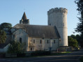
Between Blou and Neuillé

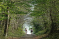
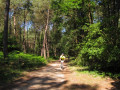
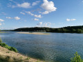
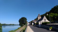
Perched atop its hill, at an altitude of over 100 metres, Blou bears the marks of its age and invites visitors to remember that it was one of the first inhabited settlements in Anjou. Further down the valley, the River Suzon winds its way through Neuillé, a village with equally timeless charm. All around, woods, fields and market gardens serve as a reminder that this is a rural area where life is peaceful.

Details

1173615
Creation:
Last update:
Last review:
  • Walking
    Activity: Walking
  • ↔
    Distance: 11.63 mi
  • ◔
    Average duration: 5h 50 
  • ▲
    Difficulty: Difficult

  • ⚐
    Back to start: Yes
  • ↗
    Ascent: + 568 ft
  • ↘
    Descent: - 545 ft

  • ▲
    Highest point: 351 ft
  • ▼
    Lowest point: 118 ft
  • ⚐ Country: France
  • ⚐ City: Blou (49160)
  • ⚑
    Start/End: N 47.362158° / W 0.0373°
  • ❏
    IGN map(s): Ref. 1622SB, 1623ET, 1623SB, 1722SB
  • Hour-by-hour weather

Photos

Description of the walk

Starting point: Blou Town Hall – Markings: Yellow – Suitable for hybrid and mountain bikes.

(Out and back) From the town hall, turn left and continue to the castle.

(1) Take the path on your left and follow it to the Butte de Blou crossroads.

(2) Turn right and continue along the Chemin de la Huetterie until you reach a road.

(3) Cross the D129 and continue along the track veering slightly to the right until you reach the next junction.

(4) Turn left to rejoin the road at a place called La Croix Marion and turn right. Carry on straight ahead, then turn left onto the first dirt track. Follow it to the village of Neuville.

(5) Turn right, then take the second street on the left. Walk past the church and turn left behind the town hall. Continue to the junction by the sports ground.

(6) Head slightly to the right, cross a street and carry on for about 1.2 km. Following thePR®® sign, take the sharp right-hand bend and continue to the junction at the hamlet of La Maison Neuve.

(7) Turn right and walk along the wall. Continue to the crossroads in front of the entrance to Salvert Castle. Turn left, then right at the hamlet known as ‘la Cognée’ and right again onto the road.

(8) At the crossroads, turn left, walk past the wash house, then turn left again.

(9) After about 100 metres, turn left onto the path leading to a pond. Carry on to the right and head towards the road. Cross over to the other side and carry on to the bend after the hamlet known as Le Brûlis.

(10) Turn onto the path on the left. At the junction, veer slightly to the right and carry on to the road.

(11) Turn left, then immediately right. Take the path until it splits into three.

(12) Take the path furthest to the left, then turn right and then left; carry on straight ahead until you reach the crossroads.

(13) Turn left and carry on for about 1 km.

(14) After the houses, take the path on the right, then turn right again and carry on straight ahead until you reach the junction.

(15) At the junction of the five paths, carry on straight ahead and you’ll come to a forest track. Follow it to the road. Turn left to reach the junction with the Route de Neuillé.

(1) Turn right to retrace your steps and return to the starting point (S/E).
Waypoints

  1. S/E : mi 0 - alt. 203 ft - Blou Town Hall
  2. 1 : mi 0.13 - alt. 223 ft - Route de Neuillé
  3. 2 : mi 0.57 - alt. 325 ft - Butte de Blou
  4. 3 : mi 1.15 - alt. 220 ft - Crossing the D129
  5. 4 : mi 1.6 - alt. 144 ft - Path on the left
  6. 5 : mi 2.77 - alt. 131 ft - D129 road
  7. 6 : mi 2.96 - alt. 148 ft - Sports ground
  8. 7 : mi 4.22 - alt. 207 ft - Castle Wall
  9. 8 : mi 5.14 - alt. 138 ft - Route du Suzon
  10. 9 : mi 5.44 - alt. 154 ft - Waterfront Trail
  11. 10 : mi 6.21 - alt. 220 ft - Path on the left
  12. 11 : mi 6.64 - alt. 243 ft - On the left, Route de Juchepie
  13. 12 : mi 7.04 - alt. 253 ft - Path on the left
  14. 13 : mi 7.46 - alt. 194 ft - Turn left
  15. 14 : mi 8.95 - alt. 262 ft - Path on the right
  16. 15 : mi 10.53 - alt. 351 ft - Crossroads of the 5 Paths
  17. S/E : mi 11.63 - alt. 203 ft - Blou Town Hall

Notes

Worth a visit

Places to visit
- Salvert Castle (16th–19th centuries)
- The Pont de la Ville washhouse
- The Fontaine Suzon washhouse
- Goupillon Castle (19th century)
- The thousand-year-old chestnut tree at Le Brûlis
- Blou Hill and its panoramic view (orientation board)
- The Church of Notre-Dame de Blou (12th century)

Always be cautious and plan ahead when you're outdoors. Visorando and the author of this route cannot be held responsible for any accidents occurring on this route.

The GR® and PR® markings are the intellectual property of the Fédération Française de Randonnée Pédestre.

Reviews and comments

4.5 / 5
Based on 2 reviews

Reliability of the description
4.5 / 5
Ease of following the route
4.5 / 5
Route interest
4.5 / 5
Pau_line
Pau_line

Overall rating : 5 / 5

Date of your route : Jun 15, 2025
Reliability of the description : ★★★★★ Very good
Ease of following the route : ★★★★★ Very good
Route interest : ★★★★★ Very good
Very busy route : No

Perfectly marked. You pass by a beautiful castle. The trail has quite a few false flats.

Machine-translated

stchat
stchat

Overall rating : 4 / 5

Date of your route : Aug 03, 2021
Reliability of the description : ★★★★☆ Good
Ease of following the route : ★★★★☆ Good
Route interest : ★★★★☆ Good
Very busy route : No

A very pleasant walk that we did a lot during the various lockdowns.
It can be done starting from either Blou or Neuillé.
It’s well signposted, but with the GPX track, there’s no problem at all.
Varied scenery and a lovely hill to climb!

Machine-translated

Other walks in the area

For more walks, use our search engine .

The GPS track and description are the property of this route's author. Please do not copy them without permission.