


PRT23

 Visorando Member
 Premium user
 Sign up:
Published route(s)
 La Taille Minaud
 4.04 mi
 +98 ft
 -85 ft
 1h 55
1h 55
 Easy
Easy
 Departure from Lourdoueix-Saint-Pierre (Creuse)
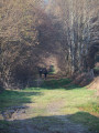
Circling the village, this circular route takes you along paths, through woodland and past small hamlets, dotted with local heritage sites, and offers lovely views of the village and its church.
Around Vost
 6.33 mi
+433 ft
-443 ft
3h 15
6.33 mi
+433 ft
-443 ft
3h 15
 Moderate
Departure from Lourdoueix-Saint-Pierre (Creuse)
Moderate
Departure from Lourdoueix-Saint-Pierre (Creuse)
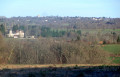
Following the old local tracks – the routes of the rural world of yesteryear – you’ll discover fords, streams, pastures and sunken lanes that criss-cross a green, undulating bocage landscape where water has shaped the terrain and influenced human activity, with lovely views of Vost Castle and its surroundings.
Caesar’s Camp in Lignaud
 2.76 mi
+69 ft
-75 ft
1h 20
Easy
Departure from Lourdoueix-Saint-Pierre (Creuse)
2.76 mi
+69 ft
-75 ft
1h 20
Easy
Departure from Lourdoueix-Saint-Pierre (Creuse)
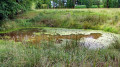
Following in the footsteps of ancient Roman roads, this route takes you to the northern plateau of Lignaud, a village rich in traces of the past. You’ll walk through meadows, farmland and coniferous woodland, skirting the plots of the ‘Camp de César’, whose cadastral layout reveals the characteristics of a Roman camp. There is a significant amount of historic architecture in the heart of the village.
La Roche aux Fées
 3.79 mi
+335 ft
-335 ft
2h 00
Easy
Departure from Lourdoueix-Saint-Pierre (Creuse)
3.79 mi
+335 ft
-335 ft
2h 00
Easy
Departure from Lourdoueix-Saint-Pierre (Creuse)
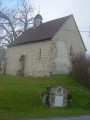
Once past the village with its rich architectural heritage (chapel, fountain, wash houses, etc.), this route takes you to the banks of the Petite Creuse, which you follow upstream along a shaded path overlooked by hillside woodland. From the Rocher des Fées cliff, the return to the agricultural plateau offers a sweeping panorama to the south.