The Dent du Cruet via Montremont and back via the Col des Nantets

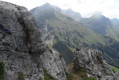
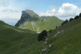
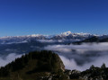
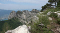
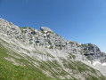
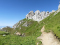
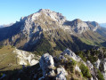
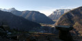
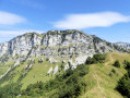
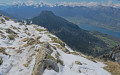
A summit with few visitors, offering exceptional views across the entire Aravis range, La Tournette and the Mont Blanc massif. At the Pointe de Talamarche, there are also fine views of the Dents de Lanfon. After the gruelling climb from Montremont to the Refuge de Larrieux, enjoy a welcome break at this pleasant spot before continuing your ascent.

Details

15633163
Creation:
Last update:
Last review:
  • Walking
    Activity: Walking
  • ↔
    Distance: 7.86 mi
  • ◔
    Average duration: 7h 35 
  • ▲
    Difficulty: Difficult

  • ⚐
    Back to start: Yes
  • ↗
    Ascent: + 4,580 ft
  • ↘
    Descent: - 4,573 ft

  • ▲
    Highest point: 6,047 ft
  • ▼
    Lowest point: 2,549 ft

Photos

Description of the walk

Coming from Thônes, 1.5 km past Les Pesets, there is a car park on the left opposite the signpost for the Refuge de Larrieux.

(S/E) From the signpost, head up the road to the right to reach the start of the path. This steep, winding path – which is easy to follow – leads to a crossroads.

(1) Turn left. The path levels out and leads you gently to the Refuge de Larrieux.

(2) Head west along the Chemin de la Pointe de Talamarche.

(3) Reach the Crêt des Tervelles, where you can see the signpost on the crest. Continue straight ahead towards: ‘sur le crêt’ and ‘Talamarche’.

(4) On the Crêt: here, a signpost indicates the Dent du Cruet ( unmarked path). The round trip will take between 1 hour 15 minutes and 1 hour 30 minutes. Take this path on your right, which descends for about 100 metres before climbing again towards the Dent and ending at a ruin.

(5) Go past this ruin and follow the path as best you can to reach the ridge of the southern summit: take care, as there is a vertiginous drop.

(6) Southern summit of the Dent du Cruet. Return via the same route to: on the ridge.

(4) Turn right and, after a short climb, reach the Pointe de Talamarche.

(7) The path veers left and descends towards the Vallon de Riant above.

(8) Join theGR®96, continue straight ahead and pass above the Riant de l’Aulp chalets, then head south to reach the Pas de l’Aulp.

(9) An easy rocky section; the path then descends gently towards the Chalets des Nantets.

(10) Walk past a farm, then a few metres further on, leave the wide path and take a narrow track branching off to the right. Further on, this track splits; ignore the one on the right. You’ll come to a track suitable for vehicles, which you’ll need to cross to take a narrow path (the start of which is not very visible) that will lead you to the Col des Nantets.

(11) Turn left onto the north-facing path, which descends steadily in tight, steep hairpin bends towards Montremont.
After passing a small cottage, you’ll come out onto a track suitable for vehicles.

(12) Follow this track straight ahead, then the road through Montremont, and return to the starting car park (S/E).

Waypoints

  1. S/E : mi 0 - alt. 2,549 ft - Car park
  2. 1 : mi 1.34 - alt. 4,777 ft - At the junction, turn left
  3. 2 : mi 1.61 - alt. 5,010 ft - Larrieux Mountain Hut
  4. 3 : mi 2.24 - alt. 5,623 ft - Crêt des Tervelles
  5. 4 : mi 2.4 - alt. 5,919 ft - On the Crêt
  6. 5 : mi 2.99 - alt. 5,778 ft - Ruins
  7. 6 : mi 3.19 - alt. 5,961 ft - Cairn on the southern summit - Dent de Cruet
  8. 7 : mi 4.23 - alt. 6,040 ft - Talamarche
  9. 8 : mi 4.82 - alt. 5,292 ft - Junction with GR°°®°°96
  10. 9 : mi 5.24 - alt. 5,440 ft - Pas de l'Aulp (1572m)
  11. 10 : mi 5.67 - alt. 4,797 ft - Col des Nantets trail
  12. 11 : mi 5.93 - alt. 4,678 ft - Col des Nantes (1426m)
  13. 12 : mi 7.3 - alt. 2,769 ft - Road accessible
  14. S/E : mi 7.86 - alt. 2,556 ft - Car park

Notes

Larrieux mountain hut: meals and accommodation available until mid-October (check in advance).
Sturdy footwear recommended.

Long route with steep slopes from Montremont to the refuge. Steep, winding descent on the return journey as you approach Montremont.

Access to the southern summit of the Dent du Cruet is unmarked, with a faintly marked path. Allow between 1 hour 15 minutes and 1 hour 30 minutes for the round trip.

Always be cautious and plan ahead when you're outdoors. Visorando and the author of this route cannot be held responsible for any accidents occurring on this route.

The GR® and PR® markings are the intellectual property of the Fédération Française de Randonnée Pédestre.

Reviews and comments

4.6 / 5
Based on 3 reviews

Reliability of the description
4.7 / 5
Ease of following the route
4.3 / 5
Route interest
4.7 / 5
anthonycolin
anthonycolin

Overall rating : 5 / 5

Date of your route : Jun 13, 2026
Reliability of the description : ★★★★★ Very good
Ease of following the route : ★★★★★ Very good
Route interest : ★★★★★ Very good
Very busy route : Yes

A lovely hike through the mountain pastures behind Lake Annecy. I’m exploring the area around the lake on foot, and it’s just absolutely lovely.

Machine-translated

jean-pierre 59
jean-pierre 59

Overall rating : 4 / 5

Date of your route : Jul 15, 2024
Reliability of the description : ★★★★☆ Good
Ease of following the route : ★★★★☆ Good
Route interest : ★★★★☆ Good
Very busy route : No

Taken on 26 and 27 June...
We spent the night at the Larrieux mountain hut, run by Albert, a retired farmer who looks after the heifers on the mountain pastures and is always happy to have a chat..
The detour to the Dent du Cruet to see the view over Lake Annecy is a bit long (with ups and downs) but less crowded, and there are blueberries near the ruins – though they’re not yet ripe at this time of year

Machine-translated

Hugo38500
Hugo38500

Overall rating : 4.7 / 5

Date of your route : May 19, 2024
Reliability of the description : ★★★★★ Very good
Ease of following the route : ★★★★☆ Good
Route interest : ★★★★★ Very good
Very busy route : Yes

A lovely walk, but very busy despite the steep climb.

Machine-translated

Annecien
Annecien

Hello, I must say I’m very impressed with your website and the hiking information provided.
However, I have a suggestion for improvement:
Please indicate for each walk, either with a message or a pictogram, whether there is a risk of encountering Patou dogs along the route.
Indeed, we are seeing more and more of them, with a rising number of accidents, whether the hiker is accompanied by their dog or even on their own.
Shepherds even admit that they are not always able to manage the situation… In such cases, it is best to avoid them. It would be helpful if, upon returning from a hike, everyone could indicate whether or not they had encountered any.
In principle, their location is fixed according to the mountain pastures where they are stationed, in line with the presence of flocks of sheep. Thank you in advance for your feedback. François

Machine-translated

Other walks in the area

For more walks, use our search engine .

The GPS track and description are the property of this route's author. Please do not copy them without permission.