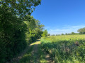
The Montatais Trail in La Chapelle-Rousselin

The Montatais Trail will take you on a tour of La Chapelle-Rousselin, its wind farm, its lake and its narrow streets.

Details

3487104
Creation:
Last update:
Last review:
  • Walking
    Activity: Walking
  • ↔
    Distance: 4.49 mi
  • ◔
    Average duration: 2h 05 
  • ▲
    Difficulty: Easy

  • ⚐
    Back to start: Yes
  • ↗
    Ascent: + 36 ft
  • ↘
    Descent: - 36 ft

  • ▲
    Highest point: 381 ft
  • ▼
    Lowest point: 318 ft

Photos

Description of the walk

Start from Saint-Jacques Church. Follow the yellow markings.

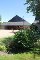
(S/E) Walk down Rue Abel Pineau and turn right into Rue des Blanderies. Go round the sports hall to the west and turn left onto the grassy esplanade. Walk past the pavilions until you come to a tarmac-surfaced lane on your right.

(1) Cross Rue de la Clairière and turn left into Allée des Tilleuls. Cross the road at the pedestrian crossing, turn left for 100 metres, then right after the last house. Immediately turn left onto the path that runs alongside the field until you reach Rue des Blottières, where you’ll turn left.

(2) Before reaching the wind turbine, take the path on the right and continue north-east. After La Chênaie, turn right at the next junction to rejoin the D349 a little further on.

(3) Carry on straight for 200 m and take a path on the left. Continue for another 200 m and turn right to head back towards the village centre. The path will take you past thefirst houses in the village until you reach Chemin de Guyonneau. Turn right and then immediately left towards Place des Mauges.

(4) Carry on straight ahead and cross the D756. Walk 50 m and turn left into Rue de l’Avenir. Do not follow it when it bends to the right, but carry on straight ahead along the track. Walk 300 m before turning right, then pass the hedge.

(5) Turn left before the small pond and you’ll then join the D349.

(6) Turn right and, before crossing the Montatais, head down to the left of the bridge. Follow the tree-lined path. Turn right after 400 m, go round the sewage treatment plant and turn right asecond time 200 m further on.
You will then return to your starting point by continuing straight on (S/E).

Waypoints

  1. S/E : mi 0 - alt. 344 ft - Saint-Jacques Church
  2. 1 : mi 0.35 - alt. 351 ft - Allée des Tilleuls
  3. 2 : mi 1.22 - alt. 381 ft - Le Pâtis Wind Farm
  4. 3 : mi 2.22 - alt. 348 ft - D349, straight ahead
  5. 4 : mi 3.03 - alt. 354 ft - Place des Mauges
  6. 5 : mi 3.65 - alt. 328 ft - On the left, before the small pond
  7. 6 : mi 3.8 - alt. 322 ft - Le Montatais
  8. S/E : mi 4.49 - alt. 344 ft - Saint-Jacques Church

Worth a visit

Pâtis Wind Farm
Three large wind turbines were erected in 2013, straddling the municipalities of Jallais and La Chapelle-Rousselin. Each tower is 100 metres high and weighs 310 tonnes, whilst each blade weighs 9.8 tonnes...

Saint-Jacques Church
Dedicated to Saint James, the church originally had a single nave. The side aisles date from 1844 and 1863. A pointed arch leads into the chancel, which features a large altarpiece from the late 17th century, itself adorned with three terracotta statues.

Reviews and comments

4 / 5
Based on 4 reviews

Reliability of the description
4.3 / 5
Ease of following the route
3.8 / 5
Route interest
4 / 5
Corciulo Giuseppe
Corciulo Giuseppe

Overall rating : 3.7 / 5

Date of your route : Dec 12, 2023
Reliability of the description : ★★★★☆ Good
Ease of following the route : ★★★★☆ Good
Route interest : ★★★☆☆ Average
Very busy route : No

A lovely walk – one to do again in the spring.

Machine-translated

Caillet monique
Caillet monique

I couldn’t download it; I’ll have a look in 2024

Machine-translated

manuuher
manuuher

Overall rating : 3.7 / 5

Date of your route : Jun 13, 2022
Reliability of the description : ★★★★☆ Good
Ease of following the route : ★★★☆☆ Average
Route interest : ★★★★☆ Good
Very busy route : No

I agree with a previous comment: the end of the route is absolutely impossible. It looks as though you’re supposed to follow a stream, but it’s simply impossible. Perhaps it had dried up when the route was mapped out? In any case, it needs correcting. It’s therefore impossible to go via the sewage treatment works. That said, I don’t know if it’s worth a detour...
Fortunately, you can quickly reach the village and the finish line.
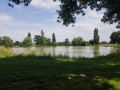
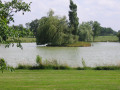
It’s nicer to walk round the pond closer to the water, as there’s a proper path and some lovely scenery.
I didn’t notice anything out of the ordinary otherwise.

Machine-translated

les rand du lundi
les rand du lundi

Overall rating : 4.7 / 5

Date of your route : Nov 29, 2021
Reliability of the description : ★★★★★ Very good
Ease of following the route : ★★★★☆ Good
Route interest : ★★★★★ Very good
Very busy route : Yes

A lovely route and, above all, very well signposted, with beautiful scenery. Thank you

Machine-translated

Lucine55
Lucine55

Overall rating : 4 / 5

Date of your route : Mar 25, 2021
Reliability of the description : ★★★★☆ Good
Ease of following the route : ★★★★☆ Good
Route interest : ★★★★☆ Good
Very busy route : No

Hello,
An interesting, easy walk, though the signposting needs reviewing near the sports centre (go round to the west?)
and at the end of the route, go down to the left of the bridge ??? to go round the sewage treatment plant.

Machine-translated

Other walks in the area

For more walks, use our search engine .

The GPS track and description are the property of this route's author. Please do not copy them without permission.