The Crête d’Infernier

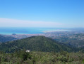
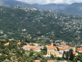
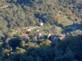
The Crête Infirnier overlooks the Nice hinterland, as well as the village of Levens, which can be seen in the distance. The rocky ridge of Lendre overlooks the village of Bendejun; its lovely wooded area will lead you to the Croix du Midi, which towers above Châteauneuf-Villevieille.
The Visorando app is strongly recommended

Details

n°76188584
Creation:
Last update:
Last review:
  • Walking
    Activity: Walking
  • ↔
    Distance: 6.54 mi
  • ◔
    Average duration: 4h 50 
  • ▲
    Difficulty: Moderate

  • ⚐
    Back to start: Yes
  • ↗
    Ascent: + 2,073 ft
  • ↘
    Descent: - 2,051 ft

  • ▲
    Highest point: 3,041 ft
  • ▼
    Lowest point: 1,890 ft

Photos

Description of the walk

Park in the Col de Châteauneuf car park.

(S/E) Cross the D815 road with care and head for the track on the opposite side. Signpost 816 directs you towards Terre Forte. Continue uphill along this track to reach this hamlet, where there is a house.

(1) After the house, the path begins a long left-hand bend, running alongside a fire water reservoir. Take the path leading uphill.

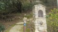
(2) Cairn. At this barely visible junction of paths, turn right. This marks the start of the Crête de l’Infernier ridge walk. Continue until you reach signpost 815.

(3) Turn right towards Colla Bassa, and follow the wooded path to marker 219.

(4) Continue left, heading due north, towards Colla Bassa.

(5) Cross the track known as Terra Forte and continue straight ahead along the steep, wooded path.

(6) Marker 218, La Colla Bassa, Alt: 888 m. Go back about twenty metres and turn left, heading due south, at the first bend in the path, as the path is somewhat hidden by the vegetation, but there is a cairn there.

(7) At this next bend in the path, a few cairns help with navigation. At the second left-hand bend, the path leads downhill.

(8) Cairn. Head off to the right, staying on the main path which leads out at the building in the hamlet of Terre Forte. Here, turn left for about 20 metres. 

(1) Blue markings on a small boulder. Turn left and follow the path through the heath and over the rocks. Follow these blue markings – which are faded but still clearly visible – as far as the Croix du Midi.

(9) The Croix du Midi, overlooking the village of Châteauneuf.

(10) Head down off the path due west, using the Visorando app, zigzagging through the vegetation, then skirting a scree slope, before rejoining the path. At this point, turn left to reach the car park. (S/E).

Waypoints

  1. S/E : mi 0 - alt. 2,054 ft - Car park - Col de Châteauneuf de Contes
  2. 1 : mi 1.17 - alt. 2,769 ft - Terra Forte
  3. 2 : mi 1.27 - alt. 2,818 ft - Trail junction
  4. 3 : mi 2.21 - alt. 1,893 ft - Trail junction
  5. 4 : mi 2.38 - alt. 1,923 ft - Trail junction
  6. 5 : mi 2.85 - alt. 2,251 ft - Footpath x Track suitable for vehicles
  7. 6 : mi 3.44 - alt. 2,907 ft - Trail junction
  8. 7 : mi 4.06 - alt. 2,936 ft - Trail junction
  9. 8 : mi 4.19 - alt. 2,923 ft - Trail junction
  10. 9 : mi 5.58 - alt. 2,835 ft - Croix du Midi
  11. 10 : mi 5.71 - alt. 2,651 ft - Scree slope
  12. S/E : mi 6.54 - alt. 2,060 ft - Car park - Col de Châteauneuf de Contes

Notes

Hiking boots and walking poles are recommended.


Between (7) and (8), it is advisable to use the Visorando app, as well as at point (9) to reach point (10).

Worth a visit

(S/E) Ruins of Châteauneuf-Villevieille: these date from the 12th century.

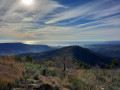
(9) The Croix du Midi stands atop a cliff. Please note: itis not marked in the correct location on the IGN map. It overlooks the village of Châteauneuf-Villevieille. This spot offers stunning views of the Alps.

Reviews and comments

3.7 / 5
Based on 2 reviews

Reliability of the description
3.5 / 5
Ease of following the route
3.5 / 5
Route interest
4 / 5
bernard bb
bernard bb

Thank you, Bebeghislaine, for your review.
Nice walk, and the Visorando app is useful.
Best regards, b.

Machine-translated

bebeghislaine
bebeghislaine

Overall rating : 4 / 5

Date of your route : Feb 01, 2026
Reliability of the description : ★★★★☆ Good
Ease of following the route : ★★★★☆ Good
Route interest : ★★★★☆ Good
Very busy route : No

A beautiful hike at the gateway to Nice with stunning views of the snow-capped mountains. We didn't climb up to the Croix du Midi due to lack of time, but we'll do that next time.

Machine-translated

bernard bb
bernard bb

Thank you, Espedaillac, for this very useful review
Best regards, b.

Machine-translated

Espedaillac
Espedaillac

Overall rating : 3.3 / 5

Date of your route : Oct 16, 2025
Reliability of the description : ★★★☆☆ Average
Ease of following the route : ★★★☆☆ Average
Route interest : ★★★★☆ Good
Very busy route : No

Hello, Nice hike for experienced hikers. A few comments: At Terra Forte, after the short climb to Waypoint 2, do not continue straight ahead; turn immediately to the right. It is not obvious, but there is a trail marker fixed to the ground. At Waypoint 6, Colla Bassa, the cairn is clearly visible. Towards Waypoint 7, it becomes difficult to find your way. Pay attention to the few cairns, which are not obvious. Return to Terra Forte Waypoint 1: it's not easy to find the path to Croix du Midi; I didn't see the blue markings and the path is difficult, especially in the upper section. From there, it's almost impossible to reach the uphill path used on the way there. As you say, zigzagging is an understatement; there isn't even a semblance of a path. I couldn't even take photos to illustrate my point between the rocky outcrops, collapsed terraces, dense vegetation and brambles. It took me 30 minutes. The solution from the Croix du Midi is to retrace your steps via the path used from Terre Forte. The Visorando app is essential. Avoid going there with your family. Thank you for your hike. See you soon on the trails.

Machine-translated

Other walks in the area

For more walks, use our search engine .

The GPS track and description are the property of this route's author. Please do not copy them without permission.