Country:

 City:


From the motorway, take the Nice Nord exit and follow signs for Saint-André-de-la-Roche, then Tourrette-Levens. Head to the centre of the village, passing the town hall, then take Avenue Joseph Baillet and park in the Sainte-Catherine car park.
(S/E) Take Rue du Général Tordo, then turn right onto Chemin de la Golette to reach marker 781.
(1) Then carefully follow the Chemin de Tralatorre due south to reach the small car park at La Tra la Torre and marker 782.
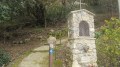
(2) Near the wayside shrine, take the path that climbs to the left through the woods, towards the Baisse de Bordinas, then reach marker 783.
(3) Follow the Camp Soubran track to the left, heading due east, to reach marker 784 and the Baisse de Bordinas crossroads.
(4) Turn slightly left onto the north-easterly path which climbs between the two access roads to the villas to reach the unnamed pass near the Pointe de Rougier and marker 744.
(5) Descend along the path, heading north-east, then climb back up whilst following the ridge of Mont Macaron to reach marker 743 near the Chapelle Saint-Joseph.
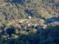
(6) Turn off north-west towards the chapel to reach the ruins of the village and the castle , taking care to avoid falling rocks in the ruins.
(7) Retrace your steps back to marker 743.
(6) Continue straight on, cross the track and take the path heading south-east, following the ridge to pass close to the summit of Mont Macaron, which you go round to the right.
(8) At marker 745, leave the track on your left, continue straight on for 200 m, then turn right at the yellow marker to take the slightly steep and stony path, using the small, refurbished Mont Macaron sighting building as a landmark. Continue to marker 744, which you passed on the way out.
(5) Continue downhill (almost directly opposite) heading north-west for about a hundred metres, then turn left at the three-way junction to reach marker 784, which you also passed on the way out.
(4) Turn right and, following the reverse route of the outward journey, return to the Sainte-Catherine car park (S/E).

 Visorando Member

 Easy
 Difficult