Country:

 City:
City:


Park at the Col de Châteauneuf car park.
(S/E) Carefully cross theRD815 to take the track opposite towards Terre Forte or Colla Bassa. The track quickly turns into a path. Continue uphill, leaving the transformer on your right, and follow the path straight ahead. Pass the Terre Forte house, cross a grassy meadow and reach a DFCI track at a water reservoir.
(1) Take the path ascending to the left along a rock face, signposted Trail 4. At the cairn, follow the Trail 4 signposts to the right and descend along the Infernier ridge to marker 815: caution, slippery descent.
(2) Take the path on the right towards Bendejun and Colla Bassa. From there, follow the signs for Trail 6. The path leaves the heath and continues through the forest.
(3) At marker 219, turn right towards Colla Bassa or Bendejun. Follow the path as it winds its way uphill.
(4) Cross the DFCI track to rejoin the path that starts just opposite: signposted Trail 6. Continue climbing to reach Colla Bassa: marker 218.
(5) Take the path on the right towards Bendeju, then leave the Trail 6 signposted path to follow the path that descends on the left.
(6) Turn right, crossing a ford over some rocks, then very quickly take the path that descends to the left. Be careful on the fairly steep and stony descent.
(7) Pass under the high-voltage power line and continue downhill to marker 215.
(8) Take the DFCI track on the right towards Châteauneuf-Villevieille. Pass a garden with terraces and olive trees on the right and a pretty ruin on the left.
(9) At a bend, at marker 216, leave the DFCI track and take the path on the right that climbs up to a balcony. This path is narrow at the start of the climb and runs parallel to the track.
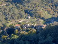
(10) Go around a low wall and continue along the path on the right. You will soon come to a house , where you can admire the view of the villages of Contes and Chateauneuf-Villevieille. Walk alongside a beautiful property with stables, a henhouse and a lovely terraced garden. You will soon reach the Route de Villevieille at a hairpin bend.
(11) Take care when travelling along this road. Go downhill, pass a narrow section and continue to the village. Just after the narrow section, you can take the road uphill on the right, Rue Abbé Martel, then turn immediately left to rejoin the main road.
(12) Take Boulevard du Brec on the right, which is lined with a wash house. Pass numerous houses and reach marker 775.
(13) The boulevard then continues along a path that climbs steeply again: a few steps and you will soon be at the top. Head for the Col de Châteauneuf car park (S/E).

 Visorando Member
 Easy
Easy 
 Moderate