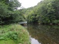
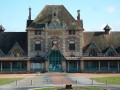
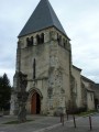
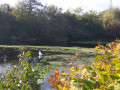
Saint-Joseph Chapel, Tigoulet Wood, Gannes Dam

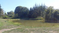
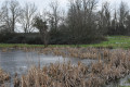
A very shaded route with plenty of ponds to see. You’ll cross the Tigoulet Wood. There’s a lovely little pond at a spot called ‘Les Combes’, perfect for a short break.
In short, a walk that brings you close to nature.

Details

1339954
Creation:
Last update:
Last review:
  • Walking
    Activity: Walking
  • ↔
    Distance: 8.05 mi
  • ◔
    Average duration: 4h 05 
  • ▲
    Difficulty: Moderate

  • ⚐
    Back to start: No
  • ↗
    Ascent: + 427 ft
  • ↘
    Descent: - 364 ft

  • ▲
    Highest point: 1,673 ft
  • ▼
    Lowest point: 1,312 ft
  • ⚐ Country: France
  • ⚐ City: Villebret (03310)
  • ⚑
    Start: N 46.275704° / E 2.655351°
  • ⚑
    End: N 46.246932° / E 2.725335°
  • ❏
    IGN map(s): Ref. 2428SB, 2429SB
  • Hour-by-hour weather

Photos

Description of the walk

The route starts at the Saint-Joseph Chapel, south of Néris-les-Bains.

(S) The start is behind the church, on the left; then take the path furthest to the right (do not go back down). Follow the GR®.

(1) At the first path on the left, leave theGR® and follow this path. Continue straight on until you reach the crossroads at the hamlet known as ‘Bramefaim’. Cross the road and carry on straight ahead along a grassy path. At the next crossroads, go straight ahead, then slightly to the right at the following one, taking the path that goes downhill. At the hamlet known as “Le Chezeau”, at the three-way junction, take the path slightly to the left.

(2) Take the path on the right.

(3) At the tarmac road, turn left and, at the bend a little further on, follow the path straight ahead.

(4) In the woods, you’ll come to a crossroads where the path on the right is blocked by a wooden barrier and the path on the left by a gate (which you won’t see at first), so you’ll just have to go straight on. This path leads uphill.

(5) At the crossroads, take the path furthest to the left. This path narrows. You’ll come across some fallen trees, but you can walk round them or climb over them. There’s a lovely little pond at a place called ‘Les Combes’ where you can take a short break.

(6) In the hamlet, turn left just in front of the barn with the red doors. You’ll reach a crossroads after walking alongside the fields and heading slightly into the woods

(7) Turn right. At the crossroads with the Durdat Larequille / Marcillat road, go straight on towards the hamlet known as “La Grange Vernet”. At the crossroads in the hamlet known as “Chez Gourbeix”, go straight on.

(8) Leave the road and take the first dirt track on the left. At the tarmac road, carry on straight ahead. At the junction with theGR® 463, carry on straight ahead.

(9) At the crossroads, first turn left then right. A little further on, on your right, you’ll see the old railway station. At the junction, turn right for a few metres.

(10) Cross the D2144 –be careful, asthis junction is dangerous because you are crossing a major road (Montluçon / Saint-Éloy). The speed limit is 70 km/h and the junction is very open. Keep going straight on, still following the old railway line.

(11) At this junction, carry on straight ahead.
You can also turn right and follow the banks of the Étang de la Ganne.

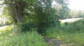
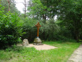
(12) Look out for a small path on the right that’s not easy to spot: there’s a field gate opposite and next to it, and there’s a small clearing (see photos). Follow it to reach the Barrage des Gannes (S/E).

Waypoints

  1. S : mi 0 - alt. 1,388 ft - The Saint-Joseph Chapel
  2. 1 : mi 0.35 - alt. 1,391 ft - Bramefaim
  3. 2 : mi 1.53 - alt. 1,476 ft - Le Chezeau
  4. 3 : mi 1.67 - alt. 1,486 ft - Les Prugnes
  5. 4 : mi 2.62 - alt. 1,463 ft - Tigoulet Wood
  6. 5 : mi 3.2 - alt. 1,647 ft - In the heart of the woods
  7. 6 : mi 3.68 - alt. 1,647 ft - Les Combes
  8. 7 : mi 4.11 - alt. 1,644 ft - End of the woods
  9. 8 : mi 5.05 - alt. 1,624 ft - At Gourbeix
  10. 9 : mi 6.74 - alt. 1,549 ft - Laquaire
  11. 10 : mi 6.95 - alt. 1,545 ft - Major crossroads
  12. 11 : mi 7.6 - alt. 1,490 ft - The Ganne
  13. 12 : mi 7.98 - alt. 1,460 ft - ‘Secret’ passage
  14. E : mi 8.05 - alt. 1,437 ft - Gannes Dam

Notes

I am not currently recommending this horse ride as there is a section in the Tigoulet woods where fallen trees lie across the path and you have to get over them.

Worth a visit

The Saint-Joseph Chapel is open on Tuesdays, Wednesdays, Thursdays and Fridays from 3 pm to 6 pm during the summer months.

Always be cautious and plan ahead when you're outdoors. Visorando and the author of this route cannot be held responsible for any accidents occurring on this route.

The GR® and PR® markings are the intellectual property of the Fédération Française de Randonnée Pédestre.

Reviews and comments

4.8 / 5
Based on 2 reviews

Reliability of the description
5 / 5
Ease of following the route
4.5 / 5
Route interest
5 / 5
User 17070350

Overall rating : 5 / 5

Date of your route : Jul 12, 2026
Reliability of the description : ★★★★★ Very good
Ease of following the route : ★★★★★ Very good
Route interest : ★★★★★ Very good
Very busy route : No

There’s no one around – probably because of the heat – as the route is pleasant and there are plenty of benches where you can take a short break.

Machine-translated

Bonzai
Bonzai

Overall rating : 4.7 / 5

Date of your route : Apr 12, 2021
Reliability of the description : ★★★★★ Very good
Ease of following the route : ★★★★☆ Good
Route interest : ★★★★★ Very good
Very busy route : Yes

A really lovely route, very hilly, with sections through the forest and the Bourbonnais countryside, finishing at the very pretty Gannes Dam.

Machine-translated

Other walks in the area

For more walks, use our search engine .

The GPS track and description are the property of this route's author. Please do not copy them without permission.